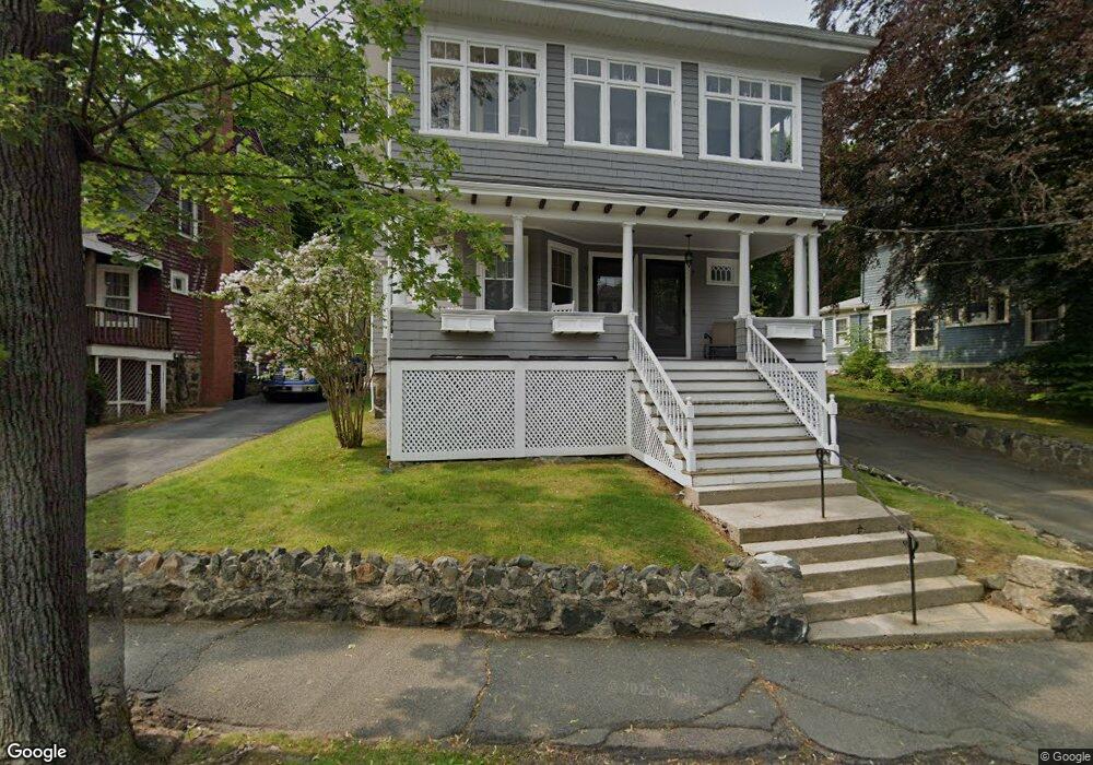
9 Grant Rd Unit 1 Swampscott, MA 01907
Estimated Value: $498,000 - $588,000
2
Beds
1
Bath
1,130
Sq Ft
$483/Sq Ft
Est. Value
About This Home
This home is located at 9 Grant Rd Unit 1, Swampscott, MA 01907 and is currently estimated at $545,601, approximately $482 per square foot. 9 Grant Rd Unit 1 is a home located in Essex County with nearby schools including Swampscott Middle School and Swampscott High School.
Ownership History
Date
Name
Owned For
Owner Type
Purchase Details
Closed on
Sep 13, 2019
Sold by
Landry Mariette and Landry Stephen
Bought by
Mariette Stephen and Mariette Landry T
Current Estimated Value
Purchase Details
Closed on
Jun 18, 2015
Sold by
Bailey Adam and Bailey Meredith
Bought by
Landry Stephen and Landry Mariette
Purchase Details
Closed on
Jul 29, 2005
Sold by
Fitch-Parker Janet
Bought by
Bailey Adam and Bailey Meredith
Home Financials for this Owner
Home Financials are based on the most recent Mortgage that was taken out on this home.
Original Mortgage
$236,800
Interest Rate
5.67%
Mortgage Type
Purchase Money Mortgage
Purchase Details
Closed on
Oct 10, 1997
Sold by
Lasala Gloria R
Bought by
Fitch Janet P
Create a Home Valuation Report for This Property
The Home Valuation Report is an in-depth analysis detailing your home's value as well as a comparison with similar homes in the area
Home Values in the Area
Average Home Value in this Area
Purchase History
| Date | Buyer | Sale Price | Title Company |
|---|---|---|---|
| Mariette Stephen | -- | -- | |
| Landry Stephen | $265,000 | -- | |
| Bailey Adam | $296,000 | -- | |
| Fitch Janet P | $130,000 | -- |
Source: Public Records
Mortgage History
| Date | Status | Borrower | Loan Amount |
|---|---|---|---|
| Previous Owner | Fitch Janet P | $222,406 | |
| Previous Owner | Fitch Janet P | $236,800 | |
| Previous Owner | Fitch Janet P | $59,200 | |
| Previous Owner | Fitch Janet P | $118,000 |
Source: Public Records
Tax History Compared to Growth
Tax History
| Year | Tax Paid | Tax Assessment Tax Assessment Total Assessment is a certain percentage of the fair market value that is determined by local assessors to be the total taxable value of land and additions on the property. | Land | Improvement |
|---|---|---|---|---|
| 2025 | $5,599 | $488,100 | $0 | $488,100 |
| 2024 | $5,083 | $442,400 | $0 | $442,400 |
| 2023 | $4,804 | $409,200 | $0 | $409,200 |
| 2022 | $4,798 | $374,000 | $0 | $374,000 |
| 2021 | $4,729 | $342,700 | $0 | $342,700 |
| 2020 | $4,703 | $328,900 | $0 | $328,900 |
| 2019 | $4,507 | $296,500 | $0 | $296,500 |
| 2018 | $4,314 | $269,600 | $0 | $269,600 |
| 2017 | $4,513 | $258,600 | $0 | $258,600 |
| 2016 | $4,398 | $253,800 | $0 | $253,800 |
| 2015 | $3,010 | $175,500 | $0 | $175,500 |
| 2014 | $3,276 | $175,200 | $0 | $175,200 |
Source: Public Records
Map
Nearby Homes
- 140 Elmwood Rd
- 106 Norfolk Ave
- 24 Barnstable St
- 80 Norfolk Ave Unit 1
- 30 Paradise Rd
- 76 Stetson Ave
- 306 Paradise Rd
- 211 Burrill St
- 189 Burrill St Unit 2
- 3 Nantucket Ave
- 309 Paradise Rd
- 108-110 Burrill St Unit 1
- 5 Summit View Dr
- 28 Claremont Terrace Unit 4
- 28 Claremont Terrace Unit 6
- 16 Duke St
- 75 Bay View Dr
- 13 Cedar Hill Terrace Unit 2
- 7-9 Rock Ave
- 71 Walnut Rd