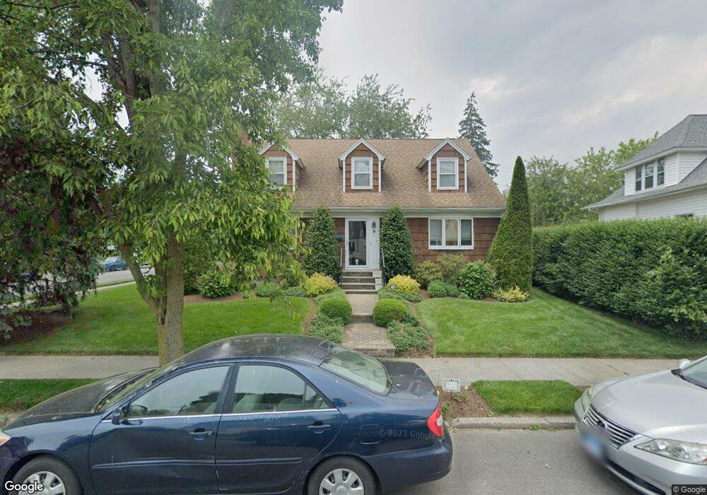
9 Harborview Place Bridgeport, CT 06605
Black Rock NeighborhoodEstimated Value: $458,000 - $764,000
3
Beds
2
Baths
1,767
Sq Ft
$376/Sq Ft
Est. Value
About This Home
This home is located at 9 Harborview Place, Bridgeport, CT 06605 and is currently estimated at $664,776, approximately $376 per square foot. 9 Harborview Place is a home located in Fairfield County with nearby schools including Black Rock School, Bassick High School, and Great Oaks Charter School Bridgeport.
Ownership History
Date
Name
Owned For
Owner Type
Purchase Details
Closed on
Nov 12, 2025
Sold by
Wohlhorn June D Est and Andrews
Bought by
Chandler Todd and Chandler Jennifer
Current Estimated Value
Home Financials for this Owner
Home Financials are based on the most recent Mortgage that was taken out on this home.
Original Mortgage
$410,000
Outstanding Balance
$409,618
Interest Rate
6.34%
Mortgage Type
New Conventional
Estimated Equity
$255,158
Purchase Details
Closed on
Nov 10, 2025
Sold by
Orton Russell W
Bought by
Chandler Todd and Chandler Jennifer
Home Financials for this Owner
Home Financials are based on the most recent Mortgage that was taken out on this home.
Original Mortgage
$410,000
Outstanding Balance
$409,618
Interest Rate
6.34%
Mortgage Type
New Conventional
Estimated Equity
$255,158
Purchase Details
Closed on
Jun 8, 1992
Sold by
Kerwin Gail and Kerwin Michael
Bought by
Simard Linda
Home Financials for this Owner
Home Financials are based on the most recent Mortgage that was taken out on this home.
Original Mortgage
$98,400
Interest Rate
8.8%
Mortgage Type
Unknown
Create a Home Valuation Report for This Property
The Home Valuation Report is an in-depth analysis detailing your home's value as well as a comparison with similar homes in the area
Home Values in the Area
Average Home Value in this Area
Purchase History
| Date | Buyer | Sale Price | Title Company |
|---|---|---|---|
| Chandler Todd | $282,708 | -- | |
| Chandler Todd | $327,292 | -- | |
| Simard Linda | $123,000 | -- | |
| Simard Linda | $123,000 | -- |
Source: Public Records
Mortgage History
| Date | Status | Borrower | Loan Amount |
|---|---|---|---|
| Open | Chandler Todd | $410,000 | |
| Previous Owner | Simard Linda | $52,547 | |
| Previous Owner | Simard Linda | $96,000 | |
| Previous Owner | Simard Linda | $98,400 |
Source: Public Records
Tax History Compared to Growth
Tax History
| Year | Tax Paid | Tax Assessment Tax Assessment Total Assessment is a certain percentage of the fair market value that is determined by local assessors to be the total taxable value of land and additions on the property. | Land | Improvement |
|---|---|---|---|---|
| 2025 | $12,164 | $279,950 | $160,210 | $119,740 |
| 2024 | $12,164 | $279,950 | $160,210 | $119,740 |
| 2023 | $12,164 | $279,950 | $160,210 | $119,740 |
| 2022 | $12,164 | $279,950 | $160,210 | $119,740 |
| 2021 | $12,164 | $279,950 | $160,210 | $119,740 |
| 2020 | $12,279 | $227,440 | $131,450 | $95,990 |
| 2019 | $12,279 | $227,440 | $131,450 | $95,990 |
| 2018 | $12,366 | $227,440 | $131,450 | $95,990 |
| 2017 | $12,366 | $227,440 | $131,450 | $95,990 |
| 2016 | $12,366 | $227,440 | $131,450 | $95,990 |
| 2015 | $11,209 | $265,620 | $139,530 | $126,090 |
| 2014 | $11,209 | $265,620 | $139,530 | $126,090 |
Source: Public Records
Map
Nearby Homes
- 75 Homestead Ave Unit 77
- 39 Jetland Place Unit 41
- 317 Brewster St
- 554 Brewster St Unit 4
- 105 Fox St Unit 107
- 26 Rowsley St Unit 3
- 37 Rowsley St Unit 6
- 165 Bennett St
- 855 Brewster St Unit 857
- 166 Alfred St
- 361 Riverside Dr
- 0 Battery Park Dr
- 167 Scofield Ave
- 188 Monroe St Unit 190
- 82 Waldorf Ave
- 2180 Kings Hwy Unit 1
- 135 Whittier St
- 25 Whittier St
- 31 Whittier St
- 96 Clinton St
- 5 Harborview Place
- 408 Courtland Ave
- 15 Harborview Place
- 4 Harborview Place
- 401 Courtland Ave Unit 403
- 420 Courtland Ave
- 395 Courtland Ave
- 385 Courtland Ave
- 137 Fayerweather Terrace
- 375 Courtland Ave
- 129 Fayerweather Terrace
- 33 Harborview Place
- 423 Courtland Ave Unit 425
- 425 Courtland Ave Unit 2-3
- 423 Courtland Ave Unit 1
- 423 Courtland Ave Unit 2-3
- 365 Courtland Ave
- 398 Midland St
- 121 Fayerweather Terrace
- 41 Harborview Place