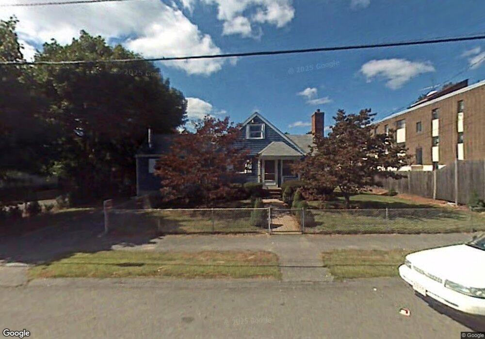
9 Harmon St Lynn, MA 01905
Upper Walnut Street NeighborhoodEstimated Value: $540,000 - $722,000
2
Beds
1
Bath
1,297
Sq Ft
$459/Sq Ft
Est. Value
About This Home
This home is located at 9 Harmon St, Lynn, MA 01905 and is currently estimated at $595,381, approximately $459 per square foot. 9 Harmon St is a home located in Essex County with nearby schools including Julia F. Callahan Elementary School, William R. Fallon School, and Breed Middle School.
Ownership History
Date
Name
Owned For
Owner Type
Purchase Details
Closed on
Apr 23, 2004
Sold by
Lanzillo Flaminio
Bought by
Cushing Gary
Current Estimated Value
Home Financials for this Owner
Home Financials are based on the most recent Mortgage that was taken out on this home.
Original Mortgage
$340,000
Outstanding Balance
$155,890
Interest Rate
5.4%
Mortgage Type
Purchase Money Mortgage
Estimated Equity
$439,491
Purchase Details
Closed on
May 24, 1995
Sold by
Leonard Kevin P
Bought by
Martin Stephen T
Home Financials for this Owner
Home Financials are based on the most recent Mortgage that was taken out on this home.
Original Mortgage
$114,000
Interest Rate
8.33%
Mortgage Type
Purchase Money Mortgage
Purchase Details
Closed on
Dec 29, 1988
Sold by
Calnan Kevin
Bought by
Leonard Kevin F
Create a Home Valuation Report for This Property
The Home Valuation Report is an in-depth analysis detailing your home's value as well as a comparison with similar homes in the area
Home Values in the Area
Average Home Value in this Area
Purchase History
| Date | Buyer | Sale Price | Title Company |
|---|---|---|---|
| Cushing Gary | $390,000 | -- | |
| Cushing Gary | $390,000 | -- | |
| Martin Stephen T | $120,000 | -- | |
| Martin Stephen T | $120,000 | -- | |
| Martin Stephen T | $120,000 | -- | |
| Leonard Kevin F | $147,000 | -- |
Source: Public Records
Mortgage History
| Date | Status | Borrower | Loan Amount |
|---|---|---|---|
| Open | Leonard Kevin F | $340,000 | |
| Closed | Leonard Kevin F | $340,000 | |
| Previous Owner | Martin Stephen T | $114,000 |
Source: Public Records
Tax History
| Year | Tax Paid | Tax Assessment Tax Assessment Total Assessment is a certain percentage of the fair market value that is determined by local assessors to be the total taxable value of land and additions on the property. | Land | Improvement |
|---|---|---|---|---|
| 2025 | $5,220 | $503,900 | $214,700 | $289,200 |
| 2024 | $5,060 | $480,500 | $213,300 | $267,200 |
| 2023 | $4,822 | $432,500 | $196,900 | $235,600 |
| 2022 | $4,921 | $395,900 | $177,200 | $218,700 |
| 2021 | $4,615 | $354,200 | $165,000 | $189,200 |
| 2020 | $4,360 | $325,400 | $146,700 | $178,700 |
| 2019 | $4,593 | $321,200 | $150,900 | $170,300 |
| 2018 | $4,366 | $288,200 | $141,100 | $147,100 |
| 2017 | $4,112 | $263,600 | $122,300 | $141,300 |
| 2016 | $4,034 | $249,300 | $115,800 | $133,500 |
| 2015 | $3,906 | $233,200 | $114,400 | $118,800 |
Source: Public Records
Map
Nearby Homes
- 43 W Sigourney St
- 27 Garfield Ave
- 32 Birch Brook Rd Unit 13
- 32 Birch Brook Rd Unit 27
- 32 Birch Brook Rd Unit 16
- 32 Birch Brook Rd Unit 1
- 32 Birch Brook Rd Unit 14
- 32 Birch Brook Rd Unit 28
- 32 Birch Brook Landing Unit 23
- 32 Birch Brook Landing Unit 25
- 32 Birch Brook Landing Unit 22
- 22 Blueridge Ave
- 268 Walnut St
- 189 Holyoke St
- 4 Oneil Way
- 52 Hesper St
- 187 Hamilton St
- 90 Newton Ave
- 70 Wyman St
- 67 Saville St
Your Personal Tour Guide
Ask me questions while you tour the home.