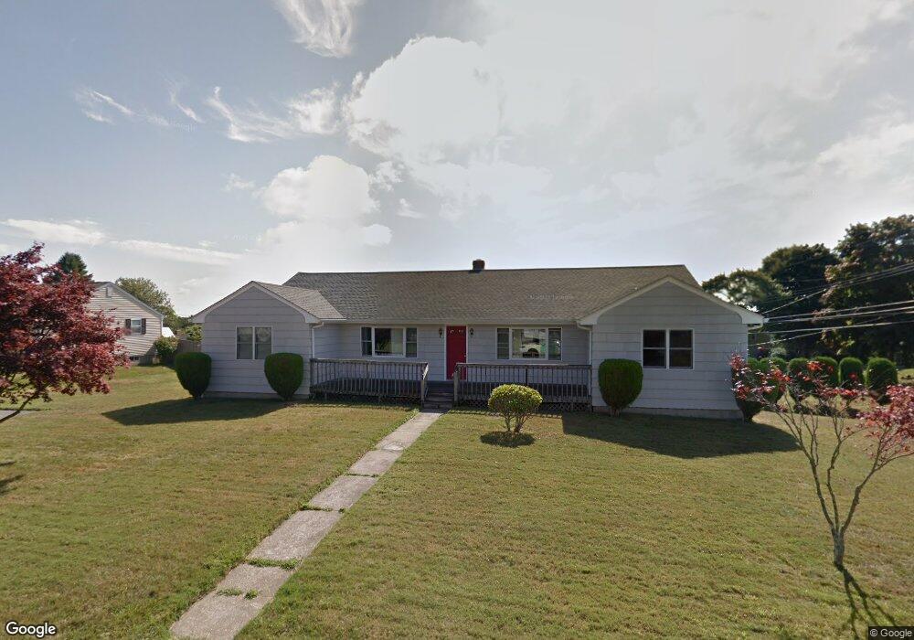
9 Harvey Rd Middletown, RI 02842
Estimated Value: $608,000 - $800,000
6
Beds
2
Baths
1,904
Sq Ft
$367/Sq Ft
Est. Value
About This Home
This home is located at 9 Harvey Rd, Middletown, RI 02842 and is currently estimated at $699,428, approximately $367 per square foot. 9 Harvey Rd is a home located in Newport County with nearby schools including Middletown High School, St Michael's Country Day School, and All Saints STEAM Academy.
Ownership History
Date
Name
Owned For
Owner Type
Purchase Details
Closed on
May 1, 1992
Sold by
Mosher Chester F
Bought by
Babinski Edward P
Current Estimated Value
Home Financials for this Owner
Home Financials are based on the most recent Mortgage that was taken out on this home.
Original Mortgage
$110,000
Interest Rate
8.96%
Create a Home Valuation Report for This Property
The Home Valuation Report is an in-depth analysis detailing your home's value as well as a comparison with similar homes in the area
Home Values in the Area
Average Home Value in this Area
Purchase History
| Date | Buyer | Sale Price | Title Company |
|---|---|---|---|
| Babinski Edward P | $151,000 | -- |
Source: Public Records
Mortgage History
| Date | Status | Borrower | Loan Amount |
|---|---|---|---|
| Closed | Babinski Edward P | $100,000 | |
| Closed | Babinski Edward P | $110,000 |
Source: Public Records
Tax History
| Year | Tax Paid | Tax Assessment Tax Assessment Total Assessment is a certain percentage of the fair market value that is determined by local assessors to be the total taxable value of land and additions on the property. | Land | Improvement |
|---|---|---|---|---|
| 2025 | $7,635 | $647,600 | $359,700 | $287,900 |
| 2024 | $7,292 | $647,600 | $359,700 | $287,900 |
| 2023 | $4,764 | $378,400 | $201,800 | $176,600 |
| 2022 | $4,548 | $378,400 | $201,800 | $176,600 |
| 2021 | $4,548 | $378,400 | $201,800 | $176,600 |
| 2020 | $4,268 | $310,200 | $149,200 | $161,000 |
| 2018 | $4,265 | $310,200 | $149,200 | $161,000 |
| 2016 | $4,362 | $282,900 | $125,100 | $157,800 |
| 2015 | $4,255 | $282,900 | $125,100 | $157,800 |
| 2014 | $3,976 | $247,400 | $113,700 | $133,700 |
| 2013 | $3,887 | $247,400 | $113,700 | $133,700 |
Source: Public Records
Map
Nearby Homes
- 476 Green End Ave
- 310 Corey Ln
- 223 Corey Ln
- 10 Oceanview Dr
- 16 Ward Ave
- 55 John Clarke Rd Unit 8
- 55 John Clarke Rd Unit 3
- 81 Beagle Dr
- 10 Smithfield Dr
- 138 Green End Ave
- 23 Indian Hill Cir
- 118 Wolcott Ave
- 7 Restmere Terrace
- 74 Valley Rd
- 181 Center Ave
- 1 Shangri-La Ln
- 14 Kay Blvd
- 141 Gray Craig Rd
- 84 Allston Ave
- 23 Livingston Place
- 552 Green End Ave
- 19 Harvey Rd
- 528 Green End Ave
- 12 Harvey Rd
- 558 Green End Ave
- 537 Green End Ave
- 20 Harvey Rd
- 635 Turner Rd
- 531 Green End Ave
- 29 Harvey Rd
- 527 Green End Ave
- 551 Green End Ave
- 512 Green End Ave
- 28 Harvey Rd
- 625 Turner Rd
- 563 Green End Ave
- 23 Honeyman Ave
- 37 Harvey Rd
- 20 Morrison Ave
- 574 Green End Ave
Your Personal Tour Guide
Ask me questions while you tour the home.