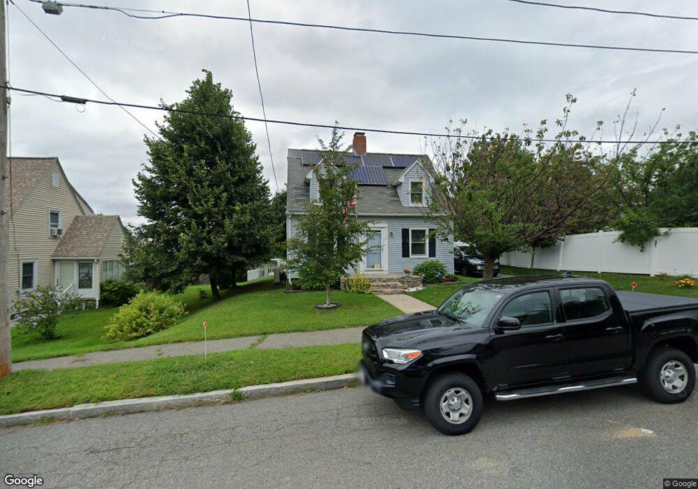
9 Hastings Rd Worcester, MA 01606
Greendale NeighborhoodEstimated Value: $375,000 - $474,000
3
Beds
2
Baths
1,602
Sq Ft
$272/Sq Ft
Est. Value
About This Home
This home is located at 9 Hastings Rd, Worcester, MA 01606 and is currently estimated at $435,579, approximately $271 per square foot. 9 Hastings Rd is a home located in Worcester County with nearby schools including Belmont Street Community School, Jacob Hiatt Magnet School, and Chandler Magnet.
Ownership History
Date
Name
Owned For
Owner Type
Purchase Details
Closed on
Jun 3, 1993
Sold by
Sampson Ricky and Sampson Kelly
Bought by
Belliveau David E and Belliveau Barbara
Current Estimated Value
Home Financials for this Owner
Home Financials are based on the most recent Mortgage that was taken out on this home.
Original Mortgage
$103,500
Interest Rate
7.33%
Mortgage Type
Purchase Money Mortgage
Purchase Details
Closed on
Mar 6, 1987
Sold by
Fegreus Esther C
Bought by
Mangan Kelly A
Home Financials for this Owner
Home Financials are based on the most recent Mortgage that was taken out on this home.
Original Mortgage
$93,420
Interest Rate
9.02%
Mortgage Type
Purchase Money Mortgage
Create a Home Valuation Report for This Property
The Home Valuation Report is an in-depth analysis detailing your home's value as well as a comparison with similar homes in the area
Home Values in the Area
Average Home Value in this Area
Purchase History
| Date | Buyer | Sale Price | Title Company |
|---|---|---|---|
| Belliveau David E | $103,500 | -- | |
| Mangan Kelly A | $98,000 | -- |
Source: Public Records
Mortgage History
| Date | Status | Borrower | Loan Amount |
|---|---|---|---|
| Open | Mangan Kelly A | $99,000 | |
| Closed | Mangan Kelly A | $76,100 | |
| Closed | Mangan Kelly A | $103,500 | |
| Previous Owner | Mangan Kelly A | $93,420 |
Source: Public Records
Tax History
| Year | Tax Paid | Tax Assessment Tax Assessment Total Assessment is a certain percentage of the fair market value that is determined by local assessors to be the total taxable value of land and additions on the property. | Land | Improvement |
|---|---|---|---|---|
| 2025 | $5,181 | $392,800 | $107,900 | $284,900 |
| 2024 | $5,072 | $368,900 | $107,900 | $261,000 |
| 2023 | $4,887 | $340,800 | $93,800 | $247,000 |
| 2022 | $4,514 | $296,800 | $75,100 | $221,700 |
| 2021 | $4,407 | $270,700 | $60,100 | $210,600 |
| 2020 | $4,294 | $252,600 | $60,100 | $192,500 |
| 2019 | $4,140 | $230,000 | $54,000 | $176,000 |
| 2018 | $4,153 | $219,600 | $54,000 | $165,600 |
| 2017 | $3,973 | $206,700 | $54,000 | $152,700 |
| 2016 | $3,959 | $192,100 | $40,900 | $151,200 |
| 2015 | $3,855 | $192,100 | $40,900 | $151,200 |
| 2014 | $3,754 | $192,100 | $40,900 | $151,200 |
Source: Public Records
Map
Nearby Homes
- 1 Triangle St
- 10 Malden St
- 93 Blue Bell Rd
- 328 Brooks St
- 4 Winston Rd
- 30 Danielles Way
- 18 Danielles Way
- 53 Mount Ave
- 22 Apthorp St
- 10 Beale St
- 12 Beale St
- 16 Beale St
- 31 Danielles Way
- 26 Danielles Way
- 47 Eustis St
- 1110 W Boylston St Unit A
- 216 W Mountain St
- 33 Santoro Rd
- 36 Sunrise Ave
- 210 Parker Ave
- 7 Hastings Rd
- 532 Burncoat St
- 12 Vendora Rd
- 530 Burncoat St
- 8 Vendora Rd
- 5 Hastings Rd
- 534 Burncoat St
- 2 Vendora Rd
- 34 Button St
- 5 Vendora Rd
- 3 Vendora Rd
- 4 Hastings Rd
- I-130 11 Gibbs Unit 130
- 531 Burncoat St
- 7 Vendora Rd
- 529 Burncoat St
- 533 Burncoat St
- 527 Burncoat St
- 32 Button St
- 32 Button St Unit 1
Your Personal Tour Guide
Ask me questions while you tour the home.