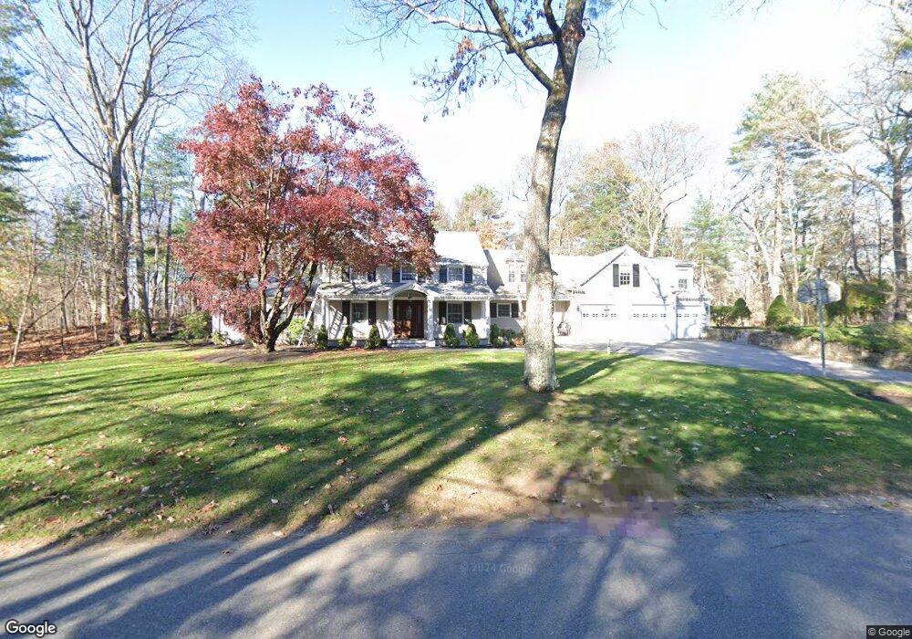
9 High Rock Rd Wayland, MA 01778
Estimated Value: $1,982,000 - $2,290,000
5
Beds
4
Baths
5,181
Sq Ft
$419/Sq Ft
Est. Value
About This Home
This home is located at 9 High Rock Rd, Wayland, MA 01778 and is currently estimated at $2,169,578, approximately $418 per square foot. 9 High Rock Rd is a home located in Middlesex County with nearby schools including Wayland High School, Veritas Christian Academy, and The Rivers School.
Ownership History
Date
Name
Owned For
Owner Type
Purchase Details
Closed on
Dec 2, 1994
Sold by
Oconnell Paul E and Oconnell Phyllis B
Bought by
Lapierre Alan W and Lapierre Debra J
Current Estimated Value
Create a Home Valuation Report for This Property
The Home Valuation Report is an in-depth analysis detailing your home's value as well as a comparison with similar homes in the area
Home Values in the Area
Average Home Value in this Area
Purchase History
| Date | Buyer | Sale Price | Title Company |
|---|---|---|---|
| Lapierre Alan W | $355,000 | -- |
Source: Public Records
Mortgage History
| Date | Status | Borrower | Loan Amount |
|---|---|---|---|
| Open | Lapierre Alan W | $213,000 | |
| Closed | Lapierre Alan W | $270,000 |
Source: Public Records
Tax History Compared to Growth
Tax History
| Year | Tax Paid | Tax Assessment Tax Assessment Total Assessment is a certain percentage of the fair market value that is determined by local assessors to be the total taxable value of land and additions on the property. | Land | Improvement |
|---|---|---|---|---|
| 2025 | $30,832 | $1,972,600 | $680,900 | $1,291,700 |
| 2024 | $29,206 | $1,881,800 | $648,200 | $1,233,600 |
| 2023 | $27,123 | $1,629,000 | $589,200 | $1,039,800 |
| 2022 | $26,734 | $1,456,900 | $488,200 | $968,700 |
| 2021 | $9,142 | $1,412,800 | $444,100 | $968,700 |
| 2020 | $25,091 | $1,412,800 | $444,100 | $968,700 |
| 2019 | $24,014 | $1,313,700 | $423,100 | $890,600 |
| 2018 | $7,855 | $1,353,100 | $423,100 | $930,000 |
| 2017 | $23,776 | $1,310,700 | $409,900 | $900,800 |
| 2016 | $22,252 | $1,283,300 | $419,000 | $864,300 |
| 2015 | $22,394 | $1,217,700 | $419,000 | $798,700 |
Source: Public Records
Map
Nearby Homes
- 208 Cochituate Rd
- 260 Cochituate Rd
- 37 Pequot Rd
- 47 Pequot Rd
- 5 Brook Trail Rd
- 125 Woodridge Rd
- 11 White Pine Knoll Rd
- 26 Dudley Rd
- 7 Shaw Dr
- 22 Lakeshore Dr
- 15 Crest Rd
- 28 Joyce Rd
- 3 Keith Rd
- 108 Dudley Rd
- 96 Lakeshore Dr
- 96 Lake Shore Dr
- 123 Dudley Rd
- 353 Old Connecticut Path
- 17 Smokey Hill Rd
- 1605 Wisteria Way
- 13 High Rock Rd
- 3 High Rock Rd
- 12 High Rock Rd
- 0 High Rock Rd
- 8 High Rock Rd
- 212 Cochituate Rd
- 4 High Rock Rd
- 45 Woodridge Rd
- 19 Woodridge Rd
- 17 High Rock Rd
- 23 Woodridge Rd
- 226 Cochituate Rd
- 15 Woodridge Rd
- 51 Woodridge Rd
- 22 High Rock Rd
- 41 Woodridge Rd
- 19 High Rock Rd
- 21 High Rock Rd
- 13 Woodridge Rd
- 42 Woodridge Rd