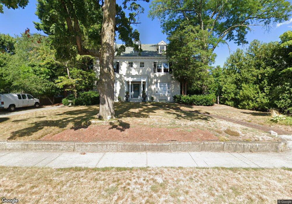
9 High St Westborough, MA 01581
Estimated Value: $926,000 - $1,434,000
6
Beds
4
Baths
4,588
Sq Ft
$259/Sq Ft
Est. Value
About This Home
This home is located at 9 High St, Westborough, MA 01581 and is currently estimated at $1,186,716, approximately $258 per square foot. 9 High St is a home located in Worcester County with nearby schools including Westborough High School, Ebridge Montessori School, and Westboro Knowledge Beginnings.
Create a Home Valuation Report for This Property
The Home Valuation Report is an in-depth analysis detailing your home's value as well as a comparison with similar homes in the area
Home Values in the Area
Average Home Value in this Area
Tax History Compared to Growth
Tax History
| Year | Tax Paid | Tax Assessment Tax Assessment Total Assessment is a certain percentage of the fair market value that is determined by local assessors to be the total taxable value of land and additions on the property. | Land | Improvement |
|---|---|---|---|---|
| 2025 | $15,643 | $960,300 | $297,300 | $663,000 |
| 2024 | $14,756 | $899,200 | $276,400 | $622,800 |
| 2023 | $14,359 | $852,700 | $258,500 | $594,200 |
| 2022 | $12,963 | $701,100 | $207,600 | $493,500 |
| 2021 | $12,956 | $698,800 | $205,300 | $493,500 |
| 2020 | $12,351 | $674,200 | $193,900 | $480,300 |
| 2019 | $12,173 | $664,100 | $186,300 | $477,800 |
| 2018 | $11,011 | $596,500 | $171,100 | $425,400 |
| 2017 | $10,618 | $596,500 | $171,100 | $425,400 |
| 2016 | $10,678 | $600,900 | $171,100 | $429,800 |
| 2015 | $10,565 | $568,300 | $171,100 | $397,200 |
Source: Public Records
Map
Nearby Homes
- 21 South St Unit 31
- 14 Grove St Unit 2
- 23 Water St
- 48 High Street Extension
- 7 Mayberry Dr Unit H
- 4403 Peters Farm Way Unit 403
- 14 Mayberry Dr Unit 10
- 43 Church St
- 75 South St
- 15 Beach St
- 6 Folly Ln
- 19 Fisher St
- 56 Ruggles St
- 9 Treetop Park
- 19 Treetop Park Unit 19
- 22 Treetop Park
- 3 Dover Way
- 7 Jennings Rd
- 52 Treetop Park Unit 52
- 9 Shaker Way