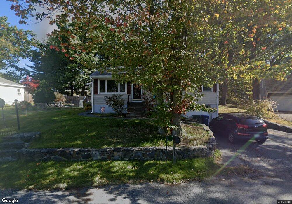
9 Hoover St Leominster, MA 01453
Estimated Value: $416,000 - $452,000
3
Beds
1
Bath
1,122
Sq Ft
$383/Sq Ft
Est. Value
About This Home
This home is located at 9 Hoover St, Leominster, MA 01453 and is currently estimated at $430,185, approximately $383 per square foot. 9 Hoover St is a home located in Worcester County with nearby schools including Leominster High School, St Bernards Elementary School, and St. Leo School.
Ownership History
Date
Name
Owned For
Owner Type
Purchase Details
Closed on
Oct 11, 2007
Sold by
Rivers Thomas D
Bought by
Rivers Katherine R
Current Estimated Value
Home Financials for this Owner
Home Financials are based on the most recent Mortgage that was taken out on this home.
Original Mortgage
$178,500
Interest Rate
6.49%
Mortgage Type
Purchase Money Mortgage
Purchase Details
Closed on
Aug 11, 1987
Sold by
Fiduccia Anthony M
Bought by
Rivers Thomas D
Home Financials for this Owner
Home Financials are based on the most recent Mortgage that was taken out on this home.
Original Mortgage
$85,000
Interest Rate
10.37%
Mortgage Type
Purchase Money Mortgage
Create a Home Valuation Report for This Property
The Home Valuation Report is an in-depth analysis detailing your home's value as well as a comparison with similar homes in the area
Home Values in the Area
Average Home Value in this Area
Purchase History
| Date | Buyer | Sale Price | Title Company |
|---|---|---|---|
| Rivers Katherine R | -- | -- | |
| Rivers Thomas D | $121,900 | -- |
Source: Public Records
Mortgage History
| Date | Status | Borrower | Loan Amount |
|---|---|---|---|
| Open | Rivers Thomas D | $179,623 | |
| Closed | Rivers Katherine R | $178,500 | |
| Previous Owner | Rivers Thomas D | $90,000 | |
| Previous Owner | Rivers Thomas D | $85,000 |
Source: Public Records
Tax History Compared to Growth
Tax History
| Year | Tax Paid | Tax Assessment Tax Assessment Total Assessment is a certain percentage of the fair market value that is determined by local assessors to be the total taxable value of land and additions on the property. | Land | Improvement |
|---|---|---|---|---|
| 2025 | $5,114 | $364,500 | $129,500 | $235,000 |
| 2024 | $4,941 | $340,500 | $123,400 | $217,100 |
| 2023 | $4,786 | $308,000 | $107,300 | $200,700 |
| 2022 | $4,599 | $277,700 | $93,300 | $184,400 |
| 2021 | $4,299 | $237,100 | $72,600 | $164,500 |
| 2020 | $3,217 | $228,200 | $72,600 | $155,600 |
| 2019 | $3,940 | $212,500 | $69,200 | $143,300 |
| 2018 | $2,786 | $199,500 | $67,200 | $132,300 |
| 2017 | $2,620 | $184,000 | $62,700 | $121,300 |
| 2016 | $3,536 | $180,600 | $62,700 | $117,900 |
| 2015 | $3,375 | $173,600 | $62,700 | $110,900 |
| 2014 | $3,104 | $164,300 | $69,300 | $95,000 |
Source: Public Records
Map
Nearby Homes
- 138 Princeton St
- 0 Palm St
- 30 Palm St
- 1220 Water St
- 20 Pleasantview Ave
- 59 Kenniston St
- 1130 Water St
- 32 Doyle St
- 58 Lindell Ave
- 31 Bemis Rd
- 35 Bemis Rd
- 29 Bamford Ave
- 45 Fruit St Unit B
- 45 Fruit St Unit A
- 12 Lindell Ave
- 22 Fruit St
- 2 Arden Mills Way Unit 2210
- 138 Country Ln
- 89 Benjamin St
- 57 Liberty St Unit 2