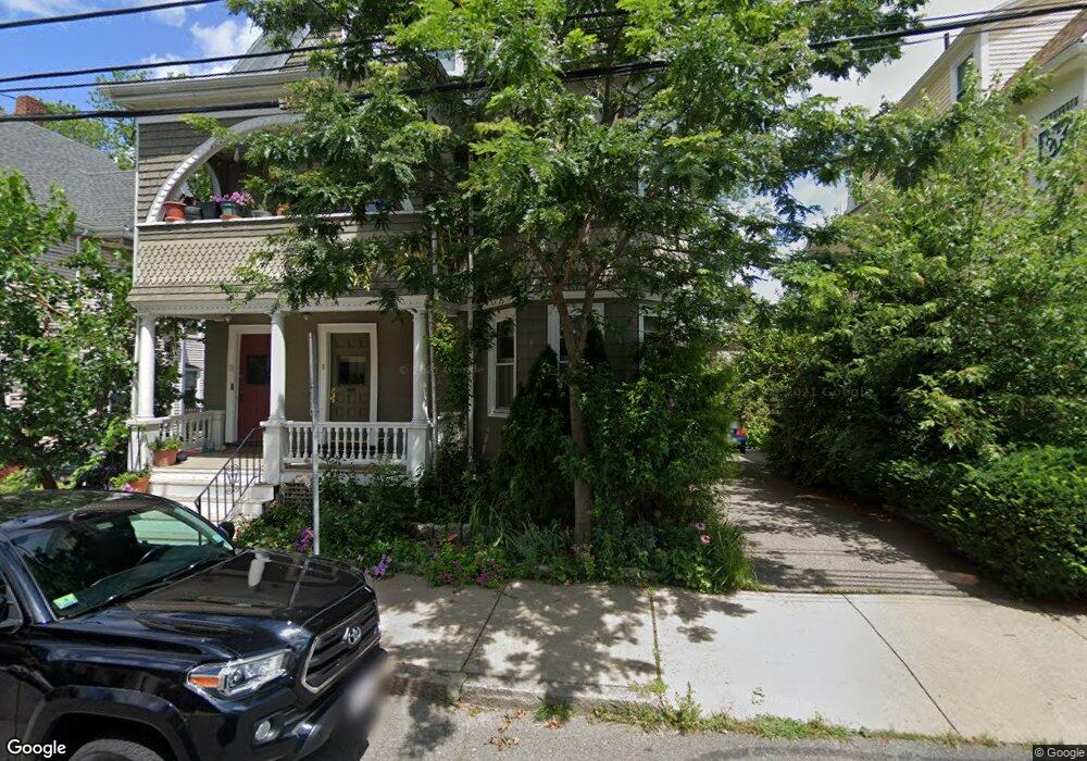
9 Hudson St Unit 1 Somerville, MA 02143
Spring Hill NeighborhoodEstimated Value: $766,002 - $828,000
2
Beds
1
Bath
1,301
Sq Ft
$613/Sq Ft
Est. Value
About This Home
This home is located at 9 Hudson St Unit 1, Somerville, MA 02143 and is currently estimated at $797,501, approximately $612 per square foot. 9 Hudson St Unit 1 is a home located in Middlesex County with nearby schools including Somerville High School and Saint Theresa School.
Ownership History
Date
Name
Owned For
Owner Type
Purchase Details
Closed on
May 21, 2024
Sold by
Mceldowney Elliott H
Bought by
9 Hudson Street Llc
Current Estimated Value
Purchase Details
Closed on
Aug 22, 2014
Sold by
Semenza Rt and Cipolle
Bought by
Hudson Ventures Group
Purchase Details
Closed on
Jun 3, 2009
Sold by
Manis David and Devecchis John
Bought by
Manis David
Create a Home Valuation Report for This Property
The Home Valuation Report is an in-depth analysis detailing your home's value as well as a comparison with similar homes in the area
Home Values in the Area
Average Home Value in this Area
Purchase History
| Date | Buyer | Sale Price | Title Company |
|---|---|---|---|
| 9 Hudson Street Llc | -- | None Available | |
| 9 Hudson Street Llc | -- | None Available | |
| Hudson Ventures Group | $575,000 | -- | |
| Hudson Ventures Group | $575,000 | -- | |
| Manis David | -- | -- | |
| Manis David | -- | -- |
Source: Public Records
Mortgage History
| Date | Status | Borrower | Loan Amount |
|---|---|---|---|
| Previous Owner | Manis David | $308,800 |
Source: Public Records
Tax History
| Year | Tax Paid | Tax Assessment Tax Assessment Total Assessment is a certain percentage of the fair market value that is determined by local assessors to be the total taxable value of land and additions on the property. | Land | Improvement |
|---|---|---|---|---|
| 2025 | $6,921 | $634,400 | $0 | $634,400 |
| 2024 | $6,540 | $621,700 | $0 | $621,700 |
| 2023 | $6,368 | $615,900 | $0 | $615,900 |
| 2022 | $6,035 | $592,800 | $0 | $592,800 |
| 2021 | $5,911 | $580,100 | $0 | $580,100 |
| 2020 | $5,668 | $561,700 | $0 | $561,700 |
| 2019 | $5,858 | $544,400 | $0 | $544,400 |
| 2018 | $5,878 | $519,700 | $0 | $519,700 |
| 2017 | $5,557 | $476,200 | $0 | $476,200 |
| 2016 | $5,502 | $439,100 | $0 | $439,100 |
Source: Public Records
Map
Nearby Homes
- 89 Central St
- 1-3 Woodbine St
- 144 Highland Ave Unit 1
- 7 Woodbine St
- 80 Hudson St
- 111 Belmont St
- 52 Thurston St Unit 3
- 15 Spring Hill Terrace
- 161 Lowell St Unit 1
- 221 Highland Ave Unit 1
- 8 Albion Terrace
- 227 Highland Ave Unit 2
- 227 Highland Ave Unit 3
- 227 Highland Ave Unit 1
- 185 School St
- 148 Lowell St Unit 3
- 109 Summer St Unit 1
- 125 Lowell St Unit 603
- 125 Lowell St Unit 3B
- 125 Lowell St Unit 202
- 11 Hudson St Unit 2
- 11 Hudson St Unit 1
- 15 Hudson St
- 15 Hudson St Unit 3
- 15 Hudson St Unit 1
- 7 Hudson St
- 12 Albion St
- 10 Albion St
- 10 Albion St
- 10 Albion St Unit 1
- 10 Albion St Unit 2
- 10 Albion St Unit 1
- 14 Albion St
- 21 Waldo St
- 17 Hudson St
- 17 Hudson St Unit 2
- 17 Hudson St Unit 2A
- 17 Hudson St Unit 2T
- 17 Hudson St Unit 1
- 8 Hudson St
Your Personal Tour Guide
Ask me questions while you tour the home.