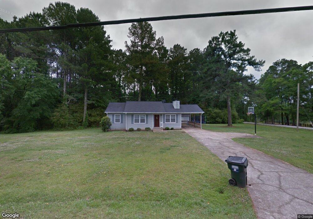
9 I Walker Brooks Rd Newnan, GA 30263
Estimated Value: $171,000 - $234,000
3
Beds
2
Baths
1,067
Sq Ft
$198/Sq Ft
Est. Value
About This Home
This home is located at 9 I Walker Brooks Rd, Newnan, GA 30263 and is currently estimated at $211,713, approximately $198 per square foot. 9 I Walker Brooks Rd is a home located in Coweta County with nearby schools including Atkinson Elementary School, Smokey Road Middle School, and Newnan High School.
Ownership History
Date
Name
Owned For
Owner Type
Purchase Details
Closed on
May 3, 2022
Sold by
Puett Steve D
Bought by
Wallace Robert Hayden
Current Estimated Value
Home Financials for this Owner
Home Financials are based on the most recent Mortgage that was taken out on this home.
Original Mortgage
$161,815
Outstanding Balance
$152,265
Interest Rate
4.42%
Mortgage Type
FHA
Estimated Equity
$59,448
Purchase Details
Closed on
May 21, 2003
Sold by
Robinson Calvin L
Bought by
Puett Steve D and Puett Pamela
Home Financials for this Owner
Home Financials are based on the most recent Mortgage that was taken out on this home.
Original Mortgage
$97,200
Interest Rate
5.79%
Mortgage Type
New Conventional
Purchase Details
Closed on
Sep 30, 1987
Bought by
Robinson Calvin L
Create a Home Valuation Report for This Property
The Home Valuation Report is an in-depth analysis detailing your home's value as well as a comparison with similar homes in the area
Home Values in the Area
Average Home Value in this Area
Purchase History
| Date | Buyer | Sale Price | Title Company |
|---|---|---|---|
| Wallace Robert Hayden | $164,800 | -- | |
| Puett Steve D | $108,000 | -- | |
| Robinson Calvin L | $51,900 | -- |
Source: Public Records
Mortgage History
| Date | Status | Borrower | Loan Amount |
|---|---|---|---|
| Open | Wallace Robert Hayden | $161,815 | |
| Previous Owner | Puett Steve D | $97,200 |
Source: Public Records
Tax History Compared to Growth
Tax History
| Year | Tax Paid | Tax Assessment Tax Assessment Total Assessment is a certain percentage of the fair market value that is determined by local assessors to be the total taxable value of land and additions on the property. | Land | Improvement |
|---|---|---|---|---|
| 2025 | $1,448 | $61,269 | $7,303 | $53,966 |
| 2024 | $1,448 | $62,372 | $7,303 | $55,069 |
| 2023 | $1,448 | $52,274 | $7,022 | $45,252 |
| 2022 | $838 | $34,028 | $6,688 | $27,340 |
| 2021 | $824 | $31,288 | $6,688 | $24,600 |
| 2020 | $829 | $31,288 | $6,688 | $24,600 |
| 2019 | $696 | $23,783 | $9,322 | $14,461 |
| 2018 | $697 | $23,783 | $9,322 | $14,461 |
| 2017 | $697 | $23,783 | $9,321 | $14,462 |
| 2016 | $689 | $23,783 | $9,322 | $14,461 |
| 2015 | $677 | $23,783 | $9,322 | $14,461 |
| 2014 | $696 | $23,783 | $9,322 | $14,461 |
Source: Public Records
Map
Nearby Homes
- 175 Joe Brown Rd
- 975 Blalock Lakes Dr
- 3986 Corinth Rd
- 598 Beavers Rd
- 196 Beavers Rd
- 407 Earl North Rd
- 715 Earl North Rd
- 831 Holbrook Rd
- 61.990 AC Mike Powers Rd
- 2117 W Grantville Rd
- 2403 W Grantville Rd
- 107 Trisha Ln
- 2086 Bethlehem Church Rd
- 0 Trisha Ln Unit 10541742
- 1967 Corinth Rd
- 296 Beavers Rd
- 1109 Old Corinth Rd
- 980 Grandma Branch Rd
- 0 Mike Powers Rd Unit 24477774
- 0 Old Smokey Rd
- 0 Brooks Landing Dr Unit 11 8409768
- 0 Brooks Landing Dr Unit 8 8409757
- 0 Brooks Landing Dr Unit 13 8327535
- 0 Brooks Landing Dr Unit 2 8293848
- 0 Brooks Landing Dr Unit 16 8293814
- 0 Brooks Landing Dr Unit 10 8293805
- 0 Brooks Landing Dr Unit 9 8228288
- 0 Brooks Landing Dr Unit 7 8228285
- 0 Brooks Landing Dr Unit 5 8179363
- 0 Brooks Landing Dr Unit 14 8134189
- 0 Brooks Landing Dr Unit 12 8134150
- 0 Brooks Landing Dr Unit 15 8134216
- 0 Brooks Landing Dr Unit 6 8159837
- 25 I Walker Brooks Rd
- 10 Westbrook Dr
- 24 I Walker Brooks Rd
- 37 I Walker Brooks Rd
- 37 I Walker Brooks Rd
- 3541 Corinth Rd
- 36 I Walker Brooks Rd