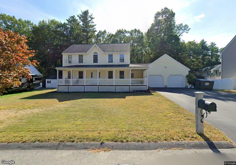
9 Isabel Cir Leominster, MA 01453
Estimated Value: $622,685 - $698,000
3
Beds
3
Baths
1,840
Sq Ft
$360/Sq Ft
Est. Value
About This Home
This home is located at 9 Isabel Cir, Leominster, MA 01453 and is currently estimated at $662,671, approximately $360 per square foot. 9 Isabel Cir is a home located in Worcester County with nearby schools including Leominster High School, St. Anna Catholic School, and St. Leo School.
Ownership History
Date
Name
Owned For
Owner Type
Purchase Details
Closed on
Jan 3, 2003
Sold by
B-J Rt and Scola Joseph M
Bought by
Osborn Steve J and Osborn Tina M
Current Estimated Value
Home Financials for this Owner
Home Financials are based on the most recent Mortgage that was taken out on this home.
Original Mortgage
$239,500
Outstanding Balance
$102,620
Interest Rate
6.08%
Mortgage Type
Purchase Money Mortgage
Estimated Equity
$560,051
Create a Home Valuation Report for This Property
The Home Valuation Report is an in-depth analysis detailing your home's value as well as a comparison with similar homes in the area
Home Values in the Area
Average Home Value in this Area
Purchase History
| Date | Buyer | Sale Price | Title Company |
|---|---|---|---|
| Osborn Steve J | $301,477 | -- |
Source: Public Records
Mortgage History
| Date | Status | Borrower | Loan Amount |
|---|---|---|---|
| Open | Osborn Steve J | $239,500 |
Source: Public Records
Tax History Compared to Growth
Tax History
| Year | Tax Paid | Tax Assessment Tax Assessment Total Assessment is a certain percentage of the fair market value that is determined by local assessors to be the total taxable value of land and additions on the property. | Land | Improvement |
|---|---|---|---|---|
| 2025 | $7,131 | $508,300 | $156,300 | $352,000 |
| 2024 | $7,034 | $484,800 | $148,800 | $336,000 |
| 2023 | $6,699 | $431,100 | $129,400 | $301,700 |
| 2022 | $6,376 | $385,000 | $112,600 | $272,400 |
| 2021 | $6,108 | $336,900 | $87,600 | $249,300 |
| 2020 | $5,883 | $327,200 | $87,600 | $239,600 |
| 2019 | $5,751 | $310,200 | $83,300 | $226,900 |
| 2018 | $5,697 | $294,700 | $80,800 | $213,900 |
| 2017 | $5,552 | $281,400 | $75,500 | $205,900 |
| 2016 | $5,543 | $283,100 | $75,500 | $207,600 |
| 2015 | $5,439 | $279,800 | $75,500 | $204,300 |
| 2014 | $5,361 | $283,800 | $82,600 | $201,200 |
Source: Public Records
Map
Nearby Homes
- 29 Wedgewood Ln
- 23 Lantern Ln
- 675 Willard St
- 315 Grant St
- 1237 Central St Unit 15
- 39 Legate Hill Rd
- 2 Keeneland Cir
- 50 Indian Ridge Dr
- 12 Walden Ct
- 93 Chapman Place Unit 93
- 197 Chapman Place Unit 197
- 12 Drummer Ln
- 177 Chapman Place
- 740 Central St Unit R24
- 740 Central St Unit L22
- 91 Berrington Rd Unit 91
- 97 Berrington Rd Unit 97
- 30 Abbey Rd Unit 207
- 10 Abbey Rd Unit 108
- 30 Abbey Rd Unit 202