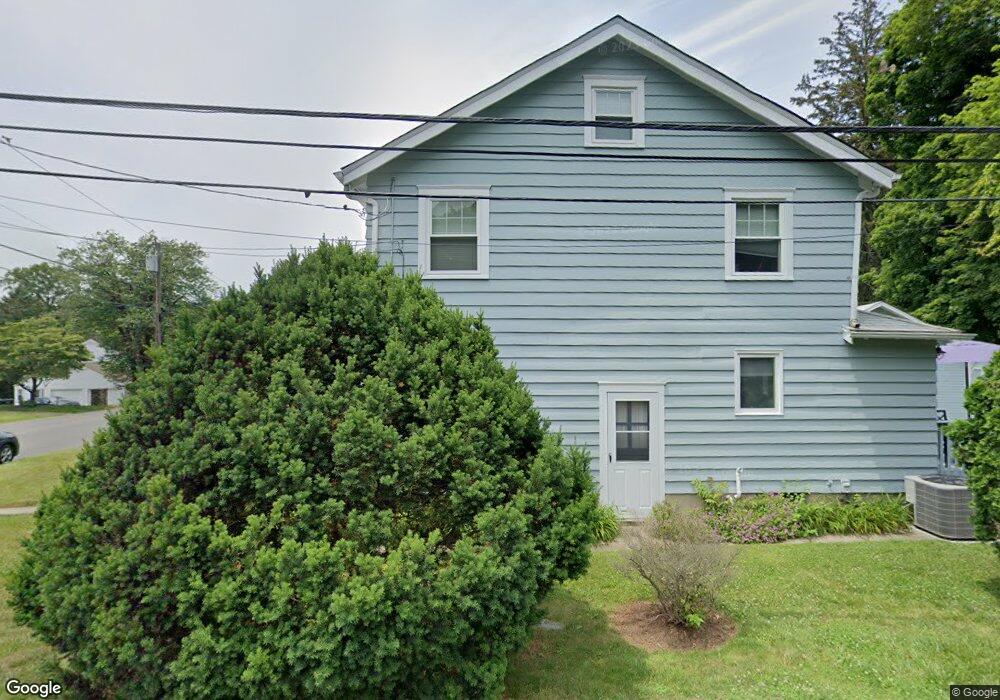
9 Jarvis St Norwalk, CT 06851
Woods Pond NeighborhoodEstimated Value: $629,522 - $683,000
3
Beds
2
Baths
1,408
Sq Ft
$465/Sq Ft
Est. Value
About This Home
This home is located at 9 Jarvis St, Norwalk, CT 06851 and is currently estimated at $654,381, approximately $464 per square foot. 9 Jarvis St is a home located in Fairfield County with nearby schools including Tracey School, West Rocks Middle School, and Norwalk High School.
Ownership History
Date
Name
Owned For
Owner Type
Purchase Details
Closed on
Dec 1, 2006
Sold by
Cannon Kerry J
Bought by
Varco Michael A and Varco Heather
Current Estimated Value
Purchase Details
Closed on
Sep 2, 2003
Sold by
Action Relo
Bought by
Cannon Kerry J
Purchase Details
Closed on
Apr 9, 2002
Sold by
Denny Ronald W and Denny Patricia L
Bought by
Hewitt Lauren E
Create a Home Valuation Report for This Property
The Home Valuation Report is an in-depth analysis detailing your home's value as well as a comparison with similar homes in the area
Home Values in the Area
Average Home Value in this Area
Purchase History
| Date | Buyer | Sale Price | Title Company |
|---|---|---|---|
| Varco Michael A | $495,000 | -- | |
| Varco Michael A | $495,000 | -- | |
| Cannon Kerry J | $390,000 | -- | |
| Cannon Kerry J | $390,000 | -- | |
| Hewitt Lauren E | $344,000 | -- | |
| Hewitt Lauren E | $344,000 | -- |
Source: Public Records
Mortgage History
| Date | Status | Borrower | Loan Amount |
|---|---|---|---|
| Open | Hewitt Lauren E | $404,300 | |
| Closed | Hewitt Lauren E | $403,000 |
Source: Public Records
Tax History Compared to Growth
Tax History
| Year | Tax Paid | Tax Assessment Tax Assessment Total Assessment is a certain percentage of the fair market value that is determined by local assessors to be the total taxable value of land and additions on the property. | Land | Improvement |
|---|---|---|---|---|
| 2025 | $8,542 | $356,740 | $170,170 | $186,570 |
| 2024 | $8,416 | $356,740 | $170,170 | $186,570 |
| 2023 | $6,738 | $267,810 | $136,490 | $131,320 |
| 2022 | $6,613 | $267,810 | $136,490 | $131,320 |
| 2021 | $6,441 | $267,810 | $136,490 | $131,320 |
| 2020 | $6,437 | $267,810 | $136,490 | $131,320 |
| 2019 | $6,257 | $267,810 | $136,490 | $131,320 |
| 2018 | $7,173 | $269,030 | $151,160 | $117,870 |
| 2017 | $6,926 | $269,030 | $151,160 | $117,870 |
| 2016 | $6,860 | $269,030 | $151,160 | $117,870 |
| 2015 | $6,841 | $269,030 | $151,160 | $117,870 |
| 2014 | $6,753 | $269,030 | $151,160 | $117,870 |
Source: Public Records
Map
Nearby Homes
- 14 E Rocks Rd
- 1 Blue Mountain Ridge
- 24 Sawmill Rd
- 6 Plumley Cir
- 46 Sunrise Hill Rd
- 4 Union Ave Unit 26
- 34 Sunrise Hill Rd
- 33 Center Ave
- 133 Main St Unit 5
- 12 Merrill Rd
- 15 Delaware Ave
- 15 Dry Hill Rd
- 31 High St Unit 4-2B
- 28 Aiken St
- 9 Park St Unit 217
- 9 Allen Ct
- 50 Aiken St Unit 312
- 50 Aiken St Unit 241
- 50 Aiken St Unit 305
- 50 Aiken St Unit 223