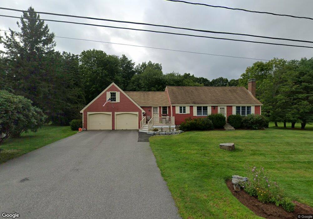
9 Jason Dr Stratham, NH 03885
Estimated Value: $795,000 - $885,000
2
Beds
3
Baths
3,219
Sq Ft
$257/Sq Ft
Est. Value
About This Home
This home is located at 9 Jason Dr, Stratham, NH 03885 and is currently estimated at $828,289, approximately $257 per square foot. 9 Jason Dr is a home located in Rockingham County with nearby schools including Stratham Memorial School, Cooperative Middle School, and Exeter High School.
Create a Home Valuation Report for This Property
The Home Valuation Report is an in-depth analysis detailing your home's value as well as a comparison with similar homes in the area
Home Values in the Area
Average Home Value in this Area
Tax History
| Year | Tax Paid | Tax Assessment Tax Assessment Total Assessment is a certain percentage of the fair market value that is determined by local assessors to be the total taxable value of land and additions on the property. | Land | Improvement |
|---|---|---|---|---|
| 2025 | $10,706 | $791,900 | $382,300 | $409,600 |
| 2024 | $10,390 | $791,900 | $382,300 | $409,600 |
| 2023 | $9,982 | $477,400 | $196,600 | $280,800 |
| 2022 | $8,932 | $477,400 | $196,600 | $280,800 |
| 2021 | $8,841 | $477,400 | $196,600 | $280,800 |
| 2020 | $9,047 | $477,400 | $196,600 | $280,800 |
| 2019 | $6,646 | $477,400 | $196,600 | $280,800 |
| 2018 | $4,032 | $389,100 | $146,800 | $242,300 |
| 2017 | $7,899 | $389,100 | $146,800 | $242,300 |
| 2016 | $6,345 | $389,100 | $146,800 | $242,300 |
| 2015 | $7,743 | $389,100 | $146,800 | $242,300 |
| 2014 | $7,747 | $389,100 | $146,800 | $242,300 |
| 2013 | $7,664 | $390,000 | $146,800 | $243,200 |
Source: Public Records
Map
Nearby Homes
- 8 Laurel Ln
- 16 Jana Ln
- 14 Squamscott Rd
- 227 Portsmouth Ave
- 2 Shirley Ln
- 217 Portsmouth Ave
- 64 Glengarry Dr
- 99 Glengarry Dr
- 8 Crockett's Way
- 38 Tansy Ave
- 11 Lovell Rd
- 85 College Rd
- 12-4 Wentworth Dr Unit 12-4
- 12-5 Wentworth Dr
- 12-3 Wentworth Dr Unit 12-3
- 00 Lovell Rd Unit 22
- 14 Lovell Rd
- 336 Portsmouth Ave
- 26 Pheasant Run Ln
- 12 Long Hill Rd
Your Personal Tour Guide
Ask me questions while you tour the home.