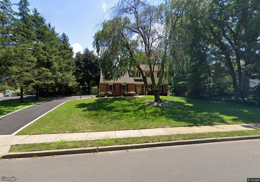
9 John Dyer Way Doylestown, PA 18902
Plumstead NeighborhoodEstimated Value: $738,893 - $821,000
4
Beds
3
Baths
2,573
Sq Ft
$303/Sq Ft
Est. Value
About This Home
This home is located at 9 John Dyer Way, Doylestown, PA 18902 and is currently estimated at $780,473, approximately $303 per square foot. 9 John Dyer Way is a home located in Bucks County with nearby schools including Gayman Elementary School, Tohickon Middle School, and Central Bucks High School - East.
Ownership History
Date
Name
Owned For
Owner Type
Purchase Details
Closed on
Jan 19, 1999
Sold by
Darcy Edward C and Tonero Judith A
Bought by
Darcy Edward C and Darcy Judith A
Current Estimated Value
Home Financials for this Owner
Home Financials are based on the most recent Mortgage that was taken out on this home.
Original Mortgage
$180,500
Interest Rate
6.42%
Purchase Details
Closed on
Apr 1, 1993
Bought by
Darcy Edward C
Create a Home Valuation Report for This Property
The Home Valuation Report is an in-depth analysis detailing your home's value as well as a comparison with similar homes in the area
Home Values in the Area
Average Home Value in this Area
Purchase History
| Date | Buyer | Sale Price | Title Company |
|---|---|---|---|
| Darcy Edward C | -- | T A Title Insurance Company | |
| Darcy Edward C | $222,500 | -- |
Source: Public Records
Mortgage History
| Date | Status | Borrower | Loan Amount |
|---|---|---|---|
| Closed | Darcy Edward C | $180,500 |
Source: Public Records
Tax History Compared to Growth
Tax History
| Year | Tax Paid | Tax Assessment Tax Assessment Total Assessment is a certain percentage of the fair market value that is determined by local assessors to be the total taxable value of land and additions on the property. | Land | Improvement |
|---|---|---|---|---|
| 2025 | $7,159 | $41,200 | $6,120 | $35,080 |
| 2024 | $7,159 | $41,200 | $6,120 | $35,080 |
| 2023 | $6,931 | $41,200 | $6,120 | $35,080 |
| 2022 | $6,854 | $41,200 | $6,120 | $35,080 |
| 2021 | $6,777 | $41,200 | $6,120 | $35,080 |
| 2020 | $6,777 | $41,200 | $6,120 | $35,080 |
| 2019 | $6,736 | $41,200 | $6,120 | $35,080 |
| 2018 | $6,736 | $41,200 | $6,120 | $35,080 |
| 2017 | $6,643 | $41,200 | $6,120 | $35,080 |
| 2016 | $6,643 | $41,200 | $6,120 | $35,080 |
| 2015 | -- | $41,200 | $6,120 | $35,080 |
| 2014 | -- | $41,200 | $6,120 | $35,080 |
Source: Public Records
Map
Nearby Homes
- 4190 Milords Ln
- 4221 Sir Andrew Cir
- 4330 Kleinot Dr
- 4263 Kleinot Dr
- 4317 Kleinot Dr
- 4306 Kleinot Dr
- 4464 Kleinot Dr
- 4246 Kleinot Dr
- 4298 Kleinot Dr
- 3923 Ferry Rd
- 4748 Bishop Cir
- 3838 Jacob Stout Rd
- 4605 Twinbrook Cir
- 3765 William Daves Rd
- 3723 William Daves Rd
- 3867 Charter Club Dr
- 3711 Jacob Stout Rd Unit 5
- 3600 Jacob Stout Rd Unit 3
- 114 Blackfriars Cir
- 100 Bishops Gate Ln Unit 67
- 8 John Dyer Way
- 10 John Dyer Way
- 7 John Dyer Way
- 42 John Dyer Way
- 43 John Dyer Way
- 11 John Dyer Way
- 12 John Dyer Way
- 44 John Dyer Way
- 41 John Dyer Way
- 13 John Dyer Way
- 45 John Dyer Way
- 40 John Dyer Way
- 6 John Dyer Way
- 5 John Dyer Way
- 14 John Dyer Way
- 39 John Dyer Way
- 46 John Dyer Way
- 4 John Dyer Way
- 53 John Dyer Way
- 4237 Landisville Rd