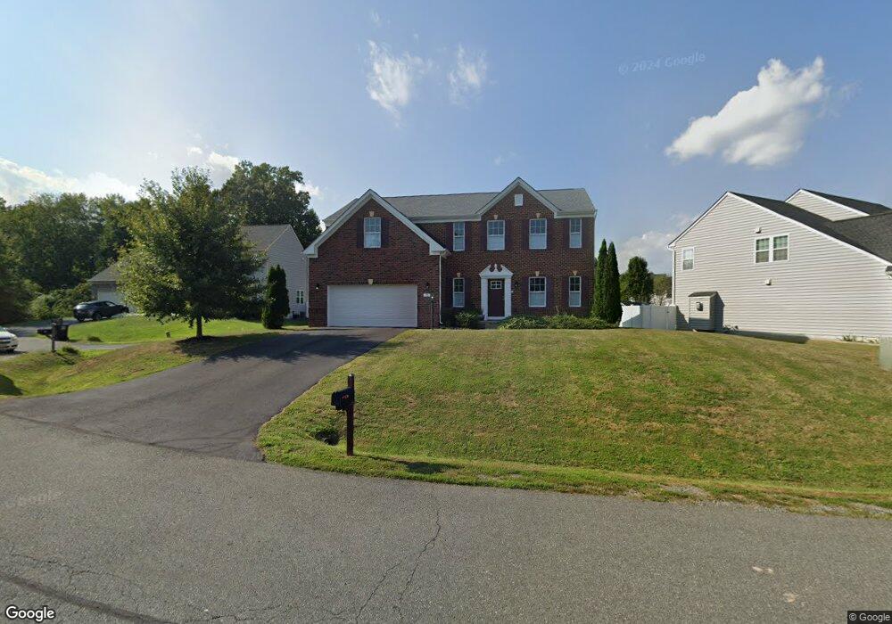
9 Kettlebrook Ct Stafford, VA 22556
Garrisonville NeighborhoodEstimated Value: $691,000 - $711,000
6
Beds
5
Baths
4,055
Sq Ft
$173/Sq Ft
Est. Value
About This Home
This home is located at 9 Kettlebrook Ct, Stafford, VA 22556 and is currently estimated at $702,116, approximately $173 per square foot. 9 Kettlebrook Ct is a home located in Stafford County with nearby schools including Kate Waller Barrett Elementary School, H.H. Poole Middle School, and North Stafford High School.
Ownership History
Date
Name
Owned For
Owner Type
Purchase Details
Closed on
Dec 6, 2019
Sold by
Almborg John and Almborg Donna
Bought by
Almborg John A and Almborg Donna D
Current Estimated Value
Purchase Details
Closed on
Nov 13, 2014
Sold by
Nvr Inc
Bought by
Almborg John
Home Financials for this Owner
Home Financials are based on the most recent Mortgage that was taken out on this home.
Original Mortgage
$464,839
Outstanding Balance
$358,302
Interest Rate
4.17%
Mortgage Type
VA
Estimated Equity
$343,814
Purchase Details
Closed on
Apr 16, 2014
Sold by
Garrett Development Corp
Bought by
Nvr Inc
Create a Home Valuation Report for This Property
The Home Valuation Report is an in-depth analysis detailing your home's value as well as a comparison with similar homes in the area
Home Values in the Area
Average Home Value in this Area
Purchase History
| Date | Buyer | Sale Price | Title Company |
|---|---|---|---|
| Almborg John A | -- | None Available | |
| Almborg John | $449,990 | -- | |
| Nvr Inc | $143,000 | -- |
Source: Public Records
Mortgage History
| Date | Status | Borrower | Loan Amount |
|---|---|---|---|
| Open | Almborg John | $464,839 |
Source: Public Records
Tax History Compared to Growth
Tax History
| Year | Tax Paid | Tax Assessment Tax Assessment Total Assessment is a certain percentage of the fair market value that is determined by local assessors to be the total taxable value of land and additions on the property. | Land | Improvement |
|---|---|---|---|---|
| 2025 | $5,218 | $575,500 | $185,000 | $390,500 |
| 2024 | $5,218 | $575,500 | $185,000 | $390,500 |
| 2023 | $5,169 | $547,000 | $175,000 | $372,000 |
| 2022 | $4,650 | $547,000 | $175,000 | $372,000 |
| 2021 | $4,175 | $430,400 | $140,000 | $290,400 |
| 2020 | $4,175 | $430,400 | $140,000 | $290,400 |
| 2019 | $4,365 | $432,200 | $140,000 | $292,200 |
| 2018 | $4,279 | $432,200 | $140,000 | $292,200 |
| 2017 | $4,229 | $427,200 | $135,000 | $292,200 |
| 2016 | $4,211 | $425,400 | $135,000 | $290,400 |
| 2015 | -- | $435,500 | $135,000 | $300,500 |
| 2014 | -- | $435,500 | $135,000 | $300,500 |
Source: Public Records
Map
Nearby Homes
- 0 Fritters Ln
- 34 Oak Rd
- 205 Powhatan Ct Unit 100
- 202 Buckingham Ln Unit 102
- 611 Madison Ct Unit 611
- 201 Mews Ct
- 200 Surry Ln Unit 118
- 224 Oak Grove Ln
- 115 Austin Dr
- 501 Garrison Woods Dr Unit 303
- 45 Hulvey Dr
- 202 Blueridge Ct
- 12 Jane Ct
- 2 David Ct
- 15 Jason Ct
- 308 Independence Dr
- 7 Lee Ct
- 119 Juggins Rd
- 304 Merrill Ct
- 4 Asmead Place
- 15 Kettlebrook Ct
- 5 Kettlebrook Ct
- 21 Kettlebrook Ct
- 19 Braewood Dr
- 0 Braewood Dr Unit ST7932457
- 0 Braewood Dr Unit ST7932443
- 0 Braewood Dr Unit ST7932437
- 0 Braewood Dr Unit ST7909533
- 0 Braewood Dr Unit ST7880910
- 0 Braewood Dr Unit ST7880904
- 0 Braewood Dr Unit ST7880899
- 0 Braewood Dr Unit ST7880896
- 0 Braewood Dr Unit ST7880892
- 0 Braewood Dr Unit ST7880884
- 0 Braewood Dr Unit 1009691384
- 0 Braewood Dr Unit 1009691350
- 0 Braewood Dr Unit 1009691340
- 0 Braewood Dr Unit 1009669940
- 0 Braewood Dr Unit 1009637670
- 0 Braewood Dr Unit 1009637656