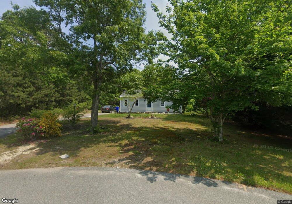
9 King Arthurs Way Buzzards Bay, MA 02532
Estimated Value: $438,298 - $534,000
2
Beds
2
Baths
864
Sq Ft
$567/Sq Ft
Est. Value
About This Home
This home is located at 9 King Arthurs Way, Buzzards Bay, MA 02532 and is currently estimated at $489,825, approximately $566 per square foot. 9 King Arthurs Way is a home located in Barnstable County with nearby schools including Bourne High School, Bridgeview Montessori School, and Waldorf School of Cape Cod.
Ownership History
Date
Name
Owned For
Owner Type
Purchase Details
Closed on
Mar 22, 2023
Sold by
Hejducek Ronald J
Bought by
Ronald J Hejducek Lt and Hejducek
Current Estimated Value
Purchase Details
Closed on
Jun 3, 1994
Sold by
Weldon Pk Rt and Gladney James S
Bought by
Hejducek Ronald J
Home Financials for this Owner
Home Financials are based on the most recent Mortgage that was taken out on this home.
Original Mortgage
$73,650
Interest Rate
8.49%
Mortgage Type
Purchase Money Mortgage
Create a Home Valuation Report for This Property
The Home Valuation Report is an in-depth analysis detailing your home's value as well as a comparison with similar homes in the area
Home Values in the Area
Average Home Value in this Area
Purchase History
| Date | Buyer | Sale Price | Title Company |
|---|---|---|---|
| Ronald J Hejducek Lt | -- | None Available | |
| Ronald J Hejducek Lt | -- | None Available | |
| Hejducek Ronald J | $98,685 | -- | |
| Hejducek Ronald J | $98,685 | -- |
Source: Public Records
Mortgage History
| Date | Status | Borrower | Loan Amount |
|---|---|---|---|
| Previous Owner | Hejducek Ronald J | $73,650 |
Source: Public Records
Tax History Compared to Growth
Tax History
| Year | Tax Paid | Tax Assessment Tax Assessment Total Assessment is a certain percentage of the fair market value that is determined by local assessors to be the total taxable value of land and additions on the property. | Land | Improvement |
|---|---|---|---|---|
| 2025 | $2,791 | $357,300 | $168,900 | $188,400 |
| 2024 | $2,746 | $342,400 | $160,900 | $181,500 |
| 2023 | $2,809 | $318,800 | $158,200 | $160,600 |
| 2022 | $2,699 | $267,500 | $140,000 | $127,500 |
| 2021 | $2,636 | $244,800 | $127,400 | $117,400 |
| 2020 | $2,597 | $241,800 | $126,200 | $115,600 |
| 2019 | $2,473 | $235,300 | $126,200 | $109,100 |
| 2018 | $2,251 | $213,600 | $120,200 | $93,400 |
| 2017 | $2,191 | $212,700 | $119,100 | $93,600 |
| 2016 | $2,138 | $210,400 | $119,100 | $91,300 |
| 2015 | $2,119 | $210,400 | $119,100 | $91,300 |
Source: Public Records
Map
Nearby Homes
- 0 State Rd
- 18 Ocean Pines Dr Unit A
- 368 Old Plymouth Rd
- 4 Fieldwood Dr
- 4 Fieldwood Dr
- 5 Oakwood Dr
- 11 Village Green Dr Unit B
- 20 Brady Rd
- 10 Tecumseh Rd
- 19 Oak Bluff Rd
- 5 Pocasset Rd
- 150 Herring Pond Rd
- 1 Kara's Way
- 133 Phillips Rd
- 29 Sheppard Rd
- 67 Phillips Rd
- 67 Phillips Rd
- 42 Siasconset Dr
- 1150 Long Pond Rd
- 38 Siasconset Dr
- 8 King Arthurs Way
- 8 King Arthurs Way
- 7 King Arthurs Way
- 7 King Arthurs Way
- 5 King Arthurs Way
- 5 King Arthurs Way
- 6 King Arthurs Way
- 3 King Arthurs Way
- 4 King Arthurs Way
- 34 Chart Well Dr
- 32 Chart Well Dr
- 34 Chartwell Dr
- 36 Chart Well Dr
- 2 King Arthurs Way
- 2 King Arthurs Way
- 36 Chartwell Dr
- 32 Chart Well Ave
- 35 Chartwell Dr
- 35 Chart Well Dr
- 5 Camelot Ln