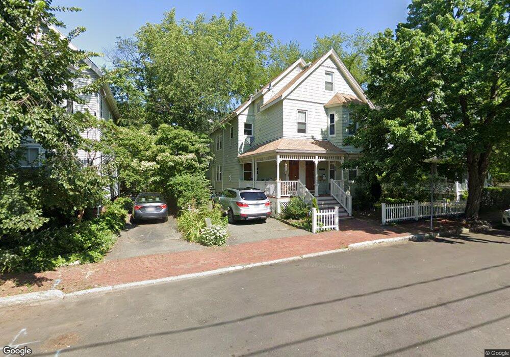
9 King St Unit 2 Cambridge, MA 02140
North Cambridge NeighborhoodEstimated Value: $1,061,000 - $1,411,000
4
Beds
2
Baths
1,474
Sq Ft
$827/Sq Ft
Est. Value
About This Home
This home is located at 9 King St Unit 2, Cambridge, MA 02140 and is currently estimated at $1,218,695, approximately $826 per square foot. 9 King St Unit 2 is a home located in Middlesex County with nearby schools including Cambridge Montessori School, Cambridge Friends School, and Wild Rose Montessori School.
Ownership History
Date
Name
Owned For
Owner Type
Purchase Details
Closed on
Dec 16, 2009
Sold by
Waters Carol L and Waters Martin J
Bought by
Monahon Lia and Barett Trumbull
Current Estimated Value
Home Financials for this Owner
Home Financials are based on the most recent Mortgage that was taken out on this home.
Original Mortgage
$328,000
Outstanding Balance
$215,036
Interest Rate
5%
Mortgage Type
Purchase Money Mortgage
Estimated Equity
$1,003,659
Create a Home Valuation Report for This Property
The Home Valuation Report is an in-depth analysis detailing your home's value as well as a comparison with similar homes in the area
Home Values in the Area
Average Home Value in this Area
Purchase History
| Date | Buyer | Sale Price | Title Company |
|---|---|---|---|
| Monahon Lia | $410,000 | -- |
Source: Public Records
Mortgage History
| Date | Status | Borrower | Loan Amount |
|---|---|---|---|
| Open | Monahon Lia | $328,000 |
Source: Public Records
Tax History
| Year | Tax Paid | Tax Assessment Tax Assessment Total Assessment is a certain percentage of the fair market value that is determined by local assessors to be the total taxable value of land and additions on the property. | Land | Improvement |
|---|---|---|---|---|
| 2025 | $6,714 | $1,057,400 | $0 | $1,057,400 |
| 2024 | $6,314 | $1,066,500 | $0 | $1,066,500 |
| 2023 | $5,879 | $1,003,200 | $0 | $1,003,200 |
| 2022 | $5,855 | $989,000 | $0 | $989,000 |
| 2021 | $5,730 | $979,500 | $0 | $979,500 |
| 2020 | $5,391 | $937,600 | $0 | $937,600 |
| 2019 | $5,165 | $869,500 | $0 | $869,500 |
| 2018 | $5,017 | $797,600 | $0 | $797,600 |
| 2017 | $4,892 | $753,700 | $0 | $753,700 |
| 2016 | $4,827 | $690,500 | $0 | $690,500 |
| 2015 | $4,780 | $611,200 | $0 | $611,200 |
| 2014 | $3,849 | $459,300 | $0 | $459,300 |
Source: Public Records
Map
Nearby Homes
- 11 Cogswell Ave Unit 15
- 11 Cogswell Ave Unit 13
- 3 Warwick Park Unit 2
- 7 Russell St Unit 1
- 7 Beech St Unit 319
- 7 Beech St Unit 317
- 24 Cambridge Terrace Unit 2
- 40 Mount Pleasant St Unit 4
- 10 Beech St Unit 4
- 10 Beech St Unit 1
- 10 Beech St Unit 3
- 80 Upland Rd Unit B
- 178 Richdale Ave
- 18 Upland Rd Unit 1
- 46 Mount Vernon St Unit 1
- 32-40 White St
- 3 Arlington St Unit 44
- 353 Summer St Unit 310
- 6 Washington Ave Unit 11
- 79 Willow Ave
- 9 King St Unit 1
- 11 King St Unit 2
- 57 King St
- 57 & 59 Creighton
- 57 Creighton St Unit 59
- 57 Creighton St Unit 59
- 59 Creighton St Unit 2
- 59 Creighton St Unit 59
- 57 Creighton St Unit 1
- 57-59 Creighton St Unit 2
- 57-59 Creighton St Unit 1
- 8 Cypress St
- 8 Cypress St Unit n/a
- 51 Creighton St Unit 53
- 53 Creighton St
- 53 Creighton St Unit 2
- 53 Creighton St Unit 53
- 6 Cypress St
- 61 Creighton St
- 61 Creighton St Unit 1
Your Personal Tour Guide
Ask me questions while you tour the home.