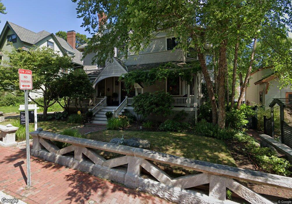
9 Lancaster St Unit 5 Cambridge, MA 02140
Neighborhood Nine NeighborhoodEstimated Value: $512,608 - $631,000
1
Bed
1
Bath
542
Sq Ft
$1,051/Sq Ft
Est. Value
About This Home
This home is located at 9 Lancaster St Unit 5, Cambridge, MA 02140 and is currently estimated at $569,652, approximately $1,051 per square foot. 9 Lancaster St Unit 5 is a home located in Middlesex County with nearby schools including Saint Theresa School, Cambridge Montessori School, and Wild Rose Montessori School.
Ownership History
Date
Name
Owned For
Owner Type
Purchase Details
Closed on
May 31, 2023
Sold by
Wang Nigel M and Wang Haiyan
Bought by
Elizabeth Skovira Ret and Skovira
Current Estimated Value
Purchase Details
Closed on
Jan 27, 2012
Sold by
Steinberg Bernard and Steinberg Roslyn
Bought by
Wang Haiyan and Wang Nigel M
Purchase Details
Closed on
Aug 6, 1993
Sold by
Davis Anthony A and Bushway Priscilla L
Bought by
Steinberg Bernard and Steinberg Roslyn
Purchase Details
Closed on
Jan 5, 1987
Sold by
Butterscotch Rt
Bought by
Davis Anthony A
Create a Home Valuation Report for This Property
The Home Valuation Report is an in-depth analysis detailing your home's value as well as a comparison with similar homes in the area
Home Values in the Area
Average Home Value in this Area
Purchase History
| Date | Buyer | Sale Price | Title Company |
|---|---|---|---|
| Elizabeth Skovira Ret | $978,000 | None Available | |
| Wang Haiyan | $399,000 | -- | |
| Steinberg Bernard | $62,800 | -- | |
| Steinberg Bernard | $62,800 | -- | |
| Davis Anthony A | $67,250 | -- |
Source: Public Records
Tax History Compared to Growth
Tax History
| Year | Tax Paid | Tax Assessment Tax Assessment Total Assessment is a certain percentage of the fair market value that is determined by local assessors to be the total taxable value of land and additions on the property. | Land | Improvement |
|---|---|---|---|---|
| 2025 | $2,330 | $367,000 | $0 | $367,000 |
| 2024 | $2,074 | $350,400 | $0 | $350,400 |
| 2023 | $2,147 | $366,300 | $0 | $366,300 |
| 2022 | $2,142 | $361,900 | $0 | $361,900 |
| 2021 | $2,068 | $353,500 | $0 | $353,500 |
| 2020 | $2,054 | $357,300 | $0 | $357,300 |
| 2019 | $1,966 | $331,000 | $0 | $331,000 |
| 2018 | $1,949 | $303,800 | $0 | $303,800 |
| 2017 | $1,805 | $278,100 | $0 | $278,100 |
| 2016 | $1,690 | $241,800 | $0 | $241,800 |
| 2015 | $1,673 | $213,900 | $0 | $213,900 |
| 2014 | $1,639 | $195,600 | $0 | $195,600 |
Source: Public Records
Map
Nearby Homes
- 3 Arlington St Unit 52
- 22 Agassiz St
- 15-15A Forest St
- 1 Richdale Ave Unit 2
- 24 Cambridge Terrace Unit 2
- 86 Avon Hill St
- 749 Somerville Ave Unit 1
- 32-40 White St
- 43 Linnaean St Unit 42
- 70 Walden St Unit 1
- 70 Walden St Unit 7
- 70 Walden St Unit 11
- 13 Mellen St Unit Front
- 72 Oxford St Unit 72
- 72 Oxford St
- 74 Oxford St
- 74 Oxford St Unit 3
- 7 Beech St Unit 319
- 7 Beech St Unit 211
- 31-33 Mellen St
- 9 Lancaster St Unit 4
- 9 Lancaster St Unit 3
- 9 Lancaster St Unit 2
- 9 Lancaster St Unit 1
- 9 Lancaster St Unit 4 & 5
- 9 Lancaster St
- 7 Lancaster St
- 7 Lancaster St Unit n/a
- 13 Lancaster St
- 5 Lancaster St Unit B
- 15 Lancaster St Unit 3
- 15 Lancaster St Unit 2
- 15 Lancaster St Unit 1
- 15 Lancaster St Unit 3,15
- 3 Lancaster St
- 3 Lancaster St Unit 1
- 3 Lancaster St Unit 3
- 3 Lancaster St
- 1 Lancaster St Unit 9
- 1 Lancaster St Unit 6