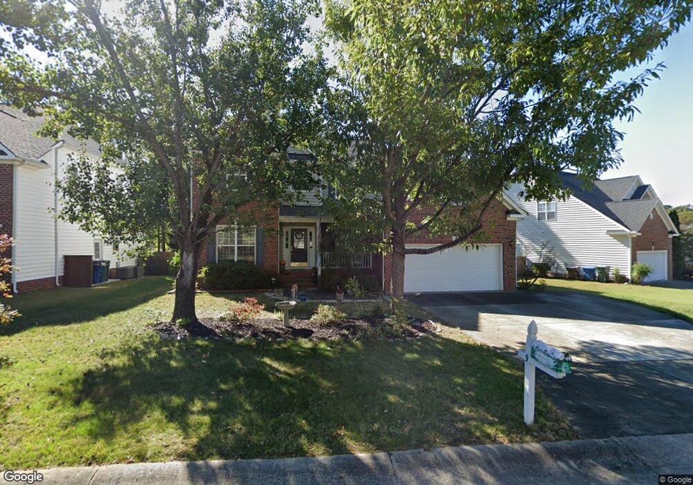
9 Laurel Leaf Ct Durham, NC 27703
South Durham NeighborhoodEstimated Value: $462,000 - $548,000
4
Beds
3
Baths
2,642
Sq Ft
$186/Sq Ft
Est. Value
About This Home
This home is located at 9 Laurel Leaf Ct, Durham, NC 27703 and is currently estimated at $491,913, approximately $186 per square foot. 9 Laurel Leaf Ct is a home located in Durham County with nearby schools including Bethesda Elementary School, John W Neal Middle School, and Southern School of Energy & Sustainability.
Ownership History
Date
Name
Owned For
Owner Type
Purchase Details
Closed on
Mar 26, 2003
Sold by
Centex Homes
Bought by
Ferguson Arthur E and Ferguson Susan H
Current Estimated Value
Home Financials for this Owner
Home Financials are based on the most recent Mortgage that was taken out on this home.
Original Mortgage
$200,000
Outstanding Balance
$85,603
Interest Rate
5.82%
Estimated Equity
$406,310
Create a Home Valuation Report for This Property
The Home Valuation Report is an in-depth analysis detailing your home's value as well as a comparison with similar homes in the area
Home Values in the Area
Average Home Value in this Area
Purchase History
| Date | Buyer | Sale Price | Title Company |
|---|---|---|---|
| Ferguson Arthur E | $253,000 | -- |
Source: Public Records
Mortgage History
| Date | Status | Borrower | Loan Amount |
|---|---|---|---|
| Open | Ferguson Arthur E | $200,000 |
Source: Public Records
Tax History
| Year | Tax Paid | Tax Assessment Tax Assessment Total Assessment is a certain percentage of the fair market value that is determined by local assessors to be the total taxable value of land and additions on the property. | Land | Improvement |
|---|---|---|---|---|
| 2025 | $5,461 | $550,895 | $126,000 | $424,895 |
| 2024 | $4,111 | $294,690 | $54,180 | $240,510 |
| 2023 | $3,860 | $294,690 | $54,180 | $240,510 |
| 2022 | $3,772 | $294,690 | $54,180 | $240,510 |
| 2021 | $3,754 | $294,690 | $54,180 | $240,510 |
| 2020 | $3,666 | $294,690 | $54,180 | $240,510 |
| 2019 | $3,666 | $294,690 | $54,180 | $240,510 |
| 2018 | $3,545 | $261,299 | $42,140 | $219,159 |
| 2017 | $3,518 | $261,299 | $42,140 | $219,159 |
| 2016 | $3,400 | $261,299 | $42,140 | $219,159 |
| 2015 | $3,833 | $276,918 | $47,885 | $229,033 |
| 2014 | $3,833 | $276,918 | $47,885 | $229,033 |
Source: Public Records
Map
Nearby Homes
- 3309 Forest Grove Ct
- 3503 Long Ridge Rd
- 2216 Jollay St
- 1016 Hollis Cir
- 4514 Cottendale Dr
- 1251 Flyfish Ave
- 102 Kingsley Woods Dr
- 1222 Flyfish Ave
- 111 Lang St
- 909 Wood Chapel Ln
- 5024 Dragonfly Dr
- 1200 Bluewater Way
- 1812 Shiva Ct
- 12 Sameer Ct
- 19 Gandhi Dr
- 4213 Congleton Place
- 334 Westgrove Ct
- 5226 Malik Dr
- 1946 Hinesley Dr
- 1931 Hinesley Dr
- 7 Laurel Leaf Ct
- 11 Laurel Leaf Ct
- 4809 Mistletoe Ln
- 4807 Mistletoe Ln
- 5 Laurel Leaf Ct
- 99999 Cedar Leaf Ln Unit 6
- 99999 Cedar Leaf Ln
- 4811 Mistletoe Ln
- 4805 Mistletoe Ln
- 10 Laurel Leaf Ct
- 8 Laurel Leaf Ct
- 13 Laurel Leaf Ct
- 12 Laurel Leaf Ct
- 4813 Mistletoe Ln
- 3 Laurel Leaf Ct
- 6 Laurel Leaf Ct
- 4803 Mistletoe Ln
- 15 Laurel Leaf Ct
- 14 Laurel Leaf Ct
- 1911 Carnation Dr
Your Personal Tour Guide
Ask me questions while you tour the home.