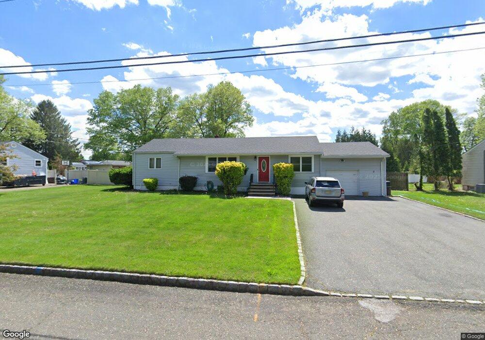
9 Lebeda Dr Fairfield, NJ 07004
Estimated Value: $581,972 - $835,000
Studio
--
Bath
1,533
Sq Ft
$442/Sq Ft
Est. Value
About This Home
This home is located at 9 Lebeda Dr, Fairfield, NJ 07004 and is currently estimated at $677,743, approximately $442 per square foot. 9 Lebeda Dr is a home located in Essex County with nearby schools including Adlai E Stevenson School, Churchill, and West Essex Middle School.
Ownership History
Date
Name
Owned For
Owner Type
Purchase Details
Closed on
Dec 21, 2006
Sold by
Drake Michael
Bought by
Kendall Kevin and Kendall Michele
Current Estimated Value
Home Financials for this Owner
Home Financials are based on the most recent Mortgage that was taken out on this home.
Original Mortgage
$355,000
Outstanding Balance
$211,422
Interest Rate
6.24%
Mortgage Type
New Conventional
Estimated Equity
$466,321
Purchase Details
Closed on
Aug 19, 1998
Sold by
Gemma Scott
Bought by
Drake Michael and Drake Vicki
Home Financials for this Owner
Home Financials are based on the most recent Mortgage that was taken out on this home.
Original Mortgage
$168,750
Interest Rate
6.74%
Purchase Details
Closed on
Jun 24, 1994
Sold by
Kennedy Edward
Bought by
Gemma Scott and Gemma Lisa
Home Financials for this Owner
Home Financials are based on the most recent Mortgage that was taken out on this home.
Original Mortgage
$166,000
Interest Rate
8.54%
Create a Home Valuation Report for This Property
The Home Valuation Report is an in-depth analysis detailing your home's value as well as a comparison with similar homes in the area
Home Values in the Area
Average Home Value in this Area
Purchase History
| Date | Buyer | Sale Price | Title Company |
|---|---|---|---|
| Kendall Kevin | $540,000 | -- | |
| Drake Michael | $225,000 | -- | |
| Gemma Scott | $208,000 | -- |
Source: Public Records
Mortgage History
| Date | Status | Borrower | Loan Amount |
|---|---|---|---|
| Open | Kendall Kevin | $355,000 | |
| Previous Owner | Drake Michael | $168,750 | |
| Previous Owner | Gemma Scott | $166,000 |
Source: Public Records
Tax History
| Year | Tax Paid | Tax Assessment Tax Assessment Total Assessment is a certain percentage of the fair market value that is determined by local assessors to be the total taxable value of land and additions on the property. | Land | Improvement |
|---|---|---|---|---|
| 2025 | $7,278 | $354,500 | $190,400 | $164,100 |
| 2024 | $7,278 | $354,500 | $190,400 | $164,100 |
Source: Public Records
Map
Nearby Homes
- 5 Addison Dr
- 78 Lane Rd Unit 1
- 20 West Dr
- 19 West Dr
- 96 Pier Ln
- 20 Barnsdale Rd
- 34 Carlos Dr
- 21 Styles Terrace
- 11 Cypress Ave
- 82 Stonyridge Dr Unit 82
- 584-588 U S 46
- 30 S Valley Rd
- 30 Andrea Dr
- 62 Pine Brook Rd
- 140 W Greenbrook Rd
- 101 Seminole Ave
- 15 Stepping Ridge Unit G2
- 74 Nakomis Path
- 9 Scalza Ln
- 250 Woodcliff Ave
Your Personal Tour Guide
Ask me questions while you tour the home.