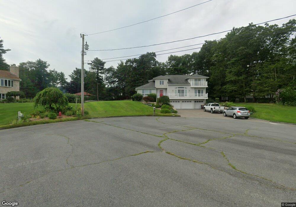
9 Lees Trail Acushnet, MA 02743
Sherwood Forest NeighborhoodEstimated Value: $765,000 - $1,089,000
4
Beds
4
Baths
4,069
Sq Ft
$231/Sq Ft
Est. Value
About This Home
This home is located at 9 Lees Trail, Acushnet, MA 02743 and is currently estimated at $939,519, approximately $230 per square foot. 9 Lees Trail is a home located in Bristol County with nearby schools including Acushnet Elementary School, Albert F Ford Middle School, and Alma del Mar Charter School.
Ownership History
Date
Name
Owned For
Owner Type
Purchase Details
Closed on
Oct 9, 2020
Sold by
Almeida Helena M Est
Bought by
Almeida Ivo M
Current Estimated Value
Purchase Details
Closed on
Jan 4, 2001
Sold by
Koska Michael J
Bought by
Almeida Helena
Create a Home Valuation Report for This Property
The Home Valuation Report is an in-depth analysis detailing your home's value as well as a comparison with similar homes in the area
Home Values in the Area
Average Home Value in this Area
Purchase History
| Date | Buyer | Sale Price | Title Company |
|---|---|---|---|
| Almeida Ivo M | -- | None Available | |
| Almeida Helena | $70,000 | -- |
Source: Public Records
Mortgage History
| Date | Status | Borrower | Loan Amount |
|---|---|---|---|
| Previous Owner | Almeida Helena | $415,000 | |
| Previous Owner | Almeida Helena | $275,000 | |
| Previous Owner | Almeida Helena | $100,000 |
Source: Public Records
Tax History
| Year | Tax Paid | Tax Assessment Tax Assessment Total Assessment is a certain percentage of the fair market value that is determined by local assessors to be the total taxable value of land and additions on the property. | Land | Improvement |
|---|---|---|---|---|
| 2025 | $98 | $912,200 | $158,400 | $753,800 |
| 2024 | $9,524 | $834,700 | $138,600 | $696,100 |
| 2023 | $7,912 | $659,300 | $126,200 | $533,100 |
| 2022 | $7,901 | $595,400 | $118,800 | $476,600 |
| 2021 | $7,869 | $569,000 | $118,800 | $450,200 |
| 2020 | $7,932 | $569,000 | $118,800 | $450,200 |
| 2019 | $0 | $588,800 | $124,700 | $464,100 |
| 2018 | $8,006 | $555,200 | $124,700 | $430,500 |
| 2017 | $7,711 | $534,000 | $124,700 | $409,300 |
| 2016 | $7,194 | $495,100 | $124,700 | $370,400 |
| 2015 | $7,070 | $495,100 | $124,700 | $370,400 |
Source: Public Records
Map
Nearby Homes
- 134 Nyes Ln
- 329 Middle Rd
- 1015 Forbes St
- 40 Foley Dr
- ES Acushnet Ave
- SS Charbonneau Ln
- 765 Pine Hill Dr
- 7 Hamlin St
- 1044 Phillips Rd Unit 25
- 1044 Phillips Rd Unit 20
- 145 Heritage Dr
- 23 Coury Dr
- 34 Poplar Rd
- WS Phillips Rd
- ES Phillips Rd
- 2800 Acushnet Ave
- 1251 Church St Unit 10
- 1056 Victoria St Unit A-13
- 1261 Church St Unit 70
- 1261 Church St Unit 53
Your Personal Tour Guide
Ask me questions while you tour the home.