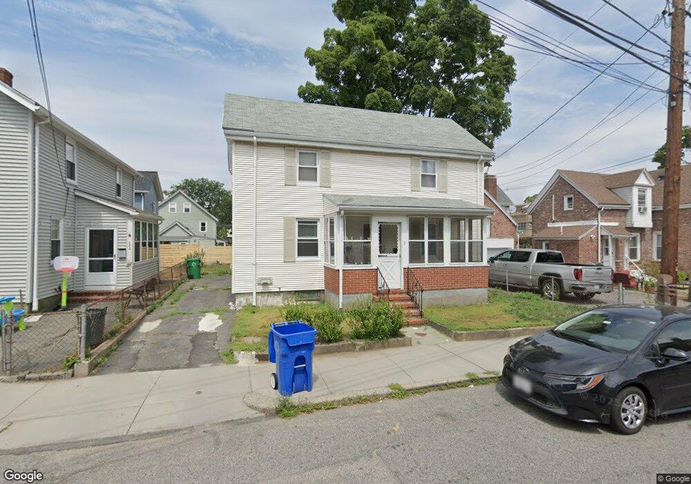
9 Lincoln Rd Newton, MA 02458
Nonantum NeighborhoodEstimated Value: $680,141 - $966,000
2
Beds
1
Bath
1,450
Sq Ft
$551/Sq Ft
Est. Value
About This Home
This home is located at 9 Lincoln Rd, Newton, MA 02458 and is currently estimated at $799,035, approximately $551 per square foot. 9 Lincoln Rd is a home located in Middlesex County with nearby schools including Lincoln-Eliot Elementary School, Bigelow Middle School, and Newton North High School.
Ownership History
Date
Name
Owned For
Owner Type
Purchase Details
Closed on
Aug 13, 2014
Sold by
Yan Hing P and Dau Siu L
Bought by
Yan Kevin K
Current Estimated Value
Purchase Details
Closed on
Nov 28, 1989
Sold by
Yobaccio Angie T
Bought by
Yan Hing P
Home Financials for this Owner
Home Financials are based on the most recent Mortgage that was taken out on this home.
Original Mortgage
$127,500
Interest Rate
9.83%
Mortgage Type
Purchase Money Mortgage
Create a Home Valuation Report for This Property
The Home Valuation Report is an in-depth analysis detailing your home's value as well as a comparison with similar homes in the area
Home Values in the Area
Average Home Value in this Area
Purchase History
| Date | Buyer | Sale Price | Title Company |
|---|---|---|---|
| Yan Kevin K | -- | -- | |
| Yan Hing P | $170,000 | -- |
Source: Public Records
Mortgage History
| Date | Status | Borrower | Loan Amount |
|---|---|---|---|
| Previous Owner | Yan Hing P | $122,850 | |
| Previous Owner | Yan Hing P | $127,500 |
Source: Public Records
Tax History Compared to Growth
Tax History
| Year | Tax Paid | Tax Assessment Tax Assessment Total Assessment is a certain percentage of the fair market value that is determined by local assessors to be the total taxable value of land and additions on the property. | Land | Improvement |
|---|---|---|---|---|
| 2025 | $5,078 | $518,200 | $0 | $0 |
| 2024 | $4,910 | $0 | $0 | $0 |
| 2023 | $4,602 | $452,100 | $0 | $0 |
| 2022 | $4,404 | $418,600 | $418,600 | $0 |
| 2021 | $4,249 | $394,900 | $394,900 | $0 |
| 2020 | $4,123 | $394,900 | $394,900 | $0 |
| 2019 | $4,007 | $383,400 | $0 | $0 |
| 2018 | $3,804 | $351,600 | $0 | $0 |
| 2017 | $3,689 | $331,700 | $0 | $0 |
| 2016 | $3,528 | $310,000 | $0 | $0 |
| 2015 | $3,363 | $289,700 | $289,700 | $0 |
Source: Public Records
Map
Nearby Homes
- 11 Murphy Ct
- 86 West St
- 3 Ashmont Ave
- 188-190 Adams St
- 12-14 Middle St
- 22-24 Emerald St
- 53 West St
- 49 Hawthorn St
- 34 West St Unit A
- 158 Adams St
- 324 Adams St Unit 2
- 290 Watertown St Unit 3
- 290 Watertown St Unit 4
- 42-44 Judkins St
- 90 Waban Park Unit 2
- 230 Bellevue St Unit 1
- 77 Court St Unit 205
- 77 Pond Ave Unit 1103
- 282 Nevada St Unit 282
- 286 Nevada St Unit 286
- 12/14 Lincoln Rd
- 11 Lincoln Rd Unit 13
- 11 Lincoln Rd
- 11 Lincoln Rd Unit 1
- 13 Lincoln Rd
- 13 Lincoln Rd Unit 4
- 13 R Lincoln Rd
- 255 Adams St
- 251 Adams St
- 19 Lincoln Rd
- 12 Lincoln Rd
- 12 Lincoln Rd Unit T
- 12 Lincoln Rd Unit 4
- 12 Lincoln Rd
- 12 Lincoln Rd Unit 2
- 12 Lincoln Rd
- 12 Lincoln Rd
- 12 Lincoln Rd
- 12 Lincoln Rd
- 12 Lincoln Rd