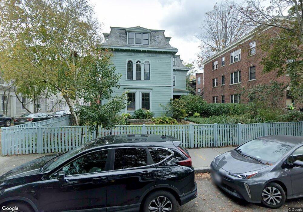
9 Linden St Unit 3 Brookline, MA 02445
Brookline Village NeighborhoodEstimated Value: $714,550 - $827,000
1
Bed
1
Bath
892
Sq Ft
$874/Sq Ft
Est. Value
About This Home
This home is located at 9 Linden St Unit 3, Brookline, MA 02445 and is currently estimated at $779,888, approximately $874 per square foot. 9 Linden St Unit 3 is a home located in Norfolk County with nearby schools including Pierce School and St. Mary of the Assumption Elementary School.
Ownership History
Date
Name
Owned For
Owner Type
Purchase Details
Closed on
Feb 27, 2023
Sold by
Foldy Sharon
Bought by
Thakkar Foldy Ft
Current Estimated Value
Purchase Details
Closed on
Aug 31, 1999
Sold by
Desimone Leonardo
Bought by
Foldy Sharon
Home Financials for this Owner
Home Financials are based on the most recent Mortgage that was taken out on this home.
Original Mortgage
$120,000
Interest Rate
7.53%
Mortgage Type
Purchase Money Mortgage
Create a Home Valuation Report for This Property
The Home Valuation Report is an in-depth analysis detailing your home's value as well as a comparison with similar homes in the area
Home Values in the Area
Average Home Value in this Area
Purchase History
| Date | Buyer | Sale Price | Title Company |
|---|---|---|---|
| Thakkar Foldy Ft | -- | None Available | |
| Foldy Sharon | $257,500 | -- |
Source: Public Records
Mortgage History
| Date | Status | Borrower | Loan Amount |
|---|---|---|---|
| Previous Owner | Foldy Sharon | $120,000 |
Source: Public Records
Tax History Compared to Growth
Tax History
| Year | Tax Paid | Tax Assessment Tax Assessment Total Assessment is a certain percentage of the fair market value that is determined by local assessors to be the total taxable value of land and additions on the property. | Land | Improvement |
|---|---|---|---|---|
| 2025 | $7,760 | $786,200 | $0 | $786,200 |
| 2024 | $7,531 | $770,800 | $0 | $770,800 |
| 2023 | $7,084 | $710,500 | $0 | $710,500 |
| 2022 | $7,029 | $689,800 | $0 | $689,800 |
| 2021 | $6,693 | $683,000 | $0 | $683,000 |
| 2020 | $6,391 | $676,300 | $0 | $676,300 |
| 2019 | $6,035 | $644,100 | $0 | $644,100 |
| 2018 | $5,854 | $618,800 | $0 | $618,800 |
| 2017 | $5,660 | $572,900 | $0 | $572,900 |
| 2016 | $5,427 | $520,800 | $0 | $520,800 |
| 2015 | $5,057 | $473,500 | $0 | $473,500 |
| 2014 | $4,946 | $434,200 | $0 | $434,200 |
Source: Public Records
Map
Nearby Homes
- 106 Brook St
- 120 Brook St Unit 1
- 14 Linden St Unit 8
- 58 Kent St Unit 302
- 58 Kent St Unit 404
- 58 Kent St Unit 305
- 58 Kent St Unit 303
- 39 Kent St Unit B
- 216 Aspinwall Ave
- 214 Aspinwall Ave Unit 2
- 57 Saint Paul St Unit 19
- 5 Auburn Ct Unit 1
- 12 Goodwin Place Unit 12-1
- 12 Goodwin Place Unit 12-2
- 11 Goodwin Place Unit 11-2
- 65 Francis St Unit 65
- 65 Francis St
- 24 Auburn St Unit 1
- 24 Auburn St Unit 2
- 24 Auburn St Unit 3
- 9 Linden St Unit 5
- 9 Linden St Unit 4
- 9 Linden St Unit 2
- 9 Linden St Unit 1
- 9 Linden St
- 7 Linden St
- 7 Linden St Unit 3
- 12 Linden St Unit 1
- 12 Linden St
- 12 Linden St Unit A
- 12 Linden St Unit 2
- 35A Harvard St Unit 1
- 35 Harvard St Unit 37A
- 35 Harvard St Unit 37A
- 35 Harvard St Unit 37A
- 35 Harvard St Unit 37A
- 35 Harvard St Unit 37A
- 35 Harvard St Unit 37A
- 35 Harvard St
- 37 A Harvard St Unit 2 / 37a