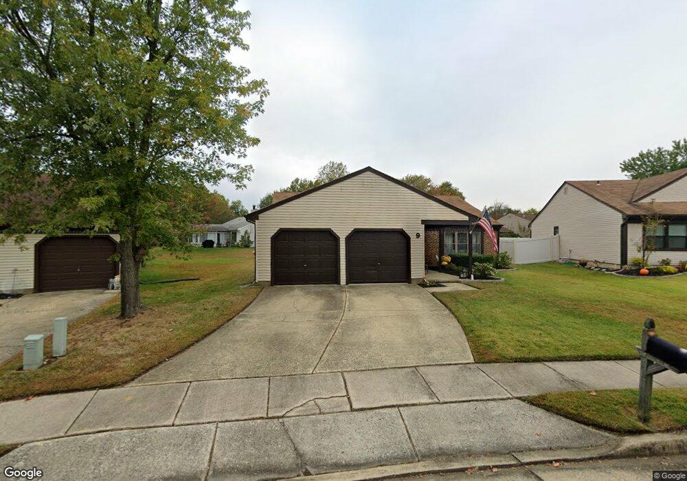
9 Locust Ct Mount Laurel, NJ 08054
Estimated Value: $343,872 - $480,000
--
Bed
--
Bath
1,656
Sq Ft
$249/Sq Ft
Est. Value
About This Home
This home is located at 9 Locust Ct, Mount Laurel, NJ 08054 and is currently estimated at $411,968, approximately $248 per square foot. 9 Locust Ct is a home located in Burlington County with nearby schools including Parkway Elementary School, T.E. Harrington Middle School, and Mount Laurel Hartford School.
Ownership History
Date
Name
Owned For
Owner Type
Purchase Details
Closed on
Jan 9, 2017
Sold by
Devery Dennis W and Devery Kelly Ann
Bought by
Devery Dennis W
Current Estimated Value
Home Financials for this Owner
Home Financials are based on the most recent Mortgage that was taken out on this home.
Original Mortgage
$198,000
Interest Rate
4.03%
Mortgage Type
New Conventional
Purchase Details
Closed on
Dec 2, 2011
Sold by
Devery Dennis W and Cariello Victoria A
Bought by
Devery Dennis W and Devery Kelly Ann
Purchase Details
Closed on
Jul 12, 1996
Sold by
Devery Kevin J
Bought by
Devery Virginia A
Create a Home Valuation Report for This Property
The Home Valuation Report is an in-depth analysis detailing your home's value as well as a comparison with similar homes in the area
Home Values in the Area
Average Home Value in this Area
Purchase History
| Date | Buyer | Sale Price | Title Company |
|---|---|---|---|
| Devery Dennis W | -- | Linera Title & Closing Ltd | |
| Devery Dennis W | -- | Regional Title Agency | |
| Devery Virginia A | -- | Freedom Title & Abstract |
Source: Public Records
Mortgage History
| Date | Status | Borrower | Loan Amount |
|---|---|---|---|
| Closed | Devery Dennis W | $198,000 |
Source: Public Records
Tax History Compared to Growth
Tax History
| Year | Tax Paid | Tax Assessment Tax Assessment Total Assessment is a certain percentage of the fair market value that is determined by local assessors to be the total taxable value of land and additions on the property. | Land | Improvement |
|---|---|---|---|---|
| 2025 | $6,724 | $213,000 | $76,500 | $136,500 |
| 2024 | $6,471 | $213,000 | $76,500 | $136,500 |
| 2023 | $6,471 | $213,000 | $76,500 | $136,500 |
| 2022 | $6,450 | $213,000 | $76,500 | $136,500 |
| 2021 | $6,078 | $213,000 | $76,500 | $136,500 |
| 2020 | $6,205 | $213,000 | $76,500 | $136,500 |
| 2019 | $6,141 | $213,000 | $76,500 | $136,500 |
| 2018 | $6,094 | $213,000 | $76,500 | $136,500 |
| 2017 | $5,936 | $213,000 | $76,500 | $136,500 |
| 2016 | $5,847 | $213,000 | $76,500 | $136,500 |
| 2015 | $5,779 | $213,000 | $76,500 | $136,500 |
| 2014 | $5,721 | $213,000 | $76,500 | $136,500 |
Source: Public Records
Map
Nearby Homes
- 130B Birchfield Ct Unit 130B
- 70B Sumac Ct Unit 70B
- 123A Birchfield Ct Unit 123A
- 60B Sumac Ct
- 12 B E Daisy Ln
- 74 Poppy Ct
- 31 Quince Ct
- 6 E Azalea Ln
- 23 E Oleander Dr
- 13 Village Ct Unit 13
- 907A Oliphant Ln Unit 907A
- 112B W Bluebell Ln Unit 112B
- 16 W Azalea Ln
- 53 Saw Mill Dr
- 99 A W Bluebell Ln
- 11 E Berwin Way
- 124 W Berwin Way
- 705A Wharton Rd
- 6 Leighton Dr
- 205 Kirby Way Unit 205