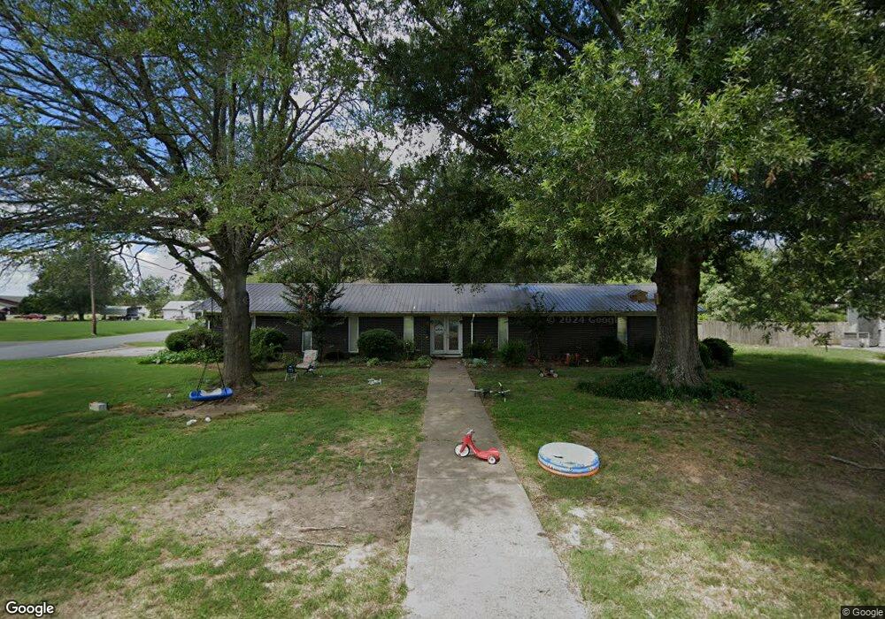
9 Lone Oak Cir de Witt, AR 72042
Estimated Value: $137,000 - $209,000
--
Bed
3
Baths
2,415
Sq Ft
$73/Sq Ft
Est. Value
About This Home
This home is located at 9 Lone Oak Cir, de Witt, AR 72042 and is currently estimated at $175,962, approximately $72 per square foot. 9 Lone Oak Cir is a home located in Arkansas County with nearby schools including Dewitt Elementary School, Dewitt Middle School, and Dewitt High School.
Ownership History
Date
Name
Owned For
Owner Type
Purchase Details
Closed on
Apr 17, 2007
Sold by
Arkansas County Bank Of Dewitt
Bought by
Dumond Joey and Dumond Carole
Current Estimated Value
Home Financials for this Owner
Home Financials are based on the most recent Mortgage that was taken out on this home.
Original Mortgage
$108,585
Outstanding Balance
$65,473
Interest Rate
6.1%
Mortgage Type
New Conventional
Estimated Equity
$110,489
Purchase Details
Closed on
Jun 22, 1998
Bought by
Gunnell
Create a Home Valuation Report for This Property
The Home Valuation Report is an in-depth analysis detailing your home's value as well as a comparison with similar homes in the area
Home Values in the Area
Average Home Value in this Area
Purchase History
| Date | Buyer | Sale Price | Title Company |
|---|---|---|---|
| Dumond Joey | $107,000 | None Available | |
| Gunnell | $84,000 | -- | |
| Excutors Deed | -- | -- |
Source: Public Records
Mortgage History
| Date | Status | Borrower | Loan Amount |
|---|---|---|---|
| Open | Dumond Joey | $108,585 |
Source: Public Records
Tax History Compared to Growth
Tax History
| Year | Tax Paid | Tax Assessment Tax Assessment Total Assessment is a certain percentage of the fair market value that is determined by local assessors to be the total taxable value of land and additions on the property. | Land | Improvement |
|---|---|---|---|---|
| 2025 | -- | $41,449 | $3,000 | $38,449 |
| 2024 | $1,513 | $41,449 | $3,000 | $38,449 |
| 2023 | $1,513 | $41,449 | $3,000 | $38,449 |
| 2022 | $1,471 | $35,300 | $3,000 | $32,300 |
| 2021 | $1,471 | $35,300 | $3,000 | $32,300 |
| 2020 | $1,455 | $35,300 | $3,000 | $32,300 |
| 2019 | $1,378 | $35,300 | $3,000 | $32,300 |
| 2018 | $1,326 | $35,300 | $3,000 | $32,300 |
| 2017 | $1,535 | $29,470 | $2,000 | $27,470 |
| 2016 | $1,191 | $29,470 | $2,000 | $27,470 |
| 2015 | -- | $29,420 | $2,000 | $27,420 |
| 2014 | -- | $28,150 | $2,000 | $26,150 |
| 2013 | -- | $28,150 | $2,000 | $26,150 |
Source: Public Records
Map
Nearby Homes
- 1200 S Grandview Dr
- 1313 W 10th St
- 1222 S Tyler St
- 37 Crescent Park Dr
- 1220 W 16th St
- 30 Green Meadow Dr
- 906 W 10th St
- 1015 S Harrison St
- 701 W 9th St
- 622 S Tyler St
- 510 S Circle Dr
- 722 W 5th St
- 621 W 5th St
- 123 W 14th St
- 1101 S Adams St
- 115 W 14th St
- 614 S Main St
- 716 S Washington St
- 120 N Harrison St
- 110 N Van Buren St
- 25 Lone Oak Cir
- 1212 S Grandview Dr
- 24 Lone Oak Cir
- 1206 S Grandview Dr
- 1321 W 13th St
- 35 Lone Oak Cir
- 1105 W 13th St
- 20 Lone Oak Cir
- 21 Lone Oak Cir
- 22 Lone Oak Cir
- 1310 S Grandview Dr
- 1305 S Grandview Dr
- 1 Lone Oak Cir
- 1408 Waller St
- 1023 W 13th St
- 1 Shiloh Ln
- 1402 S Grandview Dr
- 1409 Waller St
- 1104 S Grandview Dr
- 1506 Waller St