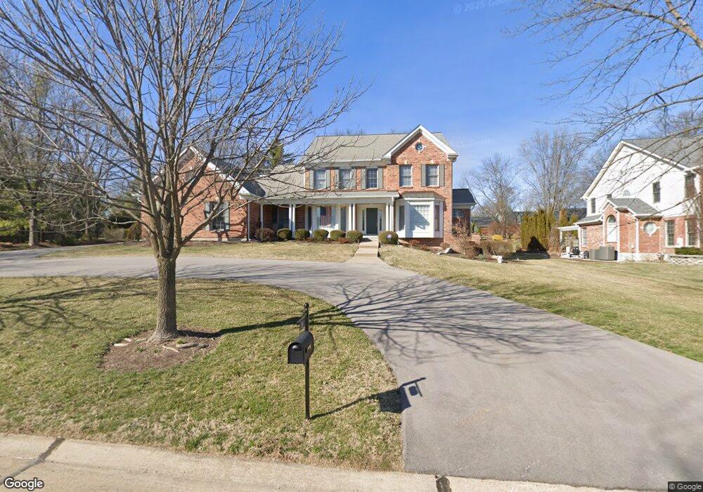
9 Longrove Ln Saint Louis, MO 63131
Estimated Value: $1,215,000 - $1,544,000
3
Beds
5
Baths
4,206
Sq Ft
$328/Sq Ft
Est. Value
About This Home
This home is located at 9 Longrove Ln, Saint Louis, MO 63131 and is currently estimated at $1,380,643, approximately $328 per square foot. 9 Longrove Ln is a home located in St. Louis County with nearby schools including Westchester Elementary School, North Kirkwood Middle School, and Kirkwood Senior High School.
Ownership History
Date
Name
Owned For
Owner Type
Purchase Details
Closed on
Aug 14, 2024
Sold by
Rollo John L and Rollo Anne H
Bought by
John And Anne Rollo Trust
Current Estimated Value
Purchase Details
Closed on
May 11, 2001
Sold by
Berkley Partnership
Bought by
Rollo John and Rollo Anne
Home Financials for this Owner
Home Financials are based on the most recent Mortgage that was taken out on this home.
Original Mortgage
$1,000,000
Interest Rate
7.12%
Create a Home Valuation Report for This Property
The Home Valuation Report is an in-depth analysis detailing your home's value as well as a comparison with similar homes in the area
Home Values in the Area
Average Home Value in this Area
Purchase History
| Date | Buyer | Sale Price | Title Company |
|---|---|---|---|
| John And Anne Rollo Trust | -- | None Listed On Document | |
| Rollo John | $760,000 | -- | |
| Rollo John | $760,000 | -- |
Source: Public Records
Mortgage History
| Date | Status | Borrower | Loan Amount |
|---|---|---|---|
| Previous Owner | Rollo John | $1,000,000 |
Source: Public Records
Tax History
| Year | Tax Paid | Tax Assessment Tax Assessment Total Assessment is a certain percentage of the fair market value that is determined by local assessors to be the total taxable value of land and additions on the property. | Land | Improvement |
|---|---|---|---|---|
| 2025 | $11,258 | $206,510 | $79,210 | $127,300 |
| 2024 | $11,258 | $195,010 | $64,350 | $130,660 |
| 2023 | $11,083 | $195,010 | $64,350 | $130,660 |
| 2022 | $10,742 | $176,180 | $64,350 | $111,830 |
| 2021 | $10,627 | $176,180 | $64,350 | $111,830 |
| 2020 | $8,692 | $138,470 | $37,920 | $100,550 |
| 2019 | $8,703 | $138,470 | $37,920 | $100,550 |
| 2018 | $9,984 | $142,600 | $28,900 | $113,700 |
| 2017 | $10,011 | $142,600 | $28,900 | $113,700 |
| 2016 | $9,627 | $138,890 | $28,900 | $109,990 |
Source: Public Records
Map
Nearby Homes
- 2046 Willow Leaf Dr
- 2030 N Ballas Rd
- TBB Ballas Ridge Hawthorne II
- TBB
- TBB Ballas Ridge Westchester IV
- TBB Ballas Ridge Roclare II
- TBB
- 1741 Pine Hill Dr
- 2056 N Ballas Rd
- 2062 N Ballas Rd
- 701 Laurel Oak
- 11230 Hermitage Hill Place
- 3 Countryside Ln
- 152 Frontenac Forest
- 12439 Springdale Ln Unit TBB
- 0 Unknown Unit 22071090
- 1319 Kendon Dr
- 1534 Woodgate Dr
- 17 Outer Ladue Dr
- 16 Outer Ladue Dr
- 5 Longrove Ln
- 1 Doubletree Ln
- 2 Doubletree Ln
- 2001 Bopp Rd
- 13 Meaux Mart Ln
- 12001 Chaltenham Dr
- 4 Doubletree Ln
- 3 Doubletree Ln
- 2009 Bopp Rd
- 2017 Bopp Rd
- 10 Doubletree Ln
- 9 Doubletree Ln
- 12000 Chaltenham Dr
- 3 Longrove Ln
- 11916 Spring Dr
- 12 Meaux Mart Ln
- 11912 Spring Dr
- 11920 Spring Dr
- 5 Doubletree Ln
- 8 Doubletree Ln
Your Personal Tour Guide
Ask me questions while you tour the home.