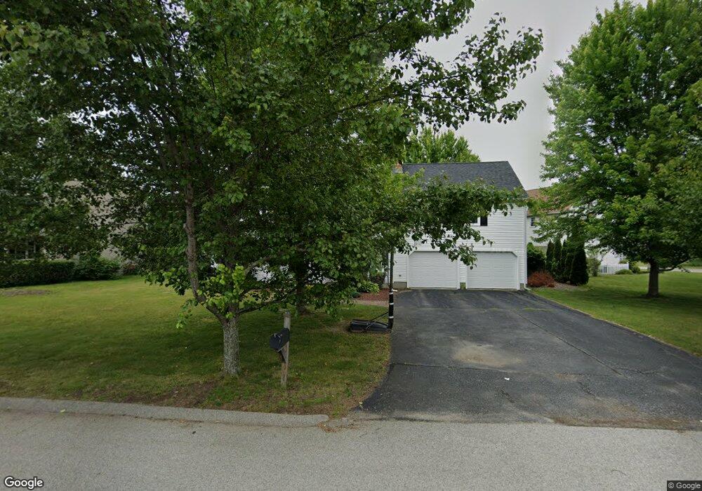
9 Lt Haynes Mem Dr Millbury, MA 01527
Estimated Value: $640,559 - $711,000
3
Beds
3
Baths
2,520
Sq Ft
$268/Sq Ft
Est. Value
About This Home
This home is located at 9 Lt Haynes Mem Dr, Millbury, MA 01527 and is currently estimated at $675,640, approximately $268 per square foot. 9 Lt Haynes Mem Dr is a home located in Worcester County with nearby schools including Elmwood Street Elementary School, Raymond E. Shaw Elementary School, and Millbury Junior/Senior High School.
Ownership History
Date
Name
Owned For
Owner Type
Purchase Details
Closed on
Mar 8, 2001
Sold by
Rollie Shepard Rt and Miles
Bought by
Pogorek Kevin M and Pogorek Stephanie C
Current Estimated Value
Home Financials for this Owner
Home Financials are based on the most recent Mortgage that was taken out on this home.
Original Mortgage
$215,000
Interest Rate
7.15%
Mortgage Type
Purchase Money Mortgage
Create a Home Valuation Report for This Property
The Home Valuation Report is an in-depth analysis detailing your home's value as well as a comparison with similar homes in the area
Home Values in the Area
Average Home Value in this Area
Purchase History
| Date | Buyer | Sale Price | Title Company |
|---|---|---|---|
| Pogorek Kevin M | $235,000 | -- | |
| Pogorek Kevin M | $235,000 | -- |
Source: Public Records
Mortgage History
| Date | Status | Borrower | Loan Amount |
|---|---|---|---|
| Open | Pogorek Kevin M | $295,000 | |
| Closed | Pogorek Kevin M | $225,000 | |
| Closed | Pogorek Kevin M | $215,000 |
Source: Public Records
Tax History Compared to Growth
Tax History
| Year | Tax Paid | Tax Assessment Tax Assessment Total Assessment is a certain percentage of the fair market value that is determined by local assessors to be the total taxable value of land and additions on the property. | Land | Improvement |
|---|---|---|---|---|
| 2025 | $8,165 | $609,800 | $113,300 | $496,500 |
| 2024 | $7,490 | $566,100 | $104,900 | $461,200 |
| 2023 | $6,849 | $474,000 | $73,600 | $400,400 |
| 2022 | $6,135 | $409,000 | $73,600 | $335,400 |
| 2021 | $4,287 | $391,300 | $73,600 | $317,700 |
| 2020 | $5,908 | $385,400 | $73,600 | $311,800 |
| 2019 | $5,492 | $346,500 | $73,200 | $273,300 |
| 2018 | $5,440 | $332,900 | $73,200 | $259,700 |
| 2017 | $5,064 | $308,200 | $73,200 | $235,000 |
| 2016 | $5,104 | $310,100 | $73,200 | $236,900 |
| 2015 | $4,940 | $300,100 | $74,500 | $225,600 |
| 2014 | $4,607 | $269,400 | $77,900 | $191,500 |
Source: Public Records
Map
Nearby Homes
- 86 Wheelock Ave
- 12 Irene Ct
- 2 Diane St
- 3 May St
- 11 Westview Ave
- 11 Maplewood Rd
- 1 Pineland Ave
- 27 A-B Grafton St
- 90 Macarthur Dr
- 3 Stidsen Way
- 1 Broadmeadow Ave
- 46 John Dr Unit 46
- 21 Lordvale Blvd Unit 406
- 5 Edward Dr
- 330 Millbury Ave
- 232 Weatherstone Dr
- 76 Weatherstone Dr
- 76 Samuel Dr
- 5 Lincoln Ln Unit 5
- 28 Lincoln Ln
- 11 Lt William S Haynes Memorial Dr
- 11 Lt Haynes Mem Dr
- 7 Lt Haynes Mem Dr
- 13 Lt Haynes Dr
- 10 Lt Haynes Dr
- 13 Lt William S Haynes Memor
- 13 Lt Haynes Mem Dr
- 10 Lt Wm S Haynes III Dr
- 10 Lt William S Haynes Memorial Dr
- 10 Lt Haynes Mem Dr
- 5 Lt Haynes Mem Dr
- 12 Lt Haynes Mem Dr
- 14 Lt Haynes Dr
- 8 Lt Haynes Mem Dr
- 8 Lt William S Haynes Memorial Dr
- 15 Lt Haynes Dr
- 18 Lt Haynes Dr
- 15 Lt Haynes Mem Dr
- 15 Lt William S Haynes Memorial Dr
- 3 Lt Haynes Mem Dr