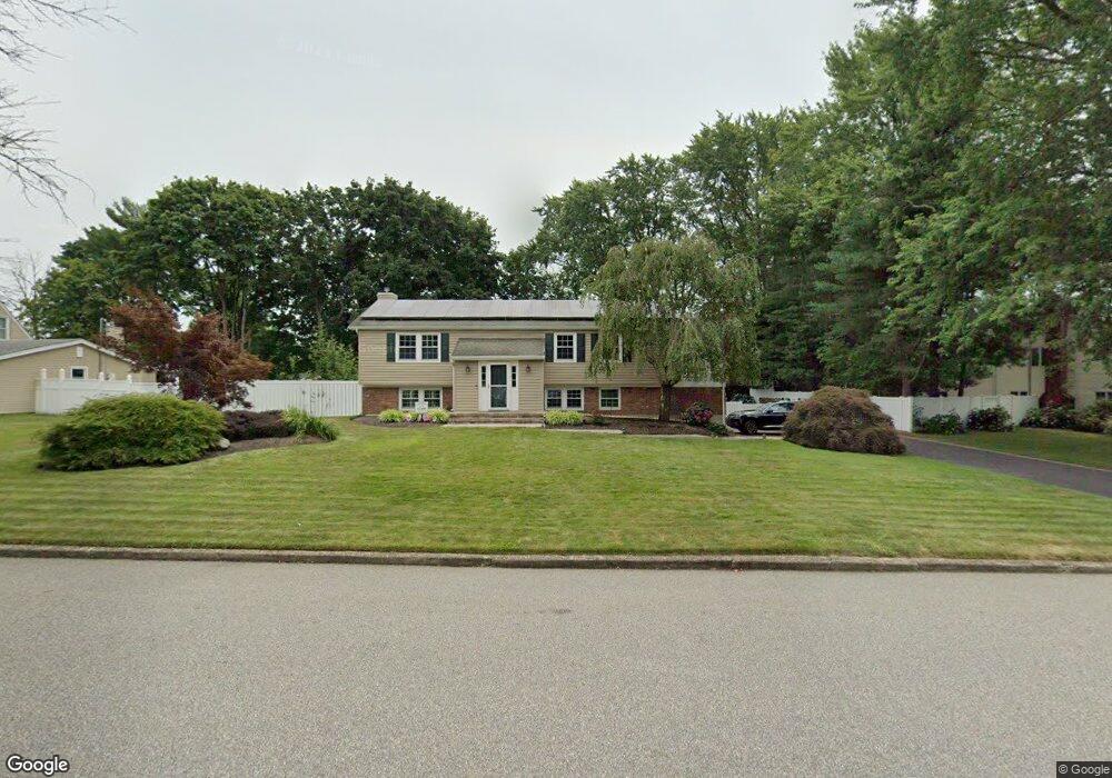
9 Manchester Ln Stony Brook, NY 11790
Estimated Value: $769,670 - $844,000
4
Beds
3
Baths
2,262
Sq Ft
$359/Sq Ft
Est. Value
About This Home
This home is located at 9 Manchester Ln, Stony Brook, NY 11790 and is currently estimated at $812,418, approximately $359 per square foot. 9 Manchester Ln is a home located in Suffolk County with nearby schools including William Sidney Mount School, Robert Cushman Murphy Junior High School, and Ward Melville Senior High School.
Ownership History
Date
Name
Owned For
Owner Type
Purchase Details
Closed on
Feb 9, 2009
Sold by
Cartus Relocaiton Corp
Bought by
Schaentzler Richard
Current Estimated Value
Home Financials for this Owner
Home Financials are based on the most recent Mortgage that was taken out on this home.
Original Mortgage
$336,000
Outstanding Balance
$211,938
Interest Rate
5.06%
Estimated Equity
$600,480
Purchase Details
Closed on
Jun 9, 2003
Sold by
Reis Ronald O and Reis Dona
Bought by
Holloway Joseph and Holloway Lynn
Home Financials for this Owner
Home Financials are based on the most recent Mortgage that was taken out on this home.
Original Mortgage
$63,975
Interest Rate
5.34%
Mortgage Type
Credit Line Revolving
Create a Home Valuation Report for This Property
The Home Valuation Report is an in-depth analysis detailing your home's value as well as a comparison with similar homes in the area
Home Values in the Area
Average Home Value in this Area
Purchase History
| Date | Buyer | Sale Price | Title Company |
|---|---|---|---|
| Schaentzler Richard | $420,000 | Michael Water | |
| Cartus Relocation Corp | $420,000 | Bruce Hofstetter | |
| Holloway Joseph | $426,500 | Commonwealth Land Title Ins |
Source: Public Records
Mortgage History
| Date | Status | Borrower | Loan Amount |
|---|---|---|---|
| Open | Cartus Relocation Corp | $336,000 | |
| Previous Owner | Holloway Joseph | $63,975 | |
| Previous Owner | Holloway Joseph | $341,200 |
Source: Public Records
Tax History
| Year | Tax Paid | Tax Assessment Tax Assessment Total Assessment is a certain percentage of the fair market value that is determined by local assessors to be the total taxable value of land and additions on the property. | Land | Improvement |
|---|---|---|---|---|
| 2024 | $13,848 | $3,300 | $300 | $3,000 |
| 2023 | $13,848 | $3,300 | $300 | $3,000 |
| 2022 | $12,317 | $3,300 | $300 | $3,000 |
| 2021 | $12,317 | $3,300 | $300 | $3,000 |
| 2020 | $12,700 | $3,300 | $300 | $3,000 |
| 2019 | $12,700 | $0 | $0 | $0 |
| 2018 | $12,008 | $3,300 | $300 | $3,000 |
| 2017 | $12,008 | $3,300 | $300 | $3,000 |
| 2016 | $11,883 | $3,500 | $300 | $3,200 |
| 2015 | -- | $3,500 | $300 | $3,200 |
| 2014 | -- | $3,300 | $300 | $3,000 |
Source: Public Records
Map
Nearby Homes
- 16 Manchester Ln
- 286 Hallock Rd
- 6 Freshman Ln
- 506 Drew Dr
- 28 Mosshill Place
- 908 Drew Ln Unit D908
- 43 Millbrook Dr
- 6 Palfrey St
- 909 Fenway Rd
- 901 Fenway Rd
- 401 Cabot Ct E Unit C401
- 607 Cabot Ct E Unit C607
- 101 Flair Ct E Unit F101
- 62 Knolls Dr
- 30 Oak Run
- 203 Cabot Ct S
- 102 Gotham Way
- 82 Strathmore Gate Dr
- 201 Bentley Ct E Unit 201
- 363 Oxhead Rd
Your Personal Tour Guide
Ask me questions while you tour the home.