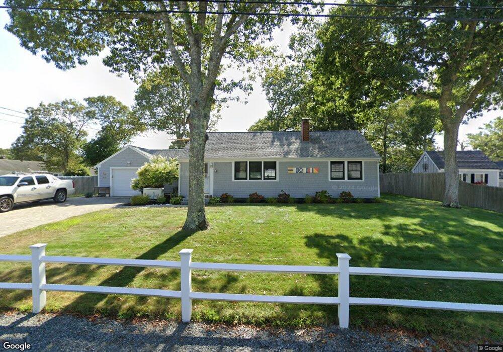
9 Mari Jane Rd West Dennis, MA 02670
West Dennis NeighborhoodEstimated Value: $594,000 - $658,000
2
Beds
1
Bath
1,068
Sq Ft
$585/Sq Ft
Est. Value
About This Home
This home is located at 9 Mari Jane Rd, West Dennis, MA 02670 and is currently estimated at $624,731, approximately $584 per square foot. 9 Mari Jane Rd is a home located in Barnstable County with nearby schools including Dennis-Yarmouth Regional High School and St. Pius X. School.
Ownership History
Date
Name
Owned For
Owner Type
Purchase Details
Closed on
Apr 9, 2019
Sold by
Damato Lisa J
Bought by
Lisa L Damto Ret
Current Estimated Value
Purchase Details
Closed on
Mar 6, 2006
Sold by
Oconnor Re T
Bought by
Damato Lisa J
Home Financials for this Owner
Home Financials are based on the most recent Mortgage that was taken out on this home.
Original Mortgage
$240,000
Interest Rate
6.16%
Mortgage Type
Purchase Money Mortgage
Purchase Details
Closed on
Oct 21, 2004
Sold by
Oconnor Elizabeth and Oconnor John
Bought by
Oconnor Elizabeth and Oconnor John A
Purchase Details
Closed on
Dec 15, 2003
Sold by
Connolly Edith P
Bought by
Oconnor John and Oconnor Elizabeth
Create a Home Valuation Report for This Property
The Home Valuation Report is an in-depth analysis detailing your home's value as well as a comparison with similar homes in the area
Home Values in the Area
Average Home Value in this Area
Purchase History
| Date | Buyer | Sale Price | Title Company |
|---|---|---|---|
| Lisa L Damto Ret | -- | -- | |
| Damato Lisa J | $340,000 | -- | |
| Oconnor Elizabeth | -- | -- | |
| Oconnor John | $230,000 | -- |
Source: Public Records
Mortgage History
| Date | Status | Borrower | Loan Amount |
|---|---|---|---|
| Previous Owner | Damato Lisa J | $240,000 |
Source: Public Records
Tax History
| Year | Tax Paid | Tax Assessment Tax Assessment Total Assessment is a certain percentage of the fair market value that is determined by local assessors to be the total taxable value of land and additions on the property. | Land | Improvement |
|---|---|---|---|---|
| 2025 | $2,531 | $584,500 | $220,400 | $364,100 |
| 2024 | $2,383 | $542,800 | $211,900 | $330,900 |
| 2023 | $2,305 | $493,600 | $192,700 | $300,900 |
| 2022 | $2,078 | $371,100 | $150,400 | $220,700 |
| 2021 | $6,573 | $330,200 | $147,500 | $182,700 |
| 2020 | $6,411 | $324,700 | $158,800 | $165,900 |
| 2019 | $2,639 | $319,800 | $166,800 | $153,000 |
| 2018 | $1,832 | $288,900 | $148,200 | $140,700 |
| 2017 | $1,749 | $284,400 | $148,200 | $136,200 |
| 2016 | $1,761 | $269,700 | $153,500 | $116,200 |
| 2015 | $1,726 | $269,700 | $153,500 | $116,200 |
| 2014 | $1,700 | $267,700 | $153,500 | $114,200 |
Source: Public Records
Map
Nearby Homes
- 467 Main St
- 428 Main St Unit 1-11
- 27 Mayflower Ln
- 7 Pinefield Ln
- 3 Pinefield Ln
- 102 Lawrence Rd
- 111 School St Unit 5
- 23 Doric Ave
- 71 Main St
- 56 Uncle Rolf Rd
- 112 Old Wharf Rd Unit E4
- 205 Lower County Rd Unit 8
- 183 Captain Chase Rd
- 38 Cranberry Ln
- 33 Kelleys Pond Rd
- 154 Old Wharf Rd Unit 14
- 268 Main St
- 10 North Rd
- 230 Old Wharf Rd Unit 272
- 230 Old Wharf Rd Unit 265
Your Personal Tour Guide
Ask me questions while you tour the home.