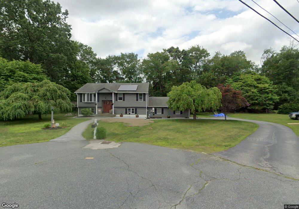
9 Matson Ln Millbury, MA 01527
Estimated Value: $482,000 - $560,000
4
Beds
2
Baths
1,900
Sq Ft
$274/Sq Ft
Est. Value
About This Home
This home is located at 9 Matson Ln, Millbury, MA 01527 and is currently estimated at $519,860, approximately $273 per square foot. 9 Matson Ln is a home located in Worcester County with nearby schools including Elmwood Street Elementary School, Raymond E. Shaw Elementary School, and Millbury Junior/Senior High School.
Ownership History
Date
Name
Owned For
Owner Type
Purchase Details
Closed on
Aug 30, 2010
Sold by
Bruso Irt and Bruso
Bought by
Travers Ronald P and Travers Cheryl E
Current Estimated Value
Home Financials for this Owner
Home Financials are based on the most recent Mortgage that was taken out on this home.
Original Mortgage
$266,412
Outstanding Balance
$177,300
Interest Rate
4.75%
Mortgage Type
FHA
Estimated Equity
$342,560
Purchase Details
Closed on
Jan 13, 2009
Sold by
Bruso Irt and Bruso
Bought by
Paquette Loring G and Paquette Rosalie L
Purchase Details
Closed on
Nov 24, 2008
Sold by
Bruso James F and Bruso Jeannette T
Bought by
Bruso Irt and Bruso
Create a Home Valuation Report for This Property
The Home Valuation Report is an in-depth analysis detailing your home's value as well as a comparison with similar homes in the area
Home Values in the Area
Average Home Value in this Area
Purchase History
| Date | Buyer | Sale Price | Title Company |
|---|---|---|---|
| Travers Ronald P | $275,000 | -- | |
| Travers Ronald P | $275,000 | -- | |
| Paquette Loring G | -- | -- | |
| Paquette Loring G | -- | -- | |
| Bruso Irt | -- | -- | |
| Bruso Irt | -- | -- |
Source: Public Records
Mortgage History
| Date | Status | Borrower | Loan Amount |
|---|---|---|---|
| Open | Travers Ronald P | $266,412 | |
| Closed | Bruso Irt | $266,412 |
Source: Public Records
Tax History
| Year | Tax Paid | Tax Assessment Tax Assessment Total Assessment is a certain percentage of the fair market value that is determined by local assessors to be the total taxable value of land and additions on the property. | Land | Improvement |
|---|---|---|---|---|
| 2025 | $5,925 | $442,500 | $115,200 | $327,300 |
| 2024 | $5,439 | $411,100 | $106,700 | $304,400 |
| 2023 | $4,978 | $344,500 | $74,800 | $269,700 |
| 2022 | $4,629 | $308,600 | $74,800 | $233,800 |
| 2021 | $4,553 | $295,100 | $74,800 | $220,300 |
| 2020 | $4,671 | $304,700 | $74,800 | $229,900 |
| 2019 | $4,321 | $272,600 | $68,000 | $204,600 |
| 2018 | $4,265 | $261,000 | $68,000 | $193,000 |
| 2017 | $3,877 | $236,000 | $68,000 | $168,000 |
| 2016 | $3,725 | $226,300 | $68,000 | $158,300 |
| 2015 | $3,700 | $224,800 | $72,300 | $152,500 |
| 2014 | $3,545 | $207,300 | $72,300 | $135,000 |
Source: Public Records
Map
Nearby Homes
- 12 Irene Ct
- 2 Diane St
- 7 Barbara St
- 8 Nightview Place
- 11 Maplewood Rd
- 1459 Grafton Rd
- 48 Macarthur Dr
- 182 Weatherstone Dr
- 51 John Dr Unit 51
- 7 Clarissa St
- 1195 Grafton St Unit 29
- 1195 Grafton St Unit 39
- 9 Marissa Cir
- 47 Ideal Rd
- 2 Wilson Rd Unit B
- 2 Wilson Rd Unit A
- 31 Blithewood Ave Unit 705
- 194 Worcester St
- 15 Lakeside Dr
- 270 Sunderland Rd Unit 73
- 7 Matson Ln
- 146 Wheelock Ave
- 8 Matson Ln
- 17 Lt Haynes Mem Dr
- 17 Lt William S Haynes Memorial Dr
- 19 Lt Haynes Mem Dr
- 5 Matson Ln
- 148 Wheelock Ave
- 6 Matson Ln
- 140 Wheelock Ave
- 150 Wheelock Ave
- 4 Matson Ln
- 147 Wheelock Ave
- 3 Matson Ln
- 20 Lt Haynes Mem Dr
- 134 Wheelock Ave
- 152 Wheelock Ave
- 15 Lt Haynes Dr
- 8 John St
- 15 Lt William S Haynes Memorial Dr