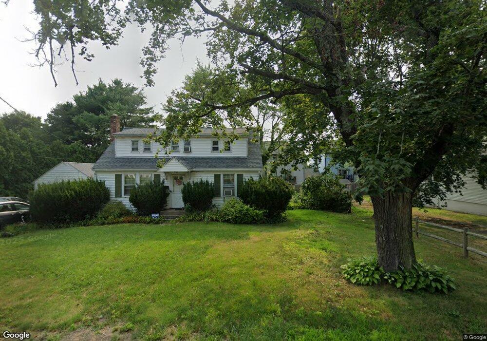
9 Meadowbrook Rd Unit 1 Millis, MA 02054
Estimated Value: $393,000 - $433,000
2
Beds
2
Baths
1,750
Sq Ft
$239/Sq Ft
Est. Value
About This Home
This home is located at 9 Meadowbrook Rd Unit 1, Millis, MA 02054 and is currently estimated at $418,347, approximately $239 per square foot. 9 Meadowbrook Rd Unit 1 is a home located in Norfolk County with nearby schools including Clyde F Brown, Millis Middle School, and Millis High School.
Ownership History
Date
Name
Owned For
Owner Type
Purchase Details
Closed on
Aug 12, 2021
Sold by
Mitchell David E and Mitchell Walter Bopha
Bought by
Ly Bopha C
Current Estimated Value
Home Financials for this Owner
Home Financials are based on the most recent Mortgage that was taken out on this home.
Original Mortgage
$172,000
Outstanding Balance
$156,401
Interest Rate
2.9%
Mortgage Type
Purchase Money Mortgage
Estimated Equity
$261,946
Purchase Details
Closed on
Sep 28, 2011
Sold by
Bank Of Canton
Bought by
Mitchell David B and Walter Bopha L
Home Financials for this Owner
Home Financials are based on the most recent Mortgage that was taken out on this home.
Original Mortgage
$100,000
Interest Rate
4.15%
Mortgage Type
Purchase Money Mortgage
Purchase Details
Closed on
Jun 9, 2011
Sold by
Bradley Christopher J
Bought by
Bank Of Canton
Purchase Details
Closed on
Sep 6, 2006
Sold by
Barrett Christopher
Bought by
Bradley Christopher J
Home Financials for this Owner
Home Financials are based on the most recent Mortgage that was taken out on this home.
Original Mortgage
$260,000
Interest Rate
6.79%
Mortgage Type
Purchase Money Mortgage
Purchase Details
Closed on
Apr 2, 2001
Sold by
Childs Richard and Childs Tracey
Bought by
Barrett Christopher
Home Financials for this Owner
Home Financials are based on the most recent Mortgage that was taken out on this home.
Original Mortgage
$177,200
Interest Rate
6.96%
Mortgage Type
Purchase Money Mortgage
Purchase Details
Closed on
Jul 1, 1996
Sold by
Langelo Laurie G
Bought by
Bengiovanni Tracey
Home Financials for this Owner
Home Financials are based on the most recent Mortgage that was taken out on this home.
Original Mortgage
$99,900
Interest Rate
8.05%
Mortgage Type
Purchase Money Mortgage
Purchase Details
Closed on
Jun 17, 1988
Sold by
Dmytryck Tr Sally W
Bought by
Langelo Laurie G
Home Financials for this Owner
Home Financials are based on the most recent Mortgage that was taken out on this home.
Original Mortgage
$92,700
Interest Rate
10.24%
Mortgage Type
Purchase Money Mortgage
Create a Home Valuation Report for This Property
The Home Valuation Report is an in-depth analysis detailing your home's value as well as a comparison with similar homes in the area
Home Values in the Area
Average Home Value in this Area
Purchase History
| Date | Buyer | Sale Price | Title Company |
|---|---|---|---|
| Ly Bopha C | $172,000 | None Available | |
| Mitchell David B | $179,000 | -- | |
| Bank Of Canton | $169,000 | -- | |
| Bradley Christopher J | $270,000 | -- | |
| Barrett Christopher | $196,900 | -- | |
| Bengiovanni Tracey | $111,000 | -- | |
| Langelo Laurie G | $115,900 | -- |
Source: Public Records
Mortgage History
| Date | Status | Borrower | Loan Amount |
|---|---|---|---|
| Open | Ly Bopha C | $172,000 | |
| Previous Owner | Mitchell David B | $100,000 | |
| Previous Owner | Bradley Christopher J | $260,000 | |
| Previous Owner | Langelo Laurie G | $177,200 | |
| Previous Owner | Langelo Laurie G | $99,900 | |
| Previous Owner | Langelo Laurie G | $92,700 |
Source: Public Records
Tax History Compared to Growth
Tax History
| Year | Tax Paid | Tax Assessment Tax Assessment Total Assessment is a certain percentage of the fair market value that is determined by local assessors to be the total taxable value of land and additions on the property. | Land | Improvement |
|---|---|---|---|---|
| 2025 | $4,954 | $302,100 | $0 | $302,100 |
| 2024 | $4,916 | $299,400 | $0 | $299,400 |
| 2023 | $5,028 | $287,500 | $0 | $287,500 |
| 2022 | $5,298 | $280,600 | $0 | $280,600 |
| 2021 | $5,189 | $264,500 | $0 | $264,500 |
| 2020 | $5,327 | $264,500 | $0 | $264,500 |
| 2019 | $4,462 | $238,600 | $0 | $238,600 |
| 2018 | $4,300 | $238,600 | $0 | $238,600 |
| 2017 | $3,995 | $216,900 | $0 | $216,900 |
| 2016 | $3,783 | $216,900 | $0 | $216,900 |
| 2015 | $3,687 | $216,900 | $0 | $216,900 |
Source: Public Records
Map
Nearby Homes
- 12 Meadowbrook Rd
- 10 Meadowbrook Rd
- 9 Meadowbrook Rd
- 9 Meadowbrook Rd Unit 9
- 331 Plain St
- 7 Meadowbrook Rd
- 6 Meadowbrook Rd
- 5 Meadowbrook Rd
- 7 Meadowbrook Rd Unit 7
- 17 Meadowbrook Rd
- 16 Meadowbrook Rd
- 15 Meadowbrook Rd
- 14 Meadowbrook Rd
- 13 Meadowbrook Rd
- 13 Meadowbrook Rd Unit 13
- 15 Meadowbrook Rd Unit 15
- 14 Meadowbrook Rd Unit 14
- 327 Plain St
- 333 Plain St
- 330 Plain St