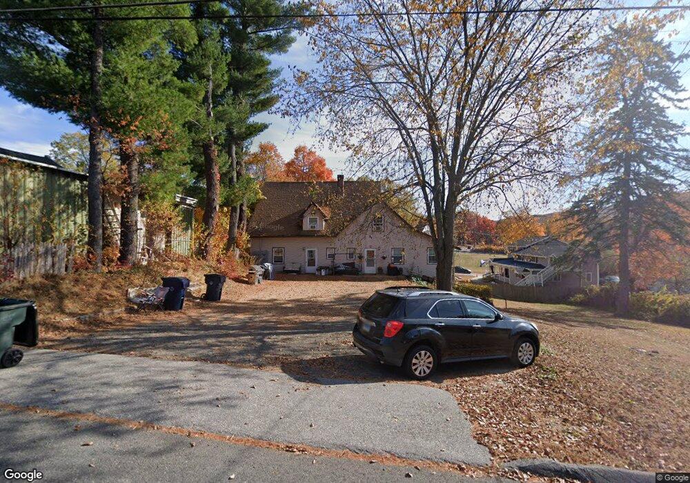
9 Meridian St Unit 2 Terryville, CT 06786
Estimated Value: $265,000 - $379,626
3
Beds
1
Bath
2,032
Sq Ft
$162/Sq Ft
Est. Value
About This Home
This home is located at 9 Meridian St Unit 2, Terryville, CT 06786 and is currently estimated at $329,907, approximately $162 per square foot. 9 Meridian St Unit 2 is a home located in Litchfield County with nearby schools including Harry S. Fisher Elementary School, Eli Terry Jr. Middle School, and Terryville High School.
Ownership History
Date
Name
Owned For
Owner Type
Purchase Details
Closed on
Dec 27, 2006
Sold by
Martone Patrick R
Bought by
Sheak Stephen E and Jawin-Sheak Deborah
Current Estimated Value
Home Financials for this Owner
Home Financials are based on the most recent Mortgage that was taken out on this home.
Original Mortgage
$206,000
Interest Rate
6.29%
Purchase Details
Closed on
May 9, 2005
Sold by
Ammerman Mark
Bought by
Martone Patrick R
Create a Home Valuation Report for This Property
The Home Valuation Report is an in-depth analysis detailing your home's value as well as a comparison with similar homes in the area
Home Values in the Area
Average Home Value in this Area
Purchase History
| Date | Buyer | Sale Price | Title Company |
|---|---|---|---|
| Sheak Stephen E | $257,500 | -- | |
| Sheak Stephen E | $257,500 | -- | |
| Martone Patrick R | $144,000 | -- | |
| Martone Patrick R | $144,000 | -- |
Source: Public Records
Mortgage History
| Date | Status | Borrower | Loan Amount |
|---|---|---|---|
| Open | Martone Patrick R | $198,200 | |
| Closed | Martone Patrick R | $206,000 |
Source: Public Records
Tax History Compared to Growth
Tax History
| Year | Tax Paid | Tax Assessment Tax Assessment Total Assessment is a certain percentage of the fair market value that is determined by local assessors to be the total taxable value of land and additions on the property. | Land | Improvement |
|---|---|---|---|---|
| 2025 | $4,767 | $120,470 | $38,360 | $82,110 |
| 2024 | $4,655 | $120,470 | $38,360 | $82,110 |
| 2023 | $4,542 | $120,470 | $38,360 | $82,110 |
| 2022 | $4,375 | $120,470 | $38,360 | $82,110 |
| 2021 | $3,711 | $91,329 | $25,340 | $65,989 |
| 2020 | $3,711 | $91,329 | $25,340 | $65,989 |
| 2019 | $3,711 | $91,329 | $25,340 | $65,989 |
| 2016 | $3,701 | $102,739 | $36,750 | $65,989 |
| 2015 | $3,640 | $102,739 | $36,750 | $65,989 |
| 2014 | $3,580 | $102,739 | $36,750 | $65,989 |
Source: Public Records
Map
Nearby Homes
- 78 Kearney St
- 11 William St
- Lots 16, 18 and 22 E Hill St
- 21 Coral Dr
- 69 E Washington Rd
- 21 Laurel Ave
- 10 Liberty St
- 19 Main St
- 7 Kearney St
- 4 Michael Dr
- 1 Michael Dr
- 55 E Washington Rd
- 15 Woodside Ln
- 28 Allen St
- 14 Church St
- 120 Barlow St
- 7 Allen St
- 441 Clark Ave Unit 2
- 441 Clark Ave Unit 5
- 65 Gino Dr
- 9 Meridian St
- 6 Meridian St
- 12 Meridian St
- 171 S Riverside Ave
- 171 S Riverside Ave
- 162 S Riverside Ave
- 11 Williams St
- 175 S Riverside Ave
- 193 S Riverside Ave
- 17 Canal St
- 17 Canal St
- 20 Canal St
- 13 Meridian St Unit 3
- 13 Meridian St Unit 2
- 13 Meridian St Unit 1
- 158 S Riverside Ave
- 75 Kearney St
- 158 S Riverside Ave
- 151 S Riverside Ave
- 16 Meridian St