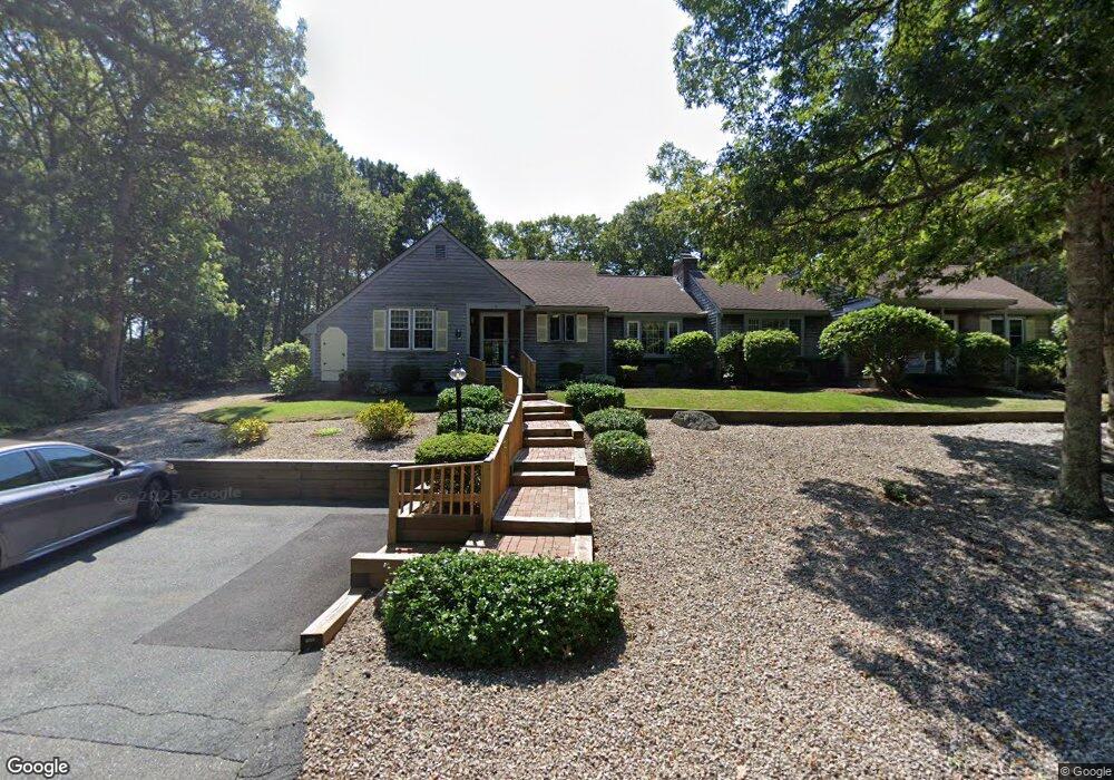
9 Miriah Dr Yarmouth Port, MA 02675
Yarmouth Port NeighborhoodEstimated Value: $475,933 - $500,000
2
Beds
2
Baths
1,352
Sq Ft
$359/Sq Ft
Est. Value
About This Home
This home is located at 9 Miriah Dr, Yarmouth Port, MA 02675 and is currently estimated at $485,233, approximately $358 per square foot. 9 Miriah Dr is a home located in Barnstable County with nearby schools including Dennis-Yarmouth Regional High School and St. Pius X. School.
Ownership History
Date
Name
Owned For
Owner Type
Purchase Details
Closed on
Jan 23, 2004
Sold by
Rinaldi Guido J and Rinaldi Genevieve B
Bought by
Larson Linda L
Current Estimated Value
Home Financials for this Owner
Home Financials are based on the most recent Mortgage that was taken out on this home.
Original Mortgage
$100,000
Outstanding Balance
$46,597
Interest Rate
5.96%
Estimated Equity
$438,636
Create a Home Valuation Report for This Property
The Home Valuation Report is an in-depth analysis detailing your home's value as well as a comparison with similar homes in the area
Home Values in the Area
Average Home Value in this Area
Purchase History
| Date | Buyer | Sale Price | Title Company |
|---|---|---|---|
| Larson Linda L | $272,900 | -- |
Source: Public Records
Mortgage History
| Date | Status | Borrower | Loan Amount |
|---|---|---|---|
| Open | Larson Linda L | $100,000 |
Source: Public Records
Tax History Compared to Growth
Tax History
| Year | Tax Paid | Tax Assessment Tax Assessment Total Assessment is a certain percentage of the fair market value that is determined by local assessors to be the total taxable value of land and additions on the property. | Land | Improvement |
|---|---|---|---|---|
| 2025 | $2,945 | $415,900 | $0 | $415,900 |
| 2024 | $3,224 | $436,800 | $0 | $436,800 |
| 2023 | $3,090 | $381,000 | $0 | $381,000 |
| 2022 | $2,511 | $273,500 | $0 | $273,500 |
| 2021 | $2,680 | $280,300 | $0 | $280,300 |
| 2020 | $2,703 | $270,300 | $0 | $270,300 |
| 2019 | $2,407 | $238,300 | $0 | $238,300 |
| 2018 | $2,370 | $230,300 | $0 | $230,300 |
| 2017 | $2,308 | $230,300 | $0 | $230,300 |
| 2016 | $2,059 | $206,300 | $0 | $206,300 |
| 2015 | $2,050 | $204,200 | $0 | $204,200 |
Source: Public Records
Map
Nearby Homes
- 16 Warren Rd Unit 16
- 16 Warren Rd
- 0 Forsyth Ave
- 8 Rowley Ln
- 176 Beacon St
- 33 Sparrow Way
- 32 Deveau Ln
- 209 Union St
- 4 Old Colony Way
- 72 Quartermaster Row
- 10 Upton Rd
- 76 Captain Chase Rd
- 1 Barnacle Rd
- 97 Captain Bacon Rd
- 17 Trowbridge Path
- 49 Captain Besse Rd
- 86 Pompano Rd
- 21 Hazelmoor Rd
- 129 Driftwood Ln
- 882 W Yarmouth Rd
- 9 Miriah Dr Unit A
- 11 Miriah Dr
- 11 Miriah Dr Unit 11
- 11 Miriah Dr Unit 13B
- 5 Miriah Dr
- 3 Miriah Dr
- 19 Miriah Dr
- 19 Miriah Dr Unit 14A
- 2 Thistle Cir
- 4 Thistle Cir
- 21 Miriah Dr
- 0 Miriah Dr Unit B-50 32214
- 0 Miriah Dr Unit 102
- 9 Debs Hill Rd
- 7 Deb Hill Rd
- 7 Debs Hill Unit 7
- 5 Thistle Cir
- 5 Thistle Cir Unit 33B
- 25 Debs Hill Rd
- 23 Debs Hill Rd