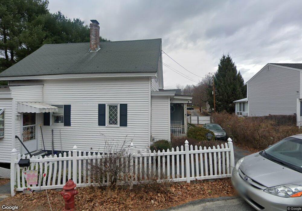
9 Mitchells Ave Lowell, MA 01854
Pawtucketville NeighborhoodEstimated Value: $435,127 - $496,000
4
Beds
1
Bath
1,226
Sq Ft
$371/Sq Ft
Est. Value
About This Home
This home is located at 9 Mitchells Ave, Lowell, MA 01854 and is currently estimated at $455,032, approximately $371 per square foot. 9 Mitchells Ave is a home located in Middlesex County with nearby schools including Joseph McAvinnue Elementary School, Charlotte M. Murkland Elementary School, and Charles W. Morey Elementary School.
Ownership History
Date
Name
Owned For
Owner Type
Purchase Details
Closed on
May 28, 2004
Sold by
Raymond and Germaine Dur
Bought by
Meehan John F and Meehan Chrissy A
Current Estimated Value
Home Financials for this Owner
Home Financials are based on the most recent Mortgage that was taken out on this home.
Original Mortgage
$203,000
Outstanding Balance
$98,435
Interest Rate
5.88%
Mortgage Type
Purchase Money Mortgage
Estimated Equity
$356,597
Create a Home Valuation Report for This Property
The Home Valuation Report is an in-depth analysis detailing your home's value as well as a comparison with similar homes in the area
Home Values in the Area
Average Home Value in this Area
Purchase History
| Date | Buyer | Sale Price | Title Company |
|---|---|---|---|
| Meehan John F | $220,000 | -- | |
| Meehan John F | $220,000 | -- |
Source: Public Records
Mortgage History
| Date | Status | Borrower | Loan Amount |
|---|---|---|---|
| Open | Meehan John F | $203,000 | |
| Closed | Meehan John F | $203,000 |
Source: Public Records
Tax History
| Year | Tax Paid | Tax Assessment Tax Assessment Total Assessment is a certain percentage of the fair market value that is determined by local assessors to be the total taxable value of land and additions on the property. | Land | Improvement |
|---|---|---|---|---|
| 2025 | $4,017 | $349,900 | $114,800 | $235,100 |
| 2024 | $3,741 | $314,100 | $92,600 | $221,500 |
| 2023 | $3,469 | $279,300 | $75,600 | $203,700 |
| 2022 | $3,165 | $249,400 | $66,900 | $182,500 |
| 2021 | $2,953 | $219,400 | $58,200 | $161,200 |
| 2020 | $3,051 | $228,400 | $75,300 | $153,100 |
| 2019 | $2,755 | $196,200 | $66,100 | $130,100 |
| 2018 | $2,675 | $185,900 | $63,000 | $122,900 |
| 2017 | $2,589 | $173,500 | $57,200 | $116,300 |
| 2016 | $2,645 | $174,500 | $55,700 | $118,800 |
| 2015 | $2,526 | $163,200 | $53,300 | $109,900 |
| 2013 | $2,339 | $155,800 | $58,900 | $96,900 |
Source: Public Records
Map
Nearby Homes
- 2300 Skyline Dr Unit 3
- 1400 Skyline Dr Unit 6
- 25 W 5th Ave
- 30 4th Ave
- 89 Mammoth Rd
- 15 Barbara St
- 530 Mammoth Rd Unit 42
- 591 Varnum Ave
- 307 Pawtucket Blvd Unit 24
- 109 Navy Yard Rd
- 311 Pawtucket Blvd Unit 9
- 311 Pawtucket Blvd Unit 3
- 15 Robin Ln
- 244 White St
- 351 Pawtucket Blvd Unit 3
- 295 Pawtucket Blvd Unit 7
- 339 Pawtucket Blvd Unit 19
- 28 Sarah Ave
- 79 School St Unit 4
- 39 Phoebe Ave
- 15 Mitchells Ave
- 100 W Meadow Rd
- 99 Chase Ave
- L23 Charant Rd
- LOT 8 Devonshire Crossing
- LOT 7 Devonshire Crossing
- LOT B2 Cunningham St
- LOT 3A Draper St
- LOT 9 Fauvel Dr
- LOT 7 Fauvel Dr
- LOT 8 Fauvel Dr
- LOT 4 Fauvel Dr
- LOT 2 Fauvel Dr
- LOT 20 Kelley Cir
- LOT 1 Eighteenth St
- LOT 13 Patriot Way
- LOT 19 Independence Dr
- LOT 1 Christman Ave
- LOT 1 Carroll Pkwy
- A-2 Viola St
Your Personal Tour Guide
Ask me questions while you tour the home.