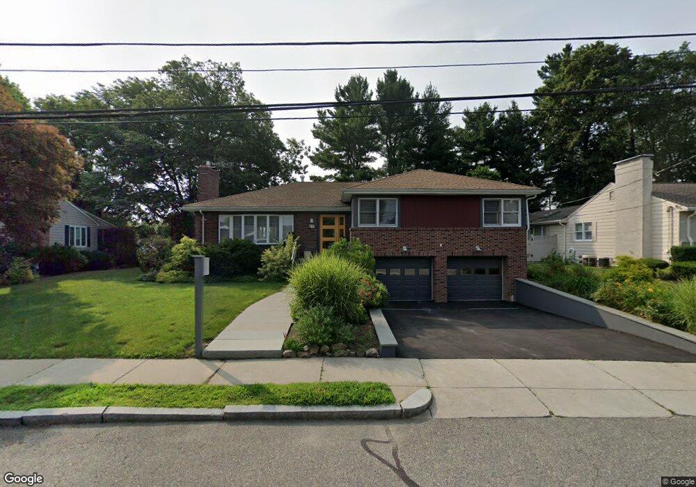
9 Mossdale Rd Jamaica Plain, MA 02130
Jamaica Plain NeighborhoodEstimated Value: $1,346,000 - $1,395,746
3
Beds
3
Baths
1,934
Sq Ft
$708/Sq Ft
Est. Value
About This Home
This home is located at 9 Mossdale Rd, Jamaica Plain, MA 02130 and is currently estimated at $1,368,937, approximately $707 per square foot. 9 Mossdale Rd is a home located in Suffolk County with nearby schools including Dexter School and The Park School.
Ownership History
Date
Name
Owned For
Owner Type
Purchase Details
Closed on
Jun 3, 1997
Sold by
Carter Joseph S and Carter Christine S
Bought by
Kennedy Patrick J
Current Estimated Value
Home Financials for this Owner
Home Financials are based on the most recent Mortgage that was taken out on this home.
Original Mortgage
$260,000
Interest Rate
8.09%
Mortgage Type
Purchase Money Mortgage
Create a Home Valuation Report for This Property
The Home Valuation Report is an in-depth analysis detailing your home's value as well as a comparison with similar homes in the area
Home Values in the Area
Average Home Value in this Area
Purchase History
| Date | Buyer | Sale Price | Title Company |
|---|---|---|---|
| Kennedy Patrick J | $325,000 | -- | |
| Carter Joseph S | $221,500 | -- |
Source: Public Records
Mortgage History
| Date | Status | Borrower | Loan Amount |
|---|---|---|---|
| Open | Carter Joseph S | $410,000 | |
| Closed | Carter Joseph S | $356,300 | |
| Closed | Carter Joseph S | $260,000 |
Source: Public Records
Tax History Compared to Growth
Tax History
| Year | Tax Paid | Tax Assessment Tax Assessment Total Assessment is a certain percentage of the fair market value that is determined by local assessors to be the total taxable value of land and additions on the property. | Land | Improvement |
|---|---|---|---|---|
| 2025 | $14,616 | $1,262,200 | $392,200 | $870,000 |
| 2024 | $13,746 | $1,261,100 | $407,600 | $853,500 |
| 2023 | $12,657 | $1,178,500 | $380,900 | $797,600 |
| 2022 | $11,768 | $1,081,600 | $349,600 | $732,000 |
| 2021 | $10,887 | $1,020,300 | $329,800 | $690,500 |
| 2020 | $9,494 | $899,100 | $315,300 | $583,800 |
| 2019 | $9,202 | $873,100 | $260,400 | $612,700 |
| 2018 | $8,715 | $831,600 | $260,400 | $571,200 |
| 2017 | $8,807 | $831,600 | $260,400 | $571,200 |
| 2016 | $8,168 | $742,500 | $260,400 | $482,100 |
| 2015 | $8,782 | $725,200 | $266,900 | $458,300 |
| 2014 | $8,432 | $670,300 | $266,900 | $403,400 |
Source: Public Records
Map
Nearby Homes
- 57 Louders Ln
- 1000 Centre St Unit 4
- 7 Rambler Rd
- 83 Whitcomb Ave
- 29 Goldsmith St Unit 1
- 27-29 Ballard St
- 41 Jamaica St
- 12 Allandale St
- 2 Brownson Terrace
- 18 Atwood Square Unit 3
- 79 Goddard Ave
- 96 Jamaica St
- 55 South St
- 55 South St Unit 3
- 75 Goddard Ave
- 5 View South Ave Unit 1
- 2 Brewer St
- 5 Hampstead Ln Unit 1
- 16 Mcbride St Unit 1
- 16 Mcbride St
- 7 Mossdale Rd
- 17 Mossdale Rd
- 18 Slocum Rd
- 14 Slocum Rd
- 20 Mossdale Rd
- 20 Mossdale Rd Unit 20
- 20 Mossdale Rd Unit 1
- 20 Mossdale Rd Unit T
- 20 Mossdale Rd
- 20 Mossdale Rd Unit 4
- 22 Slocum Rd
- 5 Mossdale Rd
- 10 Slocum Rd
- 23 Mossdale Rd
- 2 Driftwood Rd
- 24 Mossdale Rd
- 26 Slocum Rd
- 5 Driftwood Rd
- 4 Driftwood Rd
- 6 Slocum Rd