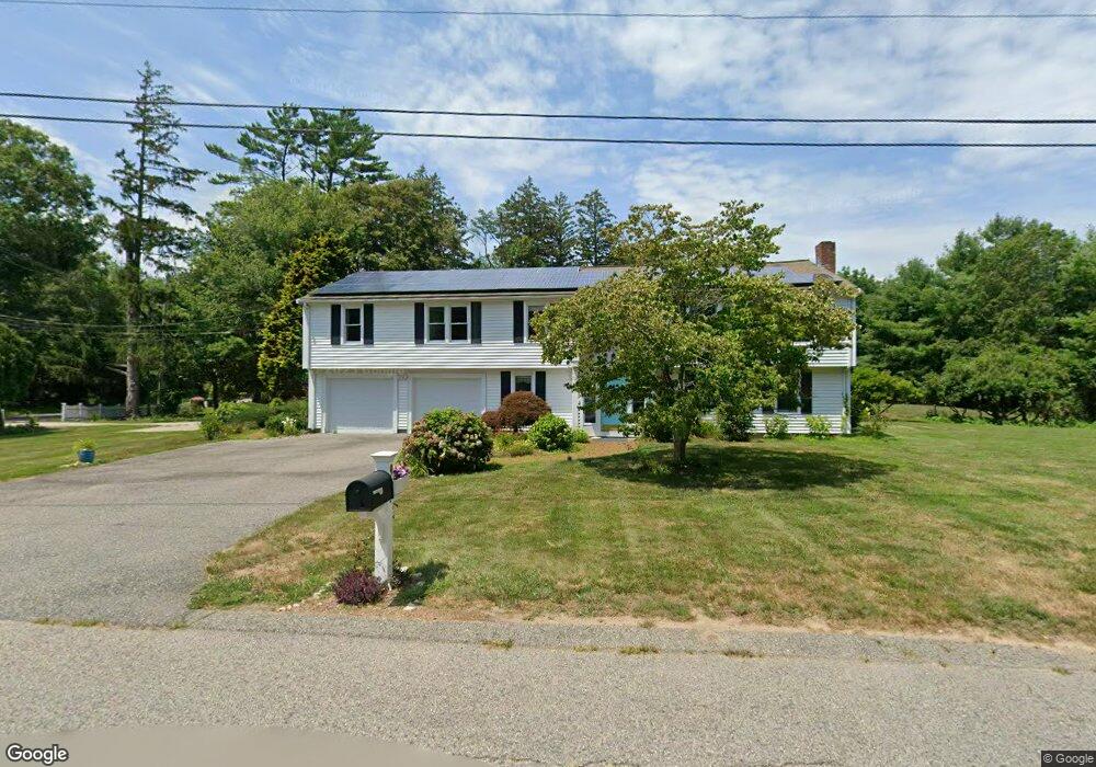
9 N River Dr Marshfield, MA 02050
Estimated Value: $1,036,890 - $1,188,000
4
Beds
3
Baths
3,675
Sq Ft
$298/Sq Ft
Est. Value
About This Home
This home is located at 9 N River Dr, Marshfield, MA 02050 and is currently estimated at $1,096,223, approximately $298 per square foot. 9 N River Dr is a home located in Plymouth County with nearby schools including Eames Way School, Furnace Brook Middle School, and Marshfield High School.
Ownership History
Date
Name
Owned For
Owner Type
Purchase Details
Closed on
Dec 21, 2006
Sold by
Acer Joseph P and Acer Barbara
Bought by
Buening Bruce and Buening Patricia
Current Estimated Value
Home Financials for this Owner
Home Financials are based on the most recent Mortgage that was taken out on this home.
Original Mortgage
$398,000
Outstanding Balance
$237,268
Interest Rate
6.35%
Mortgage Type
Purchase Money Mortgage
Estimated Equity
$858,955
Purchase Details
Closed on
Mar 13, 1995
Sold by
Marshall Paul K and Marshall Donna G
Bought by
Acer Joseph and Acer Barbara
Home Financials for this Owner
Home Financials are based on the most recent Mortgage that was taken out on this home.
Original Mortgage
$125,000
Interest Rate
9.09%
Mortgage Type
Purchase Money Mortgage
Create a Home Valuation Report for This Property
The Home Valuation Report is an in-depth analysis detailing your home's value as well as a comparison with similar homes in the area
Home Values in the Area
Average Home Value in this Area
Purchase History
| Date | Buyer | Sale Price | Title Company |
|---|---|---|---|
| Buening Bruce | $497,500 | -- | |
| Acer Joseph | $190,000 | -- |
Source: Public Records
Mortgage History
| Date | Status | Borrower | Loan Amount |
|---|---|---|---|
| Open | Acer Joseph | $398,000 | |
| Previous Owner | Acer Joseph | $132,800 | |
| Previous Owner | Acer Joseph | $35,500 | |
| Previous Owner | Acer Joseph | $125,000 |
Source: Public Records
Tax History
| Year | Tax Paid | Tax Assessment Tax Assessment Total Assessment is a certain percentage of the fair market value that is determined by local assessors to be the total taxable value of land and additions on the property. | Land | Improvement |
|---|---|---|---|---|
| 2025 | $8,318 | $840,200 | $320,200 | $520,000 |
| 2024 | $8,061 | $775,800 | $304,900 | $470,900 |
| 2023 | $7,576 | $692,500 | $283,100 | $409,400 |
| 2022 | $7,576 | $585,000 | $250,500 | $334,500 |
| 2021 | $7,402 | $561,200 | $250,500 | $310,700 |
| 2020 | $7,112 | $533,500 | $228,700 | $304,800 |
| 2019 | $6,940 | $518,700 | $228,700 | $290,000 |
| 2018 | $6,737 | $503,900 | $228,700 | $275,200 |
| 2017 | $6,502 | $473,900 | $228,700 | $245,200 |
| 2016 | $6,225 | $448,500 | $228,700 | $219,800 |
| 2015 | $5,961 | $448,500 | $228,700 | $219,800 |
| 2014 | $5,626 | $423,300 | $228,700 | $194,600 |
Source: Public Records
Map
Nearby Homes
- 32 Carolyn Cir
- 55 Macombers Way
- 76 Macombers Way
- 48 Neal Gate St
- 480 Pleasant St
- 9 Cushing Park Rd
- 95 Stony Brook Ln
- 19 Ford Place Unit 1
- 19 Ford Place Unit 2
- 17 Old Oaken Bucket Rd
- 1 Valley Path
- 3 Harbor Ln
- 19 Dunster Ln
- 40 Driftway Unit 27
- 21 Jenkins Place
- 94 Old Oaken Bucket Rd
- 59 Greenfield Ln
- 98 Satuit Trail
- 1155 Main St
- 3 Summer St
- 1000 Summer St
- 25 N River Dr
- 970 Summer St
- 956R Summer St
- 979 Summer St
- 37 N River Dr
- 30 N River Dr
- 969 Summer St
- 956 Summer St
- 47 N River Dr
- 948 Summer St
- 941 Summer St
- 48 N River Dr
- 3 Hannah Brooke Waye Unit 2
- 5 Hannah Brooke Waye Unit 3
- 7 Hannah Brooke Waye Unit 4
- 7 Hannah Brooke Waye Way Unit 4
- 5 Hannah Brooke Waye Way Unit 3
- 7 Hannah Brooke Waye
- 3 Hannah Brooke Waye Way Unit 2
Your Personal Tour Guide
Ask me questions while you tour the home.