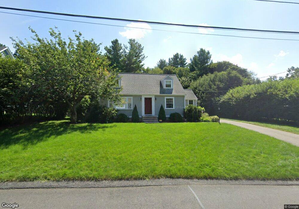
9 Notre Dame Rd Bedford, MA 01730
Estimated Value: $963,832 - $1,119,000
4
Beds
3
Baths
1,426
Sq Ft
$734/Sq Ft
Est. Value
About This Home
This home is located at 9 Notre Dame Rd, Bedford, MA 01730 and is currently estimated at $1,046,458, approximately $733 per square foot. 9 Notre Dame Rd is a home located in Middlesex County with nearby schools including Lt. Elezer Davis Elementary School, Lt .Job Lane Elementary School, and John Glenn Middle School.
Ownership History
Date
Name
Owned For
Owner Type
Purchase Details
Closed on
Jun 3, 2002
Sold by
Anthony Christopher M and Anthony Christine T
Bought by
Mcallister Michael E and Boschetto Margaret W
Current Estimated Value
Home Financials for this Owner
Home Financials are based on the most recent Mortgage that was taken out on this home.
Original Mortgage
$220,000
Outstanding Balance
$94,269
Interest Rate
7%
Mortgage Type
Purchase Money Mortgage
Estimated Equity
$952,189
Purchase Details
Closed on
Jul 28, 1995
Sold by
Rogers Carolyn B and Rogers Bert W
Bought by
Flynn Joel D and Flynn Sandra R
Home Financials for this Owner
Home Financials are based on the most recent Mortgage that was taken out on this home.
Original Mortgage
$177,000
Interest Rate
7.56%
Mortgage Type
Purchase Money Mortgage
Purchase Details
Closed on
Sep 28, 1990
Sold by
Cronin Lawrence J
Bought by
Rogers Carolyn B
Home Financials for this Owner
Home Financials are based on the most recent Mortgage that was taken out on this home.
Original Mortgage
$184,000
Interest Rate
9.95%
Mortgage Type
Purchase Money Mortgage
Create a Home Valuation Report for This Property
The Home Valuation Report is an in-depth analysis detailing your home's value as well as a comparison with similar homes in the area
Home Values in the Area
Average Home Value in this Area
Purchase History
| Date | Buyer | Sale Price | Title Company |
|---|---|---|---|
| Mcallister Michael E | $440,000 | -- | |
| Flynn Joel D | $235,000 | -- | |
| Rogers Carolyn B | $207,000 | -- |
Source: Public Records
Mortgage History
| Date | Status | Borrower | Loan Amount |
|---|---|---|---|
| Open | Mcallister Michael E | $220,000 | |
| Previous Owner | Rogers Carolyn B | $15,000 | |
| Previous Owner | Rogers Carolyn B | $15,000 | |
| Previous Owner | Rogers Carolyn B | $177,000 | |
| Previous Owner | Rogers Carolyn B | $184,000 |
Source: Public Records
Tax History Compared to Growth
Tax History
| Year | Tax Paid | Tax Assessment Tax Assessment Total Assessment is a certain percentage of the fair market value that is determined by local assessors to be the total taxable value of land and additions on the property. | Land | Improvement |
|---|---|---|---|---|
| 2025 | $100 | $834,600 | $527,200 | $307,400 |
| 2024 | $9,442 | $794,800 | $502,100 | $292,700 |
| 2023 | $9,001 | $721,200 | $474,200 | $247,000 |
| 2022 | $8,891 | $654,700 | $447,300 | $207,400 |
| 2021 | $8,566 | $633,100 | $438,400 | $194,700 |
| 2020 | $8,344 | $633,100 | $438,400 | $194,700 |
| 2019 | $8,167 | $630,200 | $438,400 | $191,800 |
| 2018 | $8,137 | $577,900 | $383,300 | $194,600 |
| 2017 | $9,425 | $636,400 | $429,600 | $206,800 |
| 2016 | $8,933 | $584,623 | $390,500 | $194,123 |
| 2015 | $8,195 | $560,552 | $390,500 | $170,052 |
| 2014 | $8,377 | $533,200 | $371,900 | $161,300 |
Source: Public Records
Map
Nearby Homes
- 5 Clark Rd
- 20 Selfridge Rd
- 6 Parker Rd
- 186 Concord Rd
- 26 Kendall Ct Unit 67
- 7 Blue Heron Way
- 54 Minot Rd
- 86 Butternut Cir
- 45 Winterberry Way
- 644 Old Bedford Rd
- 389 River Rd
- 28 Hatch Farm Ln
- 10 Hatch Farm Ln
- 16 Hatch Farm Ln
- 62 Carlisle Rd
- 10 Carlisle Rd Unit 12
- 267 Carlisle Rd
- 1437-3 Monument St
- 25 Pickman Dr Unit 25
- 22 Springs Rd
- 11 Notre Dame Rd
- 7 Notre Dame Rd
- 10 Notre Dame Rd
- 15 Notre Dame Rd
- 12 Notre Dame Rd
- 8 Notre Dame Rd
- 1 Candlewick Ln
- 6 Notre Dame Rd
- 14 Notre Dame Rd
- 5 Notre Dame Rd
- 17 Notre Dame Rd
- 4 Notre Dame Rd
- 2 Candlewick Ln
- 3 Notre Dame Rd
- 1 Cedar Ln
- 16 Notre Dame Rd
- 2 Notre Dame Rd
- 19 Notre Dame Rd
- 1 Notre Dame Rd
- 18 Notre Dame Rd