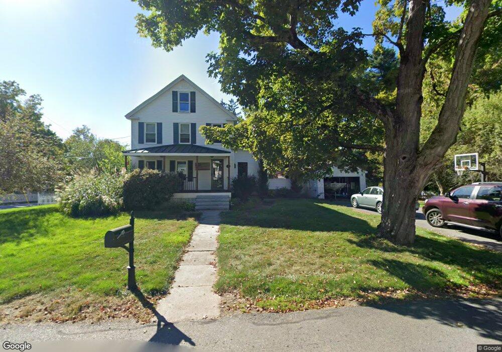
9 Old Orchard Rd Groton, MA 01450
Estimated Value: $557,835 - $621,000
3
Beds
1
Bath
1,548
Sq Ft
$374/Sq Ft
Est. Value
About This Home
This home is located at 9 Old Orchard Rd, Groton, MA 01450 and is currently estimated at $579,709, approximately $374 per square foot. 9 Old Orchard Rd is a home located in Middlesex County with nearby schools including Groton Dunstable Regional High School, Seven Hills At Groton, and Lawrence Academy.
Ownership History
Date
Name
Owned For
Owner Type
Purchase Details
Closed on
Jun 16, 2005
Sold by
Babcock Dorothy M
Bought by
Stark Erin M and Stark Joshua E
Current Estimated Value
Home Financials for this Owner
Home Financials are based on the most recent Mortgage that was taken out on this home.
Original Mortgage
$315,000
Interest Rate
5.78%
Mortgage Type
Purchase Money Mortgage
Create a Home Valuation Report for This Property
The Home Valuation Report is an in-depth analysis detailing your home's value as well as a comparison with similar homes in the area
Home Values in the Area
Average Home Value in this Area
Purchase History
| Date | Buyer | Sale Price | Title Company |
|---|---|---|---|
| Stark Erin M | $350,000 | -- | |
| Stark Erin M | $350,000 | -- |
Source: Public Records
Mortgage History
| Date | Status | Borrower | Loan Amount |
|---|---|---|---|
| Open | Stark Erin M | $326,230 | |
| Closed | Stark Erin M | $315,000 | |
| Previous Owner | Stark Erin M | $50,000 |
Source: Public Records
Tax History Compared to Growth
Tax History
| Year | Tax Paid | Tax Assessment Tax Assessment Total Assessment is a certain percentage of the fair market value that is determined by local assessors to be the total taxable value of land and additions on the property. | Land | Improvement |
|---|---|---|---|---|
| 2025 | $6,928 | $454,300 | $160,100 | $294,200 |
| 2024 | $6,303 | $417,700 | $160,100 | $257,600 |
| 2023 | $6,264 | $400,500 | $160,100 | $240,400 |
| 2022 | $6,182 | $359,600 | $143,500 | $216,100 |
| 2021 | $7,337 | $312,000 | $136,600 | $175,400 |
| 2020 | $5,129 | $295,100 | $136,600 | $158,500 |
| 2019 | $5,018 | $277,100 | $130,100 | $147,000 |
| 2018 | $6,883 | $264,700 | $130,100 | $134,600 |
| 2017 | $4,722 | $258,600 | $130,100 | $128,500 |
| 2016 | $4,734 | $252,100 | $130,700 | $121,400 |
| 2015 | $4,204 | $230,100 | $130,700 | $99,400 |
Source: Public Records
Map
Nearby Homes
- 37 Pepperell Rd
- 59 Squannacook Rd
- 55 W Main St
- 65 W Main St
- 346 Townsend Rd
- 354 Townsend Rd
- 111 Squannacook Rd
- 43 Longley Rd
- 147 Shirley St
- 22 Townsend Rd
- 21 Magnolia Ln
- 49 Magnolia Ln Unit 49
- 521 Main St Unit D
- 44 Nod Rd
- Lot 10 Christian Cir
- 49 Parker Rd
- 436 Main St
- 111 Farmers Row
- 22 Lakin St
- 10 Lakin St
- 10 Old Orchard Rd
- 13 Old Orchard Rd
- 21 Old Orchard Rd
- 42 Bixby Hill Rd
- 43 Windmill Hill Rd
- 12 Old Orchard Rd
- 37 Bixby Hill Rd
- 36 Bixby Hill Rd
- 46 Windmill Hill Rd
- 20 Old Orchard Rd
- 47 Windmill Hill Rd
- 21 Old Orchard St
- 38 Windmill Hill Rd
- 31 Windmill Hill Rd
- 29 Bixby Hill Rd
- 38 Westview St
- 6 Westview St
- 135 Pepperell Rd
- 135 Pepperell Rd Unit 3
- 135 Pepperell Rd Unit 2