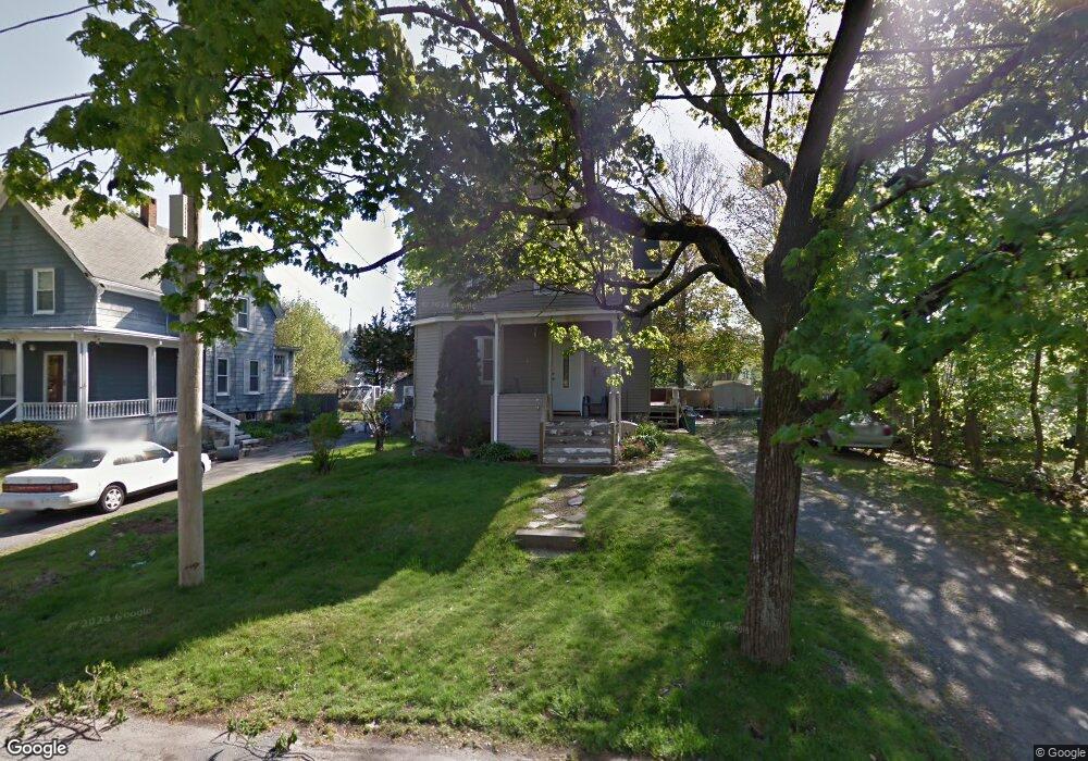
9 Oneida Ave Brockton, MA 02301
Estimated Value: $395,000 - $506,000
3
Beds
1
Bath
1,877
Sq Ft
$237/Sq Ft
Est. Value
About This Home
This home is located at 9 Oneida Ave, Brockton, MA 02301 and is currently estimated at $444,838, approximately $236 per square foot. 9 Oneida Ave is a home located in Plymouth County with nearby schools including Louis F Angelo Elementary School, Hancock Elementary School, and Raymond K-8 Elementary School.
Ownership History
Date
Name
Owned For
Owner Type
Purchase Details
Closed on
Dec 29, 1999
Sold by
Nota Paul
Bought by
Nota Paul and Robinson Tammie L
Current Estimated Value
Purchase Details
Closed on
Jan 6, 1997
Sold by
G & M Rt
Bought by
Nota Paul
Create a Home Valuation Report for This Property
The Home Valuation Report is an in-depth analysis detailing your home's value as well as a comparison with similar homes in the area
Home Values in the Area
Average Home Value in this Area
Purchase History
| Date | Buyer | Sale Price | Title Company |
|---|---|---|---|
| Nota Paul | $82,000 | -- | |
| Nota Paul | $82,000 | -- |
Source: Public Records
Mortgage History
| Date | Status | Borrower | Loan Amount |
|---|---|---|---|
| Open | Nota Paul | $77,727 | |
| Open | Nota Paul | $153,930 |
Source: Public Records
Tax History Compared to Growth
Tax History
| Year | Tax Paid | Tax Assessment Tax Assessment Total Assessment is a certain percentage of the fair market value that is determined by local assessors to be the total taxable value of land and additions on the property. | Land | Improvement |
|---|---|---|---|---|
| 2025 | $4,448 | $367,300 | $143,900 | $223,400 |
| 2024 | $4,331 | $360,300 | $143,900 | $216,400 |
| 2023 | $4,095 | $315,500 | $108,600 | $206,900 |
| 2022 | $3,759 | $269,100 | $98,600 | $170,500 |
| 2021 | $3,798 | $261,900 | $90,900 | $171,000 |
| 2020 | $3,795 | $250,500 | $87,400 | $163,100 |
| 2019 | $3,758 | $241,800 | $80,700 | $161,100 |
| 2018 | $3,495 | $217,600 | $80,700 | $136,900 |
| 2017 | $3,149 | $195,600 | $80,700 | $114,900 |
| 2016 | $2,953 | $170,100 | $73,000 | $97,100 |
| 2015 | $2,418 | $133,200 | $73,000 | $60,200 |
| 2014 | $2,611 | $144,000 | $73,000 | $71,000 |
Source: Public Records
Map
Nearby Homes
- 20 Montauk Rd
- 75 Colonel Bell Dr Unit 77-11
- 77 Colonel Bell Dr Unit 4
- 721 Pleasant St
- 7 N Winnifred Rd
- 15 Troy St
- 4 Park Rd
- 45 Cross St
- 126 Coventry Cir
- 96 Coventry Cir
- 161 Moraine St
- 72 W Elm Terrace
- 42 Baxendale Terrace
- 194 Prospect St
- 72 Kurland Ave
- 0 Moraine St
- 10 Fitzpatrick Ave
- 34 Eaton St
- 508 Oak St Unit 10
- 114 Oak Ln Unit 11