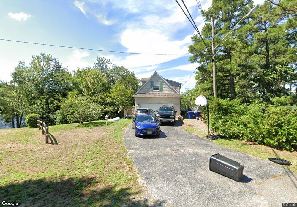
9 Pheasant Dr Browns Mills, NJ 08015
Estimated Value: $369,757 - $480,000
--
Bed
--
Bath
1,746
Sq Ft
$247/Sq Ft
Est. Value
About This Home
This home is located at 9 Pheasant Dr, Browns Mills, NJ 08015 and is currently estimated at $431,439, approximately $247 per square foot. 9 Pheasant Dr is a home located in Burlington County.
Ownership History
Date
Name
Owned For
Owner Type
Purchase Details
Closed on
Aug 29, 2017
Sold by
Rellstar Diana and Lange Carolyn R
Bought by
Hadfield Ronald
Current Estimated Value
Home Financials for this Owner
Home Financials are based on the most recent Mortgage that was taken out on this home.
Original Mortgage
$120,000
Interest Rate
3.9%
Mortgage Type
Purchase Money Mortgage
Purchase Details
Closed on
Mar 29, 1996
Sold by
Lange Ward G
Bought by
Lange Ward G and Lange Carolyn
Home Financials for this Owner
Home Financials are based on the most recent Mortgage that was taken out on this home.
Original Mortgage
$87,200
Interest Rate
6.83%
Create a Home Valuation Report for This Property
The Home Valuation Report is an in-depth analysis detailing your home's value as well as a comparison with similar homes in the area
Home Values in the Area
Average Home Value in this Area
Purchase History
| Date | Buyer | Sale Price | Title Company |
|---|---|---|---|
| Hadfield Ronald | $240,000 | S&H Abstract | |
| Lange Ward G | -- | Twenty First Century Title |
Source: Public Records
Mortgage History
| Date | Status | Borrower | Loan Amount |
|---|---|---|---|
| Closed | Hadfield Ronald | $120,000 | |
| Previous Owner | Lange Ward G | $87,200 |
Source: Public Records
Tax History Compared to Growth
Tax History
| Year | Tax Paid | Tax Assessment Tax Assessment Total Assessment is a certain percentage of the fair market value that is determined by local assessors to be the total taxable value of land and additions on the property. | Land | Improvement |
|---|---|---|---|---|
| 2025 | $7,212 | $235,300 | $52,300 | $183,000 |
| 2024 | $6,767 | $235,300 | $52,300 | $183,000 |
| 2023 | $6,767 | $235,300 | $52,300 | $183,000 |
| 2022 | $6,264 | $235,300 | $52,300 | $183,000 |
| 2021 | $6,006 | $235,300 | $52,300 | $183,000 |
| 2020 | $5,781 | $235,300 | $52,300 | $183,000 |
| 2019 | $5,537 | $235,300 | $52,300 | $183,000 |
| 2018 | $5,348 | $235,300 | $52,300 | $183,000 |
| 2017 | $5,238 | $235,300 | $52,300 | $183,000 |
| 2016 | $5,697 | $152,400 | $40,300 | $112,100 |
| 2015 | $5,651 | $152,400 | $40,300 | $112,100 |
| 2014 | $5,403 | $152,400 | $40,300 | $112,100 |
Source: Public Records
Map
Nearby Homes
- 419 Chippewa Trail
- 203 Seneca Trail
- 224 Cherokee Dr
- 13 Muskogean Trail
- 1714 Red Feather Trail
- 22 Maricopa Trail
- 219 Chippewa Trail
- 77 Sepulga Dr
- 2 Kiowa Trail
- 304 Mohawk Trail
- 304 Spring Lake Blvd
- 306 Apache Trail
- 315 Algonquin Trail
- 208 Wichita Trail
- 206 Piute Trail
- 310 Piute Trail
- 1 S Branch Dr
- 764 Lakehurst Rd
- 111 Huckleberry Ln
- 258 Ridge Rd
- 7 Pheasant Dr
- 11 Pheasant Dr
- 10 Pheasant Dr
- 5 Pheasant Dr
- 8 Pheasant Dr
- 0 Pheasant Dr
- 6 Pheasant Dr
- 4 Pheasant Dr
- 413 Chippewa Trail
- 415 Chippewa Trail
- 411 Chippewa Trail
- 409 Chippewa Trail
- 2 Pheasant Dr
- 417 Chippewa Trail
- 403 Chippewa Trail
- 410 Chippewa Trail
- 408 Chippewa Trail
- 406 Chippewa Trail
- 412 Chippewa Trail
- 404 Chippewa Trail