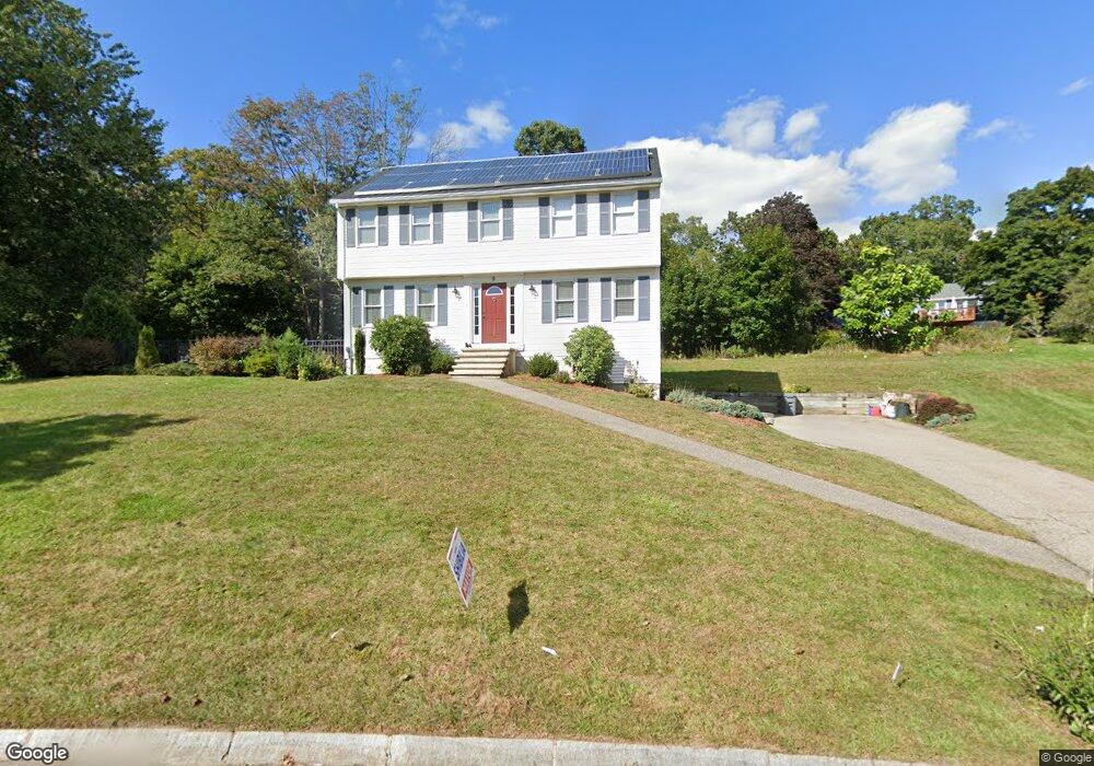
9 Pheasant Hill Ln Methuen, MA 01844
The West End NeighborhoodEstimated Value: $658,000 - $801,000
3
Beds
3
Baths
2,288
Sq Ft
$316/Sq Ft
Est. Value
About This Home
This home is located at 9 Pheasant Hill Ln, Methuen, MA 01844 and is currently estimated at $723,422, approximately $316 per square foot. 9 Pheasant Hill Ln is a home located in Essex County with nearby schools including Marsh Grammar School, South Point Elementary School, and Methuen High School.
Ownership History
Date
Name
Owned For
Owner Type
Purchase Details
Closed on
Apr 23, 2024
Sold by
Monahan Steven R and Monahan Cherie L
Bought by
Monahan Ft and Monahan
Current Estimated Value
Purchase Details
Closed on
May 24, 1994
Sold by
Bradford Meadows Inc
Bought by
Monahan Steven R
Create a Home Valuation Report for This Property
The Home Valuation Report is an in-depth analysis detailing your home's value as well as a comparison with similar homes in the area
Home Values in the Area
Average Home Value in this Area
Purchase History
| Date | Buyer | Sale Price | Title Company |
|---|---|---|---|
| Monahan Ft | -- | None Available | |
| Monahan Ft | -- | None Available | |
| Monahan Ft | -- | None Available | |
| Monahan Steven R | $169,900 | -- | |
| Monahan Steven R | $169,900 | -- |
Source: Public Records
Mortgage History
| Date | Status | Borrower | Loan Amount |
|---|---|---|---|
| Previous Owner | Monahan Steven R | $255,000 | |
| Previous Owner | Monahan Steven R | $185,500 |
Source: Public Records
Tax History Compared to Growth
Tax History
| Year | Tax Paid | Tax Assessment Tax Assessment Total Assessment is a certain percentage of the fair market value that is determined by local assessors to be the total taxable value of land and additions on the property. | Land | Improvement |
|---|---|---|---|---|
| 2025 | $6,742 | $637,200 | $251,600 | $385,600 |
| 2024 | $6,617 | $609,300 | $221,000 | $388,300 |
| 2023 | $6,327 | $540,800 | $195,500 | $345,300 |
| 2022 | $6,111 | $468,300 | $170,000 | $298,300 |
| 2021 | $5,767 | $437,200 | $161,500 | $275,700 |
| 2020 | $5,719 | $425,500 | $161,500 | $264,000 |
| 2019 | $5,562 | $392,000 | $153,000 | $239,000 |
| 2018 | $5,310 | $372,100 | $144,500 | $227,600 |
| 2017 | $5,174 | $353,200 | $144,500 | $208,700 |
| 2016 | $5,175 | $349,400 | $144,500 | $204,900 |
| 2015 | $4,866 | $333,300 | $136,000 | $197,300 |
Source: Public Records
Map
Nearby Homes
- 2 Sugar Hill Cir
- 1 Tilbury Rd
- 38 Butternut Ln
- 86 Butternut Ln
- 90 Butternut Ln
- 14 Tyler St
- 14 Youngfarm Rd
- 73 Myrtle St
- 492 Lowell St
- 50 & 51 Jane St
- 128 West St
- 100 Salem Rd
- 1 Bridle Path Ln
- 5 Bailey Rd
- 362 Lowell St
- 65 Clayton Ave
- 11 Vineyard Ln Unit 11
- 35 Memorial Dr
- 351 Peters Pond Dr
- 96 Harris St
- 11 Pheasant Hill Ln
- 142 Tyler St
- 7 Pheasant Hill Ln
- 18 Pheasant Hill Ln
- 140 Tyler St
- 138 Tyler St
- 150 Tyler St
- 16 Pheasant Hill Ln
- 15 Pheasant Hill Ln
- 136 Tyler St
- 137 Tyler St
- 20 Pheasant Hill Ln
- 5 Pheasant Hill Ln
- 154 Tyler St
- 134 Tyler St
- 141 Tyler St
- 135 Tyler St
- 17 Pheasant Hill Ln
- 14 Pheasant Hill Ln
- 139 Tyler St