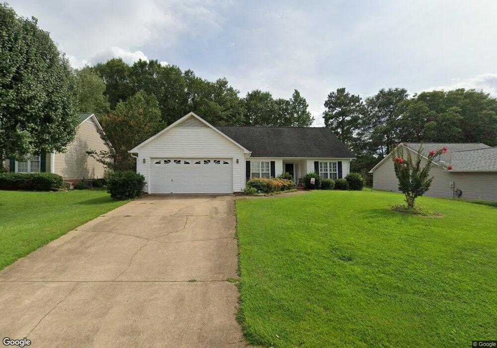
9 Pheasant Ridge Dr Taylors, SC 29687
Estimated Value: $295,000 - $306,000
3
Beds
2
Baths
1,521
Sq Ft
$197/Sq Ft
Est. Value
About This Home
This home is located at 9 Pheasant Ridge Dr, Taylors, SC 29687 and is currently estimated at $299,281, approximately $196 per square foot. 9 Pheasant Ridge Dr is a home located in Greenville County with nearby schools including Taylors Elementary School, Sevier Middle, and Wade Hampton High.
Ownership History
Date
Name
Owned For
Owner Type
Purchase Details
Closed on
Jun 26, 2017
Sold by
Hightiower Jane Roper
Bought by
Shervey Larry and Shervey Lorelei
Current Estimated Value
Home Financials for this Owner
Home Financials are based on the most recent Mortgage that was taken out on this home.
Original Mortgage
$156,750
Outstanding Balance
$130,802
Interest Rate
4.05%
Mortgage Type
New Conventional
Estimated Equity
$168,479
Purchase Details
Closed on
Apr 16, 2015
Sold by
Roper Robert E and Roper Flossie R
Bought by
The Roper Family Trust and Roper Robert E
Create a Home Valuation Report for This Property
The Home Valuation Report is an in-depth analysis detailing your home's value as well as a comparison with similar homes in the area
Home Values in the Area
Average Home Value in this Area
Purchase History
| Date | Buyer | Sale Price | Title Company |
|---|---|---|---|
| Shervey Larry | $165,000 | None Available | |
| The Roper Family Trust | -- | -- |
Source: Public Records
Mortgage History
| Date | Status | Borrower | Loan Amount |
|---|---|---|---|
| Open | Shervey Larry | $156,750 |
Source: Public Records
Tax History Compared to Growth
Tax History
| Year | Tax Paid | Tax Assessment Tax Assessment Total Assessment is a certain percentage of the fair market value that is determined by local assessors to be the total taxable value of land and additions on the property. | Land | Improvement |
|---|---|---|---|---|
| 2024 | $949 | $6,520 | $1,020 | $5,500 |
| 2023 | $949 | $6,520 | $1,020 | $5,500 |
| 2022 | $880 | $6,520 | $1,020 | $5,500 |
| 2021 | $966 | $6,520 | $1,020 | $5,500 |
| 2020 | $1,029 | $6,540 | $940 | $5,600 |
| 2019 | $1,018 | $6,540 | $940 | $5,600 |
| 2018 | $1,487 | $6,540 | $940 | $5,600 |
| 2017 | $1,175 | $5,470 | $940 | $4,530 |
| 2016 | $736 | $136,740 | $23,500 | $113,240 |
| 2015 | $702 | $136,740 | $23,500 | $113,240 |
| 2014 | -- | $139,171 | $23,406 | $115,765 |
Source: Public Records
Map
Nearby Homes
- 205 Pheasant Ridge Dr
- 528 Indian Trail
- 4 Sylvania Dr
- 43 Birdsong Ln
- 1 Hartsville Dr Unit 14
- 107 Wood Heights Ave
- 105 Edwards Mill Rd
- 4 Edwards Mill Ct
- 0 Tanner Rd
- 24 Robin Hood Rd
- 17 Nonnington Way Unit Homesite 127
- 21 Nonnington Way Unit Homesite 125
- 25 Nonnington Way Unit Homesite 124
- 27 Nonnington Way Unit Homesite 123
- 29 Nonnington Way Unit Homesite 122
- 35 Nonnington Way Unit Homesite 120
- 37 Nonnington Way Unit Homesite 119
- 39 Nonnington Way Unit Homesite 118
- 22 Nonnington Way Unit Homesite 9
- 41 Nonnington Way Unit Homesite 117
- 11 Pheasant Ridge Dr
- 7 Pheasant Ridge Dr
- 5 Pheasant Ridge Dr
- 101 Pheasant Ridge Dr
- 10 Pheasant Ridge Dr
- 8 Haven Reach Way
- 1 Stonington Way
- 12 Haven Reach Way
- 6 Pheasant Ridge Dr
- 103 Pheasant Ridge Dr
- 14 Haven Reach Way
- 102 Pheasant Ridge Dr
- 4 Stonington Way
- 3 Stonington Way
- 105 Pheasant Ridge Dr
- 204 S Autumn Crest Place
- 1 Haven Reach Way
- 104 Pheasant Ridge Dr
- 10 Spring Fellow Ln
- 6 Spring Fellow Ln