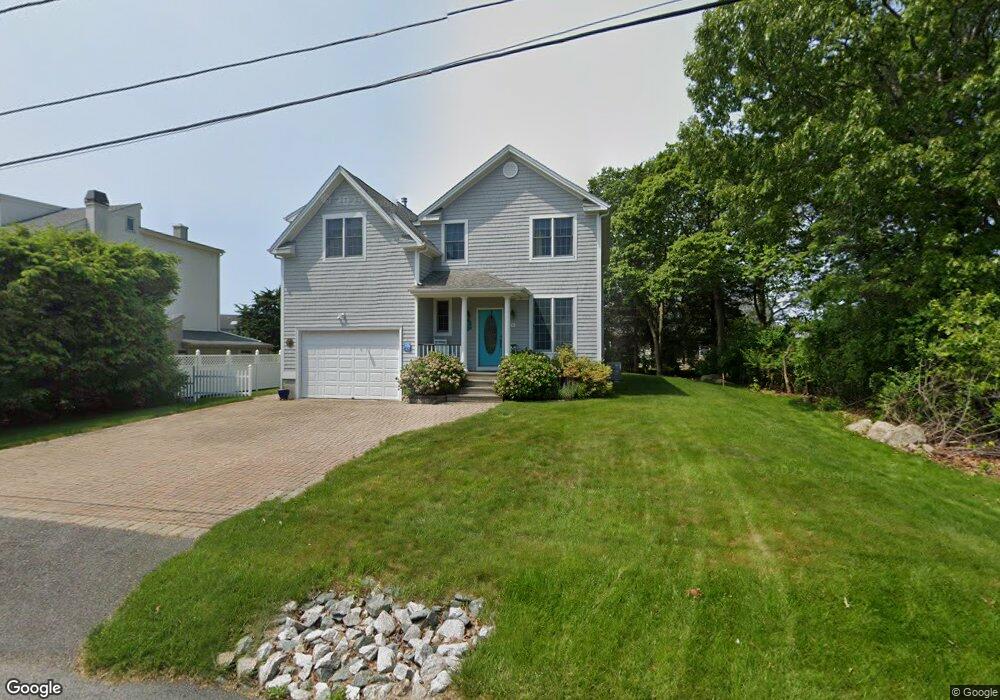
9 Pondview Ave Westerly, RI 02891
Estimated Value: $985,096 - $1,312,000
4
Beds
2
Baths
2,532
Sq Ft
$462/Sq Ft
Est. Value
About This Home
This home is located at 9 Pondview Ave, Westerly, RI 02891 and is currently estimated at $1,169,774, approximately $461 per square foot. 9 Pondview Ave is a home located in Washington County with nearby schools including Westerly High School.
Ownership History
Date
Name
Owned For
Owner Type
Purchase Details
Closed on
Jul 14, 2025
Sold by
Mackie William L and Mackie Janice
Bought by
Mackie Ft and Mackie
Current Estimated Value
Purchase Details
Closed on
Jun 4, 2004
Sold by
Attianese Harry and Attanese Lynda
Bought by
Mackie William and Mackie Janice
Home Financials for this Owner
Home Financials are based on the most recent Mortgage that was taken out on this home.
Original Mortgage
$150,000
Interest Rate
5.94%
Mortgage Type
Purchase Money Mortgage
Purchase Details
Closed on
May 29, 1998
Sold by
Diroma Franklin J and Diroma Carol Ann
Bought by
Fuller Julia A and Fuller Beverly L
Purchase Details
Closed on
May 1, 1995
Sold by
Quattromani A Francis
Bought by
Diroma Frank and Diroma Carol
Create a Home Valuation Report for This Property
The Home Valuation Report is an in-depth analysis detailing your home's value as well as a comparison with similar homes in the area
Home Values in the Area
Average Home Value in this Area
Purchase History
| Date | Buyer | Sale Price | Title Company |
|---|---|---|---|
| Mackie Ft | -- | -- | |
| Mackie William | $559,000 | -- | |
| Fuller Julia A | $214,000 | -- | |
| Diroma Frank | $40,000 | -- |
Source: Public Records
Mortgage History
| Date | Status | Borrower | Loan Amount |
|---|---|---|---|
| Previous Owner | Diroma Frank | $33,130 | |
| Previous Owner | Diroma Frank | $112,200 | |
| Previous Owner | Diroma Frank | $150,000 | |
| Previous Owner | Diroma Frank | $70,000 |
Source: Public Records
Tax History
| Year | Tax Paid | Tax Assessment Tax Assessment Total Assessment is a certain percentage of the fair market value that is determined by local assessors to be the total taxable value of land and additions on the property. | Land | Improvement |
|---|---|---|---|---|
| 2025 | $6,155 | $865,700 | $387,100 | $478,600 |
| 2024 | $6,436 | $656,100 | $276,500 | $379,600 |
| 2023 | $6,312 | $656,100 | $276,500 | $379,600 |
| 2022 | $6,272 | $656,100 | $276,500 | $379,600 |
| 2021 | $5,854 | $508,200 | $204,400 | $303,800 |
| 2020 | $5,748 | $508,200 | $204,400 | $303,800 |
| 2019 | $5,692 | $508,200 | $204,400 | $303,800 |
| 2018 | $5,788 | $487,200 | $204,400 | $282,800 |
| 2017 | $5,647 | $487,200 | $204,400 | $282,800 |
| 2016 | $5,690 | $487,200 | $204,400 | $282,800 |
| 2015 | $5,445 | $503,200 | $208,600 | $294,600 |
| 2014 | $5,354 | $503,200 | $208,600 | $294,600 |
Source: Public Records
Map
Nearby Homes
- 19 Wicklow Rd
- 8 Kettle Close
- 9 Compass Way Unit 201
- 9 Compass Way Unit 202
- 9 Compass Way Unit 101
- 9 Compass Way Unit 102
- 9 Compass Way Unit 103
- 9 Compass Way Unit 203
- 432 Atlantic Ave
- 446 Atlantic Ave
- 54 Sherwood Dr
- 46 Salt Pond Way
- 13 Plateau Rd
- 20 Snowberry Ln
- 30 Clifford Dr
- 27 Benson Ave
- 22 Breach Dr
- 10 Tristam St
- 15 Breach Dr
- 11 Bucks Trail
- 11 Pondview Ave
- 10 W Fairway Ave
- 8 W Fairway Ave
- 5 Pond View Ave
- 5 Pondview Ave
- 13 Pond View Ave
- 1618 Pondview Ave
- 20 Pondview Ave
- 8 Pondview Ave
- 12 W Fairway Ave
- 10 Pondview Ave
- 6 W Fairway Ave
- 15 Pond View Ave
- 6 Pondview Ave
- 15 Pondview Ave
- 15 Pond View Ave
- 12 Pondview Ave
- 14 W Fairway Ave
- 17 Pondview Ave
- 177 Shore Rd
Your Personal Tour Guide
Ask me questions while you tour the home.