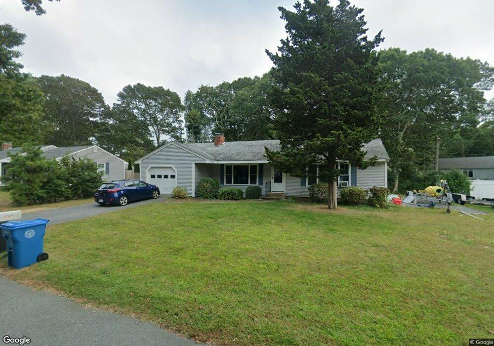
9 Portside Cir East Falmouth, MA 02536
Estimated Value: $723,000 - $865,000
2
Beds
2
Baths
1,201
Sq Ft
$681/Sq Ft
Est. Value
About This Home
This home is located at 9 Portside Cir, East Falmouth, MA 02536 and is currently estimated at $817,357, approximately $680 per square foot. 9 Portside Cir is a home located in Barnstable County with nearby schools including Teaticket Elementary School, Morse Pond School, and Lawrence School.
Ownership History
Date
Name
Owned For
Owner Type
Purchase Details
Closed on
Oct 18, 2023
Sold by
Connerney William F Est and Connerney
Bought by
Trestmentary T T and Trestmentary Connerney
Current Estimated Value
Purchase Details
Closed on
Nov 1, 2016
Sold by
Connerney William F and Connerney Ruth E
Bought by
Connerney William F and Connerney Ruth E
Purchase Details
Closed on
Jun 28, 2001
Sold by
Mcdonald Michel V and Mcdonald Sandra M
Bought by
Connerney William F and Connerney Ruth E
Purchase Details
Closed on
Jul 18, 1995
Sold by
Tate Nancy M
Bought by
Mcdonald Michael V and Mcdonald Sandra Marie
Create a Home Valuation Report for This Property
The Home Valuation Report is an in-depth analysis detailing your home's value as well as a comparison with similar homes in the area
Home Values in the Area
Average Home Value in this Area
Purchase History
| Date | Buyer | Sale Price | Title Company |
|---|---|---|---|
| Trestmentary T T | -- | None Available | |
| Trestmentary T T | -- | None Available | |
| Connerney William F | -- | -- | |
| Connerney William F | -- | -- | |
| Connerney William F | $210,000 | -- | |
| Connerney William F | $210,000 | -- | |
| Mcdonald Michael V | $140,000 | -- | |
| Mcdonald Michael V | $140,000 | -- |
Source: Public Records
Tax History Compared to Growth
Tax History
| Year | Tax Paid | Tax Assessment Tax Assessment Total Assessment is a certain percentage of the fair market value that is determined by local assessors to be the total taxable value of land and additions on the property. | Land | Improvement |
|---|---|---|---|---|
| 2025 | $3,981 | $678,200 | $296,500 | $381,700 |
| 2024 | $3,802 | $605,400 | $258,100 | $347,300 |
| 2023 | $3,488 | $504,000 | $206,500 | $297,500 |
| 2022 | $3,608 | $448,200 | $193,100 | $255,100 |
| 2021 | $3,362 | $395,500 | $193,100 | $202,400 |
| 2020 | $3,246 | $377,900 | $175,500 | $202,400 |
| 2019 | $3,141 | $366,900 | $175,500 | $191,400 |
| 2018 | $3,063 | $356,200 | $175,500 | $180,700 |
| 2017 | $2,981 | $349,500 | $175,500 | $174,000 |
| 2016 | $2,925 | $349,500 | $175,500 | $174,000 |
| 2015 | $2,862 | $349,500 | $175,500 | $174,000 |
| 2014 | $2,843 | $348,800 | $175,600 | $173,200 |
Source: Public Records
Map
Nearby Homes
- 84 Portside Cir
- 26 Sanddollar Cir
- 21 Kilmer Rd
- 69 Reynolds St
- 52 Cedar St
- 58 Striper Ln
- Lot 2 Pine Grove Ave
- 16 Edgewood Dr
- 231 Great Bay St
- 37 Seashell Ln
- 27 Harborview Dr
- 7 Montauk St
- 110 Teaticket Path
- LOTA Commodore Ln
- 5 Massasoit St
- 224 Menauhant Rd
- 214 Menauhant Rd
- 20 Swallow St
- 29 Miami Ave
- 19 Moniz Way
- 15 Portside Cir
- 127 Portside Cir
- 3 Portside Cir
- 10 Portside Cir
- 121 Portside Cir
- 4 Portside Cir
- 16 Portside Cir
- 19 Portside Cir
- 117 Portside Cir
- 117 Portside Cir Unit 8B
- 7 Cuttysark Rd
- 20 Portside Cir
- 1 Cuttysark Rd
- 124 Portside Cir
- 11 Cuttysark Rd
- 389 Shorewood Dr
- 399 Shorewood Dr
- 23 Portside Cir
- 405 Shorewood Dr
- 118 Portside Cir