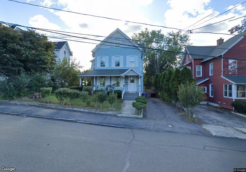
9 Quintard Ave Unit 2 RIG Norwalk, CT 06854
South Norwalk NeighborhoodEstimated Value: $500,000 - $634,000
3
Beds
2
Baths
1,300
Sq Ft
$452/Sq Ft
Est. Value
About This Home
This home is located at 9 Quintard Ave Unit 2 RIG, Norwalk, CT 06854 and is currently estimated at $587,704, approximately $452 per square foot. 9 Quintard Ave Unit 2 RIG is a home located in Fairfield County with nearby schools including Rowayton Elementary School, Roton Middle School, and Brien Mcmahon High School.
Ownership History
Date
Name
Owned For
Owner Type
Purchase Details
Closed on
Nov 24, 1992
Sold by
Citicorp Mtg
Bought by
Santamaria Alejandro and Santamaria Marta
Current Estimated Value
Home Financials for this Owner
Home Financials are based on the most recent Mortgage that was taken out on this home.
Original Mortgage
$109,600
Interest Rate
7.95%
Mortgage Type
Unknown
Purchase Details
Closed on
Sep 1, 1989
Sold by
Zucker Irwin
Bought by
Funches Wilbur
Create a Home Valuation Report for This Property
The Home Valuation Report is an in-depth analysis detailing your home's value as well as a comparison with similar homes in the area
Home Values in the Area
Average Home Value in this Area
Purchase History
| Date | Buyer | Sale Price | Title Company |
|---|---|---|---|
| Santamaria Alejandro | $127,000 | -- | |
| Santamaria Alejandro | $127,000 | -- | |
| Funches Wilbur | $232,500 | -- |
Source: Public Records
Mortgage History
| Date | Status | Borrower | Loan Amount |
|---|---|---|---|
| Open | Funches Wilbur | $136,000 | |
| Closed | Funches Wilbur | $14,000 | |
| Closed | Funches Wilbur | $109,600 |
Source: Public Records
Tax History Compared to Growth
Tax History
| Year | Tax Paid | Tax Assessment Tax Assessment Total Assessment is a certain percentage of the fair market value that is determined by local assessors to be the total taxable value of land and additions on the property. | Land | Improvement |
|---|---|---|---|---|
| 2025 | $8,654 | $362,110 | $104,830 | $257,280 |
| 2024 | $8,526 | $362,110 | $104,830 | $257,280 |
| 2023 | $6,135 | $244,560 | $96,100 | $148,460 |
| 2022 | $6,003 | $244,560 | $96,100 | $148,460 |
| 2021 | $5,862 | $244,560 | $96,100 | $148,460 |
| 2020 | $5,859 | $244,560 | $96,100 | $148,460 |
| 2019 | $5,702 | $244,560 | $96,100 | $148,460 |
| 2018 | $4,674 | $175,670 | $93,450 | $82,220 |
| 2017 | $4,512 | $175,670 | $93,450 | $82,220 |
| 2016 | $4,498 | $176,790 | $93,450 | $83,340 |
| 2015 | $4,457 | $175,670 | $93,450 | $82,220 |
| 2014 | $4,399 | $175,670 | $93,450 | $82,220 |
Source: Public Records
Map
Nearby Homes
- 11 Burritt Ave
- 58 Shorefront Park
- 72 Shorefront Park
- 28 Chestnut St
- 41 Baxter Dr
- 52 Lexington Ave
- 32 Haviland St Unit 210
- 24 Neptune Ave
- 15 Madison St Unit H9
- 15 Madison St Unit F9
- 15 Madison St Unit G11
- 118 Washington St Unit 309
- 118 Washington St Unit 304
- 110 Washington St Unit 202
- 94 Washington St Unit 20
- 94 Washington St Unit 1
- 47 Neptune Ave
- 18 Soundview Ave
- 26 Cove Ave Unit 2D
- 26 Cove Ave Unit 3B
- 9 Quintard Ave
- 7 Quintard Ave
- 11 Quintard Ave
- 5 Quintard Ave
- 13 Quintard Ave
- 4 Lincoln Ave
- 4 Lincoln Ave Unit 2
- 6 Lincoln Ave
- 2 Lincoln Ave
- 8 Lincoln Ave
- 10 Quintard Ave
- 12 Quintard Ave
- 8 Quintard Ave
- 10 Burritt Ave
- 6 Quintard Ave
- 10 Lincoln Ave
- 14 Quintard Ave
- 14 Burritt Ave
- 22 Burritt Ave
- 12 Burritt Ave