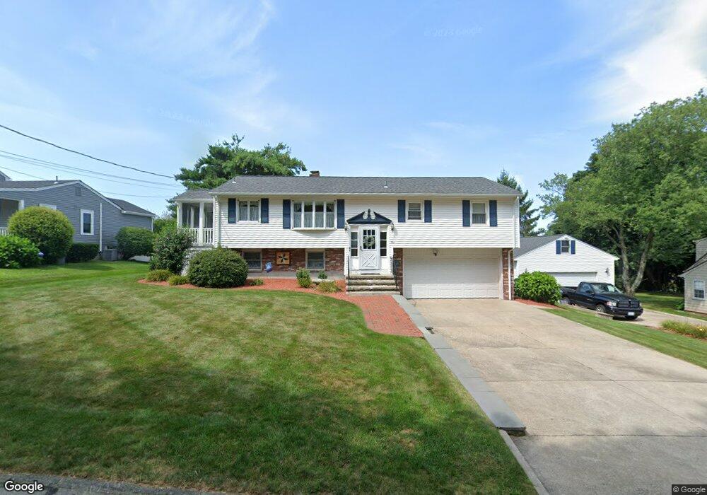
9 Red Gate Rd Cumberland, RI 02864
Ashton NeighborhoodEstimated Value: $510,759 - $598,000
3
Beds
2
Baths
1,890
Sq Ft
$291/Sq Ft
Est. Value
About This Home
This home is located at 9 Red Gate Rd, Cumberland, RI 02864 and is currently estimated at $550,440, approximately $291 per square foot. 9 Red Gate Rd is a home located in Providence County with nearby schools including Ashton Elementary School, Joseph L. McCourt Middle School, and Cumberland High School.
Ownership History
Date
Name
Owned For
Owner Type
Purchase Details
Closed on
Sep 15, 1997
Sold by
Mays Joan S
Bought by
Trottier Robert F and Trottier Eileen
Current Estimated Value
Home Financials for this Owner
Home Financials are based on the most recent Mortgage that was taken out on this home.
Original Mortgage
$70,000
Outstanding Balance
$9,020
Interest Rate
7.31%
Estimated Equity
$541,420
Create a Home Valuation Report for This Property
The Home Valuation Report is an in-depth analysis detailing your home's value as well as a comparison with similar homes in the area
Home Values in the Area
Average Home Value in this Area
Purchase History
| Date | Buyer | Sale Price | Title Company |
|---|---|---|---|
| Trottier Robert F | $162,500 | -- |
Source: Public Records
Mortgage History
| Date | Status | Borrower | Loan Amount |
|---|---|---|---|
| Open | Trottier Robert F | $39,500 | |
| Open | Trottier Robert F | $70,000 | |
| Previous Owner | Trottier Robert F | $57,000 |
Source: Public Records
Tax History
| Year | Tax Paid | Tax Assessment Tax Assessment Total Assessment is a certain percentage of the fair market value that is determined by local assessors to be the total taxable value of land and additions on the property. | Land | Improvement |
|---|---|---|---|---|
| 2025 | $5,237 | $426,800 | $124,300 | $302,500 |
| 2024 | $5,100 | $426,800 | $124,300 | $302,500 |
| 2023 | $4,959 | $426,800 | $124,300 | $302,500 |
| 2022 | $5,010 | $334,200 | $96,100 | $238,100 |
| 2021 | $4,926 | $334,200 | $96,100 | $238,100 |
| 2020 | $4,786 | $334,200 | $96,100 | $238,100 |
| 2019 | $5,190 | $326,800 | $112,800 | $214,000 |
| 2018 | $5,039 | $326,800 | $112,800 | $214,000 |
| 2017 | $4,971 | $326,800 | $112,800 | $214,000 |
| 2016 | $4,735 | $277,200 | $113,600 | $163,600 |
| 2015 | $4,735 | $277,200 | $113,600 | $163,600 |
| 2014 | $4,038 | $277,200 | $113,600 | $163,600 |
| 2013 | $4,396 | $278,600 | $109,900 | $168,700 |
Source: Public Records
Map
Nearby Homes
- 1 Barway Ln
- 1251 Mendon Rd
- 97 Angell Rd
- 3 Barrett St
- 7 Hidden Valley Ln
- 21 A St
- 164 Scott Rd
- 64 Peacedale Rd
- 140 Lippitt Ave
- 200 Old Mendon Rd
- 1504 Hunting Hill Dr
- 1502 Hunting Hill Dr
- 1503 Hunting Hill Dr
- 1501 Hunting Hill Dr
- 103 Old River Rd
- 27 Oxford Rd
- 107 Old River Rd Unit 11
- 20 Ferncrest Dr
- 1302 Hunting Hill Dr
- 150 Leigh Rd
- 1 Red Gate Rd
- 17 Red Gate Rd
- 16 Red Gate Rd
- 51 Angell Rd
- 2 Valley Stream Dr
- 10 Red Gate Rd
- 53 Angell Rd
- 61 Angell Rd
- 21 Red Gate Rd
- 20 Red Gate Rd
- 59 Angell Rd
- 49 Angell Rd
- 4 Valley Stream Dr
- 25 Red Gate Rd
- 24 Red Gate Rd
- 54 Angell Rd
- 54 Angell Rd
- 54 Angell Rd Unit 54 Angell Rd
- 48 Angell Rd
- 47 Angell Rd