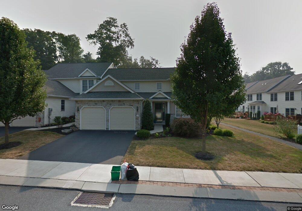
9 Red Leaf Ln Unit 78 Lancaster, PA 17602
Bridgeport NeighborhoodEstimated Value: $448,704 - $486,000
2
Beds
3
Baths
2,363
Sq Ft
$199/Sq Ft
Est. Value
About This Home
This home is located at 9 Red Leaf Ln Unit 78, Lancaster, PA 17602 and is currently estimated at $470,676, approximately $199 per square foot. 9 Red Leaf Ln Unit 78 is a home located in Lancaster County with nearby schools including Fritz Elementary School, Gerald G. Huesken Middle School, and Conestoga Valley High School.
Ownership History
Date
Name
Owned For
Owner Type
Purchase Details
Closed on
Nov 3, 2025
Sold by
Fias Peter I and Fias Priscilla L
Bought by
Fias Peter I
Current Estimated Value
Purchase Details
Closed on
Jul 10, 2013
Bought by
Fias Peter I
Purchase Details
Closed on
Jul 7, 2010
Sold by
Graner George W and Graner Mary E
Bought by
Lefever Donald E
Home Financials for this Owner
Home Financials are based on the most recent Mortgage that was taken out on this home.
Original Mortgage
$230,000
Interest Rate
4.82%
Mortgage Type
New Conventional
Create a Home Valuation Report for This Property
The Home Valuation Report is an in-depth analysis detailing your home's value as well as a comparison with similar homes in the area
Home Values in the Area
Average Home Value in this Area
Purchase History
| Date | Buyer | Sale Price | Title Company |
|---|---|---|---|
| Fias Peter I | -- | None Listed On Document | |
| Fias Peter I | $330,000 | -- | |
| Lefever Donald E | $330,000 | None Available |
Source: Public Records
Mortgage History
| Date | Status | Borrower | Loan Amount |
|---|---|---|---|
| Previous Owner | Lefever Donald E | $230,000 |
Source: Public Records
Tax History Compared to Growth
Tax History
| Year | Tax Paid | Tax Assessment Tax Assessment Total Assessment is a certain percentage of the fair market value that is determined by local assessors to be the total taxable value of land and additions on the property. | Land | Improvement |
|---|---|---|---|---|
| 2025 | $6,381 | $315,200 | -- | $315,200 |
| 2024 | $6,381 | $315,200 | -- | $315,200 |
| 2023 | $6,234 | $315,200 | $0 | $315,200 |
| 2022 | $6,079 | $315,200 | $0 | $315,200 |
| 2021 | $5,864 | $315,200 | $0 | $315,200 |
| 2020 | $5,864 | $315,200 | $0 | $315,200 |
| 2019 | $5,738 | $315,200 | $0 | $315,200 |
| 2018 | $8,252 | $315,200 | $0 | $315,200 |
| 2017 | $5,263 | $243,100 | $0 | $243,100 |
| 2016 | $5,200 | $243,100 | $0 | $243,100 |
| 2015 | $1,329 | $243,100 | $0 | $243,100 |
| 2014 | $3,510 | $243,100 | $0 | $243,100 |
Source: Public Records
Map
Nearby Homes
- 18 Red Leaf Ln
- 1864 Lincoln Hwy E
- 1942 Drexel Ave
- 1827 Krystle Dr
- 257 Longfellow Dr
- 1999 Old Philadelphia Pike
- 11 Clayton Ave
- 452 Longfellow Dr
- 71 Black Oak Dr Unit 71
- 415 Lampeter Rd
- 33 Black Oak Dr
- 6 Woodlyn Ct
- 305 Conestoga Blvd
- 347 Greenland Dr
- 19 Thicket Ln
- 305 Greenland Dr Unit 385
- 154 River Bend Park
- 403 Eastwood Ln
- 1036 E King St
- 918 Krista Ct
- 9 Red Leaf Ln
- 11 Red Leaf Ln
- 11 Red Leaf Ln Unit 79
- 13 Red Leaf Ln
- 13 Red Leaf Ln Unit 80
- 15 Red Leaf Ln
- 15 Red Leaf Ln Unit 81
- 1843 Serene Way
- 1841 Serene Way
- 1841 Serene Way Unit 118
- 1845 Serene Way
- 1847 Serene Way
- 17 Red Leaf Ln
- 12 Red Leaf Ln Unit 41
- 8 Red Leaf Ln
- 14 Red Leaf Ln
- 6 Red Leaf Ln
- 6 Red Leaf Ln Unit 44
- 16 Red Leaf Ln
- 4 Red Leaf Ln