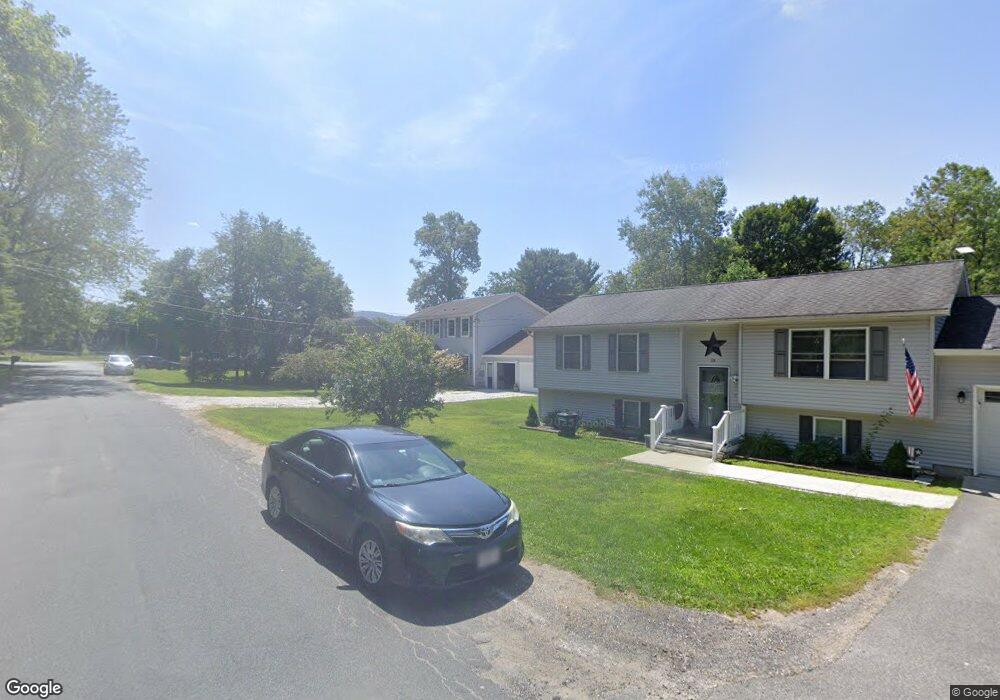
9 Redmond Ln Pittsfield, MA 01201
Estimated Value: $415,853 - $463,000
4
Beds
3
Baths
1,944
Sq Ft
$223/Sq Ft
Est. Value
About This Home
This home is located at 9 Redmond Ln, Pittsfield, MA 01201 and is currently estimated at $434,213, approximately $223 per square foot. 9 Redmond Ln is a home located in Berkshire County with nearby schools including Crosby Elementary School, John T. Reid Middle School, and Taconic High School.
Ownership History
Date
Name
Owned For
Owner Type
Purchase Details
Closed on
Mar 7, 2022
Sold by
Pollander Justin F and Pollander Alicia M
Bought by
Silver Michael and Provencher Alicia M
Current Estimated Value
Home Financials for this Owner
Home Financials are based on the most recent Mortgage that was taken out on this home.
Original Mortgage
$271,480
Interest Rate
5.7%
Mortgage Type
Stand Alone Refi Refinance Of Original Loan
Purchase Details
Closed on
May 31, 2018
Sold by
Patnode Leonard A and Patnode Melissa J
Bought by
Pollander Justin F and Pollander Alicia M
Home Financials for this Owner
Home Financials are based on the most recent Mortgage that was taken out on this home.
Original Mortgage
$269,676
Interest Rate
4.4%
Mortgage Type
New Conventional
Purchase Details
Closed on
Jun 13, 2013
Sold by
Patnode Melissa J and Patnode Leonard A
Bought by
Patnode Melissa J and Patnode Leonard A
Purchase Details
Closed on
Feb 27, 2008
Sold by
Tart Melissa J
Bought by
Tart Melissa J and Patnode Leonard A
Purchase Details
Closed on
Apr 29, 2005
Sold by
Tynan Robert B and Tynan Pamela A
Bought by
Tart Melissa J
Create a Home Valuation Report for This Property
The Home Valuation Report is an in-depth analysis detailing your home's value as well as a comparison with similar homes in the area
Home Values in the Area
Average Home Value in this Area
Purchase History
| Date | Buyer | Sale Price | Title Company |
|---|---|---|---|
| Silver Michael | -- | None Available | |
| Silver Michael | -- | None Available | |
| Silver Michael | -- | None Available | |
| Pollander Justin F | $264,000 | -- | |
| Patnode Melissa J | -- | -- | |
| Patnode Melissa J | -- | -- | |
| Tart Melissa J | -- | -- | |
| Tart Melissa J | -- | -- | |
| Tart Melissa J | $200,000 | -- | |
| Tart Melissa J | $200,000 | -- | |
| Patnode Melissa J | -- | -- | |
| Tart Melissa J | -- | -- | |
| Tart Melissa J | $200,000 | -- |
Source: Public Records
Mortgage History
| Date | Status | Borrower | Loan Amount |
|---|---|---|---|
| Previous Owner | Silver Michael | $271,480 | |
| Previous Owner | Pollander Justin F | $269,676 | |
| Previous Owner | Tart Melissa J | $195,000 |
Source: Public Records
Tax History Compared to Growth
Tax History
| Year | Tax Paid | Tax Assessment Tax Assessment Total Assessment is a certain percentage of the fair market value that is determined by local assessors to be the total taxable value of land and additions on the property. | Land | Improvement |
|---|---|---|---|---|
| 2025 | $6,333 | $353,000 | $69,300 | $283,700 |
| 2024 | $5,967 | $323,400 | $69,300 | $254,100 |
| 2023 | $5,507 | $300,600 | $69,300 | $231,300 |
| 2022 | $5,067 | $273,000 | $69,300 | $203,700 |
| 2021 | $5,490 | $285,200 | $69,300 | $215,900 |
| 2020 | $5,215 | $264,600 | $56,300 | $208,300 |
| 2019 | $4,919 | $253,300 | $52,300 | $201,000 |
| 2018 | $4,656 | $245,800 | $52,300 | $193,500 |
| 2017 | $4,623 | $235,500 | $49,300 | $186,200 |
| 2016 | $4,495 | $239,600 | $49,300 | $190,300 |
| 2015 | $4,327 | $239,600 | $49,300 | $190,300 |
Source: Public Records
Map
Nearby Homes
- 47 Gale Ave
- 208 Jason St
- Lot #112 Cadwell Rd
- 24 Lebanon Ave
- 36 Roberta Rd
- 149 Fort Hill Ave
- 2 Amy Ct Unit 2
- L 105,106 Barker Rd
- 209 Velma Ave
- 61 Tor Ct
- 20 Greenway St
- 28 Mckinley Terrace
- 32 Mead Ave
- 712 Barker Rd
- 103 Stearns Ave
- 43 Merriam St
- 90 Jones Ave
- 0 Jones Ave
- 200 W Housatonic St Unit 16
- 174 Cole Ave