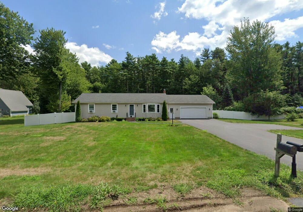
9 Richards Way Saco, ME 04072
East Saco NeighborhoodEstimated Value: $606,000 - $708,000
3
Beds
2
Baths
1,456
Sq Ft
$442/Sq Ft
Est. Value
About This Home
This home is located at 9 Richards Way, Saco, ME 04072 and is currently estimated at $643,149, approximately $441 per square foot. 9 Richards Way is a home located in York County with nearby schools including C K Burns School, Saco Middle School, and Saint James School.
Ownership History
Date
Name
Owned For
Owner Type
Purchase Details
Closed on
Sep 9, 2013
Sold by
Roberge Lawrence G
Bought by
Roberge Robert L and Roberge Amy L
Current Estimated Value
Home Financials for this Owner
Home Financials are based on the most recent Mortgage that was taken out on this home.
Original Mortgage
$232,000
Interest Rate
4.34%
Mortgage Type
New Conventional
Create a Home Valuation Report for This Property
The Home Valuation Report is an in-depth analysis detailing your home's value as well as a comparison with similar homes in the area
Home Values in the Area
Average Home Value in this Area
Purchase History
| Date | Buyer | Sale Price | Title Company |
|---|---|---|---|
| Roberge Robert L | -- | -- |
Source: Public Records
Mortgage History
| Date | Status | Borrower | Loan Amount |
|---|---|---|---|
| Closed | Roberge Robert L | $232,000 |
Source: Public Records
Tax History
| Year | Tax Paid | Tax Assessment Tax Assessment Total Assessment is a certain percentage of the fair market value that is determined by local assessors to be the total taxable value of land and additions on the property. | Land | Improvement |
|---|---|---|---|---|
| 2024 | $6,124 | $435,900 | $187,400 | $248,500 |
| 2023 | $6,430 | $435,900 | $187,400 | $248,500 |
| 2022 | $5,792 | $316,000 | $142,800 | $173,200 |
| 2021 | $5,596 | $296,400 | $130,700 | $165,700 |
| 2020 | $0 | $271,600 | $119,100 | $152,500 |
| 2019 | $5,264 | $271,600 | $119,100 | $152,500 |
| 2018 | $4,727 | $263,300 | $110,800 | $152,500 |
| 2017 | $0 | $251,500 | $100,900 | $150,600 |
| 2016 | $4,727 | $243,400 | $97,500 | $145,900 |
| 2015 | $4,642 | $241,500 | $97,500 | $144,000 |
| 2014 | $4,497 | $241,500 | $97,500 | $144,000 |
| 2013 | $4,487 | $241,500 | $97,500 | $144,000 |
Source: Public Records
Map
Nearby Homes
- 11 Peabody Ln Unit 101
- 2 Breakwater Way Unit 2
- 4 Mainsail Ln Unit 4
- 295 Ferry Rd
- 38 Pine Ridge Rd
- TBD 530 Ferry Rd
- 3 Walker Dr Unit 101
- 4 Walker Dr Unit 101
- 343 Pool St
- 3 Walker Dr Unit 101
- 8 Heritage Way Unit 21
- 353 Pool St
- 6 Decary Rd
- 16 Heritage Way Unit 17
- 20 Heritage Way Unit 15
- 378 Pool St
- 25 Heritage Way Unit 11
- 30 Vines Rd
- 12 Marial Ave
- 3 Old Orchard Rd Unit 7
- 7 Richards Way
- 7 Richard's Way
- 11 Richards Way
- 10 Richards Way
- 8 Richards Way
- 5 Richards Way
- Lot #5 Richard's Way
- 5 Richard's Way
- 2 Rachel Ln
- 12 Richards Way
- 3 Richards Way
- Lot #3 Richard's Way
- 6 Richards Way
- 190 Ferry Rd
- 190 Ferry Rd
- 190 Ferry Rd Unit 1
- 15 Richards Way
- 7 Stone Pony Cir
- 1 Richards Way
- 5 Stone Pony Cir
Your Personal Tour Guide
Ask me questions while you tour the home.