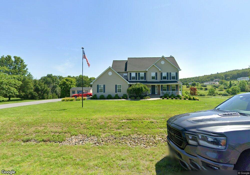
9 Robin Ln Kunkletown, PA 18058
Estimated Value: $488,000 - $520,000
4
Beds
3
Baths
2,539
Sq Ft
$199/Sq Ft
Est. Value
About This Home
This home is located at 9 Robin Ln, Kunkletown, PA 18058 and is currently estimated at $505,703, approximately $199 per square foot. 9 Robin Ln is a home located in Monroe County with nearby schools including Pleasant Valley Elementary School, Pleasant Valley Intermediate School, and Pleasant Valley Middle School.
Ownership History
Date
Name
Owned For
Owner Type
Purchase Details
Closed on
May 27, 2021
Sold by
Barnes Linda M
Bought by
Betz Darryl R and Meklunebetz Elizabeth M
Current Estimated Value
Home Financials for this Owner
Home Financials are based on the most recent Mortgage that was taken out on this home.
Original Mortgage
$324,885
Outstanding Balance
$294,143
Interest Rate
2.9%
Mortgage Type
VA
Estimated Equity
$211,560
Purchase Details
Closed on
Aug 23, 2004
Bought by
Barnes Robert E and Barnes Linda M
Create a Home Valuation Report for This Property
The Home Valuation Report is an in-depth analysis detailing your home's value as well as a comparison with similar homes in the area
Home Values in the Area
Average Home Value in this Area
Purchase History
| Date | Buyer | Sale Price | Title Company |
|---|---|---|---|
| Betz Darryl R | $388,000 | Keystone Premier Stlmt Svcs | |
| Barnes Robert E | $293,000 | -- |
Source: Public Records
Mortgage History
| Date | Status | Borrower | Loan Amount |
|---|---|---|---|
| Open | Betz Darryl R | $324,885 |
Source: Public Records
Tax History Compared to Growth
Tax History
| Year | Tax Paid | Tax Assessment Tax Assessment Total Assessment is a certain percentage of the fair market value that is determined by local assessors to be the total taxable value of land and additions on the property. | Land | Improvement |
|---|---|---|---|---|
| 2025 | $1,678 | $259,500 | $49,310 | $210,190 |
| 2024 | $1,193 | $259,500 | $49,310 | $210,190 |
| 2023 | $7,391 | $259,500 | $49,310 | $210,190 |
| 2022 | $7,178 | $259,500 | $49,310 | $210,190 |
| 2021 | $7,014 | $259,500 | $49,310 | $210,190 |
| 2019 | $8,314 | $47,420 | $11,500 | $35,920 |
| 2018 | $8,219 | $47,420 | $11,500 | $35,920 |
| 2017 | $8,219 | $47,420 | $11,500 | $35,920 |
| 2016 | $1,212 | $47,420 | $11,500 | $35,920 |
| 2015 | -- | $47,420 | $11,500 | $35,920 |
| 2014 | -- | $47,420 | $11,500 | $35,920 |
Source: Public Records
Map
Nearby Homes
- 2 T425
- 157 Viewtop Rd
- 90 Halina Way
- 1101 Red Fox Ct Unit Ct 9
- 85 Panorama Cir
- 125 Hillview Rd
- 0 T425
- 969 Hideaway Hill Rd
- 229 Deer Path
- 150 Red Oak Dr
- Lot 32 Greenview Ct
- 0 Log Fence Rd Unit PACC2006852
- 0 Log Fence Rd Unit PM-136800
- 0 Log Fence Rd Unit 767042
- 209 Floyd Dr
- 207 Scenic Dr
- 0 Victoria Arms Cir Unit PM-133039
- 0 Sr 209 Unit PM-130225
- CO Line Forest Dr
- 424 Mark Ln
- 145 Robin Ln
- 8 Robin Ln
- 1 Robin Ln
- 138 Robin Ln
- 0 Robin Ln Unit 10656
- 0 Robin Ln Unit PM-60762
- 0 Robin Ln Unit 10-9509
- 0 Robin Ln Unit 8-8495
- 0 Robin Ln Unit 4 729768
- 0 Robin Ln
- 2 Robin Ln
- 152 Robin Ln
- 135 Robin Ln
- 15 Pohopoco Dr N
- 16 Pohopoco Dr N
- 5 Robin Ln
- 7 Robin Ln
- 136 New Smith Dr
- 145 New Smith Dr
- T 437 2 Smith Dr